Drone 101: What’s the Buzz About?
So, what’s the big deal with drones? You see them everywhere these days, from movie sets to farms, and maybe you’ve even wondered if you should get one yourself. They’re not just toys anymore; these flying machines, often called Unmanned Aerial Vehicles or UAVs, have become super useful tools. We’re going to break down what exactly a drone is, why they’re so popular, and what you need to know if you’re thinking about flying one.
Key Takeaways
- Drones, or Unmanned Aerial Vehicles (UAVs), are flying machines that can be controlled remotely or fly on their own.
- They’ve evolved from hobbyist kits to sophisticated tools used in many fields like filmmaking, agriculture, and delivery.
- The quadcopter design, with four rotors, is a common and recognizable drone type.
- While similar to radio-controlled aircraft, drones often have advanced features like onboard cameras and hovering capabilities.
- Regulations, especially from the FAA, are important for safe drone operation, covering everything from weight to airspace.
- Modern drones use GPS, Wi-Fi, and radio frequencies for guidance, with improved cameras and batteries.
- Drones offer diverse applications, from capturing stunning aerial footage to monitoring environmental changes and managing crops.
- Choosing the right drone depends on your needs, with options ranging from beginner-friendly models under 250 grams to professional systems.
Understanding What Is A Drone
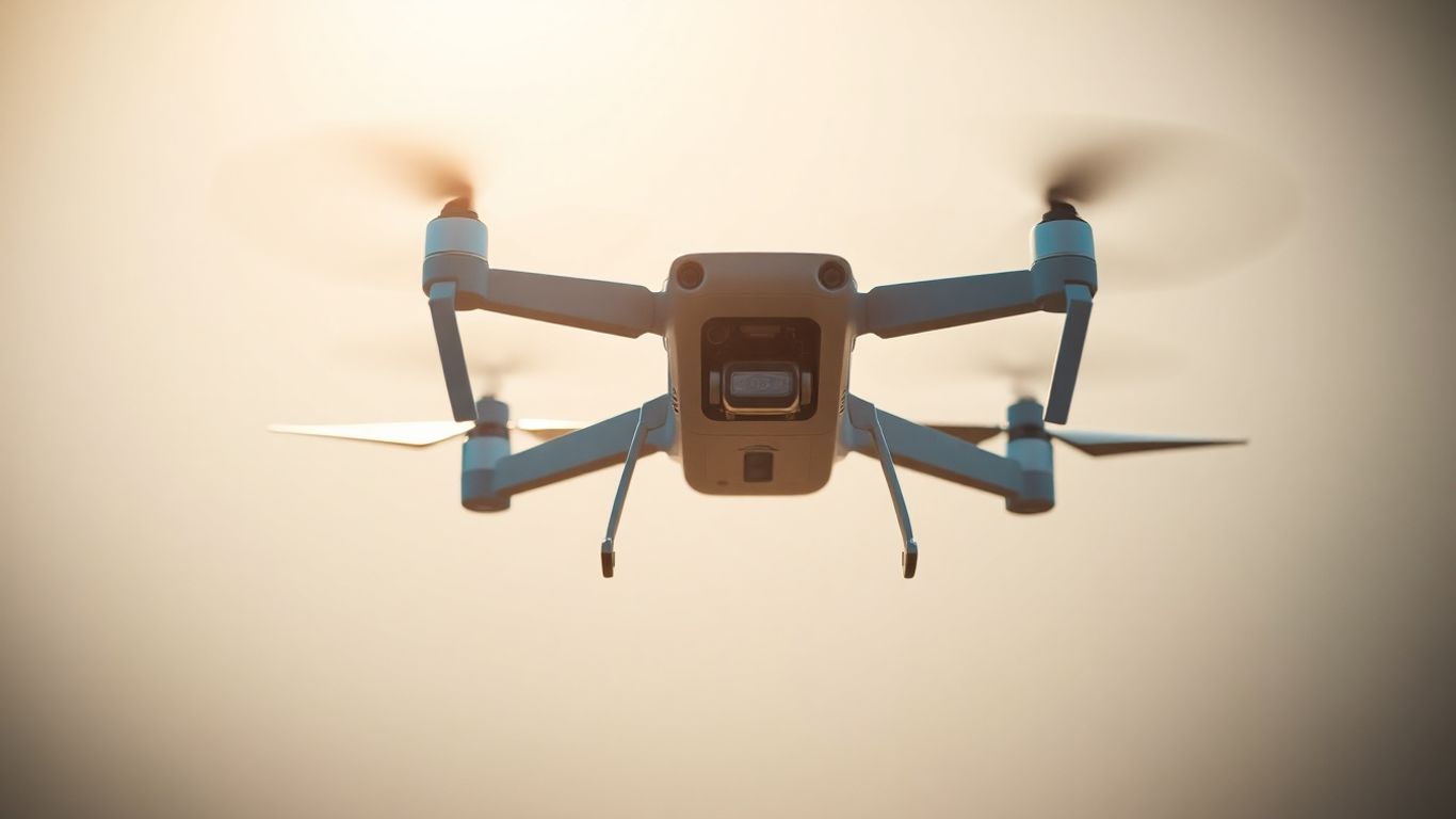
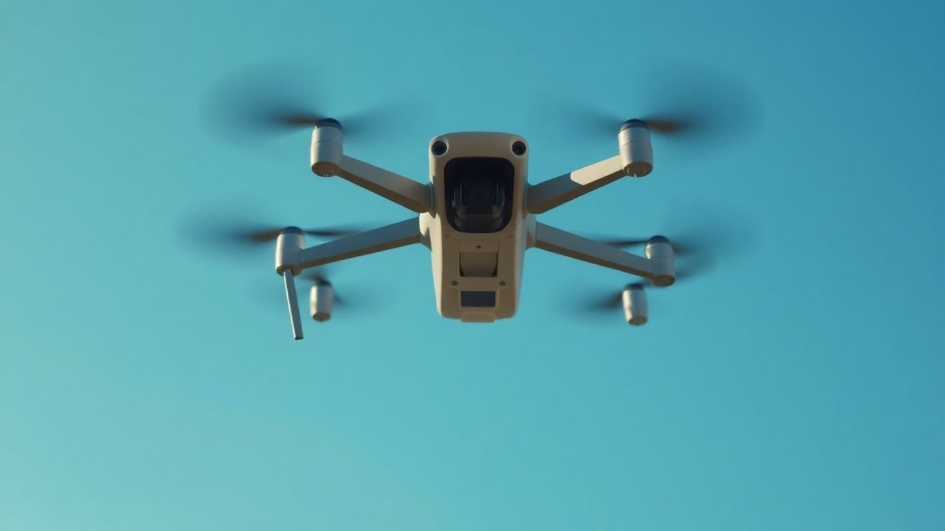
So, what exactly is a drone? At its core, a drone is an aircraft that flies without a human pilot on board. Think of it as an unmanned aerial vehicle, or UAV for short. These machines have come a long way from just being hobbyist kits that required a lot of tinkering. Now, you can get ready-to-fly systems that are pretty user-friendly. The most common design you’ll see is the quadcopter, which has four rotors. This design gives them a lot of stability and maneuverability, making them great for capturing smooth video or just for fun flying.
It’s important to know that drones are different from standard radio-controlled (RC) aircraft. While both are flown remotely, drones often have advanced features like onboard cameras and the ability to hover in place, much like a helicopter. Both types, however, fall under the classification of Unmanned Aerial Vehicles (UAVs) and are regulated by the Federal Aviation Administration (FAA) to keep the skies safe for everyone.
The Evolution of Unmanned Aerial Vehicles
These flying machines weren’t always the sleek gadgets we see today. Early versions were often experimental or used for military purposes. But over time, technology improved, making them smaller, more affordable, and accessible to the public. It’s pretty wild how far they’ve come.
From Hobbyist Kits to Ready-To-Fly Systems
Remember when building a drone meant soldering wires and figuring out complex electronics? Those days are largely behind us for most people. The market has exploded with systems you can take right out of the box and fly, though there are still plenty of options for those who love to build and customize.
The Quadcopter: A Common Drone Design
When most people picture a drone, they’re probably imagining a quadcopter. With its four propellers, it’s a stable platform that’s relatively easy to control. This design is a big reason why drones have become so popular for photography, videography, and recreation.
Distinguishing Drones from Radio-Controlled Aircraft
While both are remotely piloted, drones typically have more advanced capabilities. Think built-in cameras, GPS for navigation, and the ability to hold a position in the air. RC planes are more about mimicking traditional flight, while drones offer a broader range of functions.
FAA Classification: Unmanned Aerial Vehicles
No matter what you call them – drones or UAVs – they are all aircraft. The FAA has specific rules for them to ensure they don’t interfere with manned aircraft. This classification is key to understanding the regulations surrounding their use.
The Core Functionality of Modern Drones
At their heart, modern drones are flying robots. They use a combination of sensors, motors, and a flight controller to stay airborne and follow commands. The ability to fly and capture aerial footage is their primary function for many users. They rely on systems like GPS, radio frequencies, and Wi-Fi for guidance.
Experiencing Flight Without Leaving the Ground
One of the coolest things about drones is that they let you see the world from a new perspective. You can get amazing aerial shots of landscapes, your neighborhood, or even just your backyard. It’s like being a bird, but with your feet still firmly on the ground.
Technological Advancements in Drone Guidance
Guidance systems have gotten incredibly sophisticated. Drones use GPS for precise positioning, radio frequencies for control signals, and Wi-Fi for transmitting video feeds. These technologies work together to make flying more stable and intuitive. You can find out more about UAV regulations on the FAA’s website.
The Expanding World Of Drone Applications
Cinematic Shots in Film and Television
Remember those sweeping aerial shots in movies that make you feel like you’re right there? Drones have totally changed the game for filmmakers. Instead of needing expensive helicopters or cranes, directors can now get those dynamic, smooth camera movements with a drone. This means more creative freedom and often, a lower budget. You can get close-up shots of actors, follow a car chase from above, or capture breathtaking landscapes without breaking the bank. It’s like having a flying camera operator that can go almost anywhere.
Aerial Perspectives for News Coverage
News crews used to rely on helicopters or fixed-wing planes for aerial shots, which were costly and sometimes difficult to deploy quickly. Now, a drone can be launched in minutes to provide live aerial views of breaking news events, traffic jams, or disaster areas. This immediate, bird’s-eye view gives viewers a much clearer picture of what’s happening on the ground. It helps reporters show the scale of an event and provide context that ground-level reporting might miss. Think about seeing the extent of a flood or the layout of a protest from above – it’s a whole different level of understanding.
The Potential for Drone-Based Delivery Services
This is one of those futuristic ideas that’s actually starting to happen. Companies are experimenting with using drones to deliver packages, especially in remote areas or for urgent items like medicine. Imagine getting a small package delivered right to your doorstep by a drone, bypassing traffic and saving time. While there are still a lot of regulations and logistical hurdles to sort out, the idea of drone delivery is pretty exciting. It could make getting goods faster and more efficient, especially for those hard-to-reach places.
Environmental Monitoring and Restoration Efforts
Drones are becoming super useful for folks working to protect our planet. They can fly over forests to check for wildfires, monitor wildlife populations without disturbing them, or map out areas that need restoration. For example, drones can be used to plant seeds in hard-to-reach places or spray treatments to get rid of invasive plants. They give scientists and conservationists a way to gather detailed information about ecosystems from above, helping them make better decisions about how to care for the environment.
Precision Agriculture and Crop Management
Farmers are finding drones to be incredibly helpful. Instead of walking miles of fields, a drone can fly over and take high-resolution pictures. These images can show farmers exactly where crops need more water, fertilizer, or if there’s a pest problem. This means they can treat only the specific spots that need it, saving resources and making crops healthier. It’s like giving farmers super-vision for their fields, allowing them to manage their land more smartly and efficiently.
Mapping and Data Analysis for Land Management
Beyond farming, drones are great for mapping all sorts of land. Construction companies can use them to survey a site before building, track progress, and measure materials. City planners can use drone maps to see how areas are developing or to plan new infrastructure. The data collected can be processed into detailed 3D models, giving a really accurate picture of the terrain and structures. This helps with planning, tracking changes over time, and making sure projects are on schedule and within budget.
Innovative Marketing Through Skyvertising
Who needs billboards when you can have drones? Companies are starting to use drones for advertising, sometimes called ‘skyvertising.’ This could involve drones flying in formation to create logos or messages in the sky, or carrying banners. It’s a unique way to grab attention, especially at events or in busy public spaces. It’s definitely a novel approach to getting a brand noticed.
Recreational Uses and FPV Flying
Of course, not all drone use is serious business. Many people fly drones just for fun! You can fly them around your neighborhood, take cool videos of your vacations, or even race them. FPV (First-Person View) flying is a big one, where the pilot wears goggles that show what the drone’s camera sees in real-time. It feels like you’re actually inside the drone, zipping through obstacles or performing aerial acrobatics. It’s a thrilling hobby that combines flying with a unique visual experience.
Navigating Drone Regulations And Safety
So, you’ve got your drone, and you’re itching to take it for a spin. That’s awesome! But before you launch, let’s talk about the rules of the road, or rather, the sky. It’s not just about having fun; it’s about being responsible and keeping everyone safe. Think of this as your beginners guide to drones, focusing on the important stuff.
The Federal Aviation Administration (FAA) is the main player here, setting the guidelines for flying unmanned aerial vehicles (UAVs). They’ve got rules for pretty much everything, from how high you can fly to where you can fly. It’s a good idea to get familiar with these, especially if you plan on flying anything more than just for kicks.
The Importance of FAA Regulations
These rules are in place to make sure drones don’t interfere with regular aircraft and to keep people and property on the ground out of harm’s way. Ignoring these regulations can lead to some pretty hefty fines, so it’s worth your time to know what’s what. For instance, flying over crowds or private property without permission isn’t allowed. It’s all about maintaining order in the airspace.
Understanding Drone Weight Classifications
Weight matters when it comes to drone rules. Drones under 250 grams (about half a pound) have fewer restrictions, which is why many beginner drones fall into this category. For anything heavier, especially if you’re thinking about commercial use, things get a bit more involved. The FAA has specific rules for different weight classes.
Legal Restrictions on Video Surveillance
This is a big one for privacy. You can’t just fly your drone around filming people without their consent, especially if it’s in a way that invades their privacy. Some states even have specific laws against using drones for surveillance of activities like hunting or fishing. Always be mindful of where you’re pointing that camera.
Local and State Park Drone Policies
Beyond federal rules, check with your local city or state parks. Many have their own policies about drone usage. Some might ban them entirely, while others might have designated flying areas. It’s always best to look up the specific rules for the park you plan to visit.
The Role of the B4UFLY Mobile Application
This is a super handy tool. The B4UFLY app, sanctioned by the FAA, shows you the current flight status of your location. It can tell you if you’re in an area where flying is restricted, like near an airport. It’s a quick way to check before you head out.
Commercial Pilot Certification: Part 107
If you plan to fly a drone for any kind of business, like taking photos for real estate or inspecting a roof, you’ll likely need to get certified under the FAA’s Part 107 rules. This involves passing a knowledge test. It’s a step up from recreational flying, but it opens up a lot of possibilities. You can find resources to help you prepare for the Part 107 exam.
Airspace Authorizations and LAANC System
Sometimes you need permission to fly in certain controlled airspace. The Low Altitude Authorization and Notification Capability (LAANC) system is a way to get this authorization quickly, often through mobile apps. It helps manage drone traffic and keeps things safe.
The Significance of Drone Safety and Fines
Let’s wrap this up with a reminder: safety first. The FAA takes drone safety seriously, and the fines for violations can be substantial – we’re talking thousands of dollars. So, fly smart, fly safe, and enjoy your drone adventures responsibly.
Flying a drone is a lot of fun, but it comes with responsibilities. Understanding and following the rules set by the FAA and local authorities is key to a positive experience. Always prioritize safety and respect privacy.
Drone Technology And Its Capabilities
Modern drones are packed with tech that lets them do some pretty amazing things. You might think of them as just flying cameras, but there’s a lot more going on under the hood. The core of how they work involves a blend of sophisticated guidance systems and advanced onboard components.
GPS, Radio Frequency, and Wi-Fi Guidance Systems
Drones use a few different ways to know where they are and how to get where you want them to go. GPS is a big one, giving them a general location. Then there are radio frequencies, which are key for the remote control signal from the pilot. Wi-Fi is also used, especially for shorter-range communication and sometimes for streaming video. It’s this combination that allows for precise flight paths and stable positioning.
Improvements in Camera and Battery Technology
We’ve seen huge leaps in camera quality for drones. They can now capture incredibly sharp photos and smooth video, often rivaling professional equipment. Batteries have also gotten better, meaning longer flight times. This is a big deal because nobody likes being cut short mid-flight. You can now get drones that fly for 30 minutes or more on a single charge, which is pretty wild when you think about it.
Onboard Cameras and Hovering Abilities
Most consumer drones come with built-in cameras. These aren’t just for show; they’re high-resolution and can often be controlled remotely to pan, tilt, and zoom. The ability to hover in place is another key feature. This stability is thanks to complex internal sensors and software that constantly adjust the rotors to counteract wind and other disturbances. It makes getting steady shots much easier.
The Role of SD Cards in Data Storage
All those high-quality photos and videos need a place to go, right? That’s where SD cards come in. They’re the workhorses for storing the data captured by the drone’s camera. You can get different sizes, and having a fast card means you won’t miss any frames during rapid bursts of photos or high-resolution video recording. It’s a simple piece of tech, but absolutely vital for getting your footage off the drone.
Post-Production Editing for Drone Footage
Once you’ve landed your drone and downloaded your footage, the work isn’t quite done. Most drone videos benefit from some editing. This can involve color correction to make the skies look bluer or the greens look greener, stabilizing shaky footage (though modern drones are pretty good at this already), and cutting clips together to tell a story. Software ranges from simple phone apps to professional desktop programs.
Brain-Computer Interfaces for Drone Control
This is still pretty cutting-edge stuff, but researchers are exploring ways to control drones using brain signals. Imagine thinking about moving the drone, and it just does it. While not common in everyday drones yet, it shows the direction technology is heading, pushing the boundaries of human-machine interaction.
The Impact of Drone Speed on Video Stability
When a drone moves quickly, it can make video footage look shaky or jerky, even with stabilization tech. Pilots often need to balance speed with smooth movements to get usable shots. Some drones have specific modes, like ‘cinematic mode,’ that limit speed and dampen movements for smoother video capture. It’s a trade-off between getting there fast and getting a good-looking shot.
Return-To-Home Features for Safe Landings
This is a lifesaver feature. If the drone loses its connection to the controller, or if the battery gets critically low, the Return-To-Home (RTH) function automatically guides the drone back to its takeoff point and lands it safely. It’s a really important safety net that gives pilots peace of mind, especially when flying further away or in less-than-ideal conditions.
The Future Of Drone Technology
So, what’s next for these flying gadgets? It’s pretty exciting to think about. We’re seeing constant improvements, and it feels like every year there’s something new that makes drones even more useful.
Continued Technical Development in Drones
Think about cameras and batteries. They just keep getting better, right? Drones are getting lighter, flying longer, and capturing clearer video than ever before. This means we can do more with them, for longer periods. It’s not just about making them fly further, but also about making them smarter and more capable in the air.
Automation in Drone Reloading and Charging
One of the big hurdles for using drones a lot, especially for things like spraying crops, is the downtime. You have to land, swap out the battery or refill the tank, and then take off again. The future is looking at ways to automate this. Imagine a drone landing on a special station that automatically swaps its battery or refills its payload. This would drastically cut down on the time a drone spends on the ground, making it way more efficient for commercial uses.
Integration with Artificial Intelligence
AI is popping up everywhere, and drones are no exception. We’re starting to see drones that can make decisions on their own. For example, a drone could fly over a field, identify a specific pest problem, and then automatically adjust its spraying pattern to target just that area. This kind of smarts means drones can do more complex jobs without constant human input.
The Growing Market for Ready-To-Fly Systems
Remember when you had to build your own drone from a kit? Those days are fading fast. The market is flooded with ready-to-fly systems that are super user-friendly. You can literally take it out of the box, charge it up, and be flying in minutes. This makes drones accessible to way more people, not just tech geeks.
The Possibility of Drone-Delivered Waffles
Okay, maybe this one is a bit more fun than practical, but who wouldn’t want waffles delivered by drone? While it sounds a bit silly, it points to the broader potential of drone delivery. Imagine getting your groceries, medicine, or even a hot breakfast delivered right to your doorstep by a quiet, efficient drone. It’s not science fiction anymore; it’s becoming a real possibility for certain items.
The pace of innovation in drone technology is really picking up. What seemed like a novelty a few years ago is now becoming a serious tool for businesses and hobbyists alike. We’re moving towards drones that are not just flying cameras, but intelligent assistants capable of complex tasks.
Here’s a quick look at what’s changing:
- Smarter Navigation: Drones will get better at understanding their surroundings and avoiding obstacles on their own.
- Longer Flight Times: Battery tech will keep improving, letting drones stay airborne for much longer.
- Specialized Payloads: Expect to see drones designed for very specific jobs, like advanced medical delivery or complex construction tasks.
- Improved Data Analysis: Drones will collect more data, and AI will help us make sense of it faster and more effectively.
Choosing The Right Drone For You
So, you’re thinking about getting a drone? That’s awesome! It can feel a bit overwhelming at first with all the options out there, but let’s break it down. The best drone for you really depends on what you want to do with it. Are you looking to just have some fun flying around the backyard, or do you have bigger plans like shooting cool videos or even starting a small business?
Ideal Drones for Beginners and Hobbyists
If you’re just starting out, you don’t need to spend a fortune or get something super complicated. The market has some fantastic options that are easy to fly and won’t break the bank. Think of these as your entry-level ticket to the skies.
Understanding the Under-250-Gram Weight Limit
This is a big one, especially for recreational flyers. Drones weighing less than 250 grams have fewer registration and operational requirements from the FAA. It’s a sweet spot for ease of use and compliance. Many beginner-friendly drones fall into this category, making them super accessible.
Popular Drone Manufacturers and Models
When you start looking, you’ll see a few names pop up again and again. DJI is a major player, known for its reliable and user-friendly drones. Brands like Autel and Parrot also make some solid choices. For beginners, models like the DJI Mini series are often recommended because they’re compact and simple to operate.
Features of DJI Mini and Mini 2 Drones
These little guys are incredibly popular for a reason. They’re lightweight (under 250g!), foldable, and surprisingly capable. You can get decent video quality, often up to 4K on the Mini 2, and they handle pretty well for their size. They’re perfect for travel and casual flying.
The Functionality of the Return-To-Home Button
This is a lifesaver, especially for new pilots. The Return-to-Home (RTH) feature uses GPS to bring your drone back to its takeoff point. It’s usually triggered automatically if the signal is lost or the battery gets low, giving you peace of mind.
Cinematic Mode for Stable Video Recording
Want those smooth, sweeping shots you see in movies? Many drones have a ‘Cinematic Mode’ (or similar). This mode slows down the drone’s movements, making the footage much more stable and professional-looking, even if you’re not a pro pilot.
Factors Influencing Drone Purchase Decisions
When you’re deciding, think about:
- Budget: How much are you willing to spend?
- Intended Use: Photography, videography, racing, or just fun?
- Portability: Do you need something that folds up small for travel?
- Camera Quality: How important are high-resolution photos and videos?
- Flight Time: How long do you want to be able to fly on a single battery charge?
The Range of Consumer-Level Drone Prices
For the beginner-friendly, under-250-gram drones, you’re typically looking at a price range of about $350 to $800. This gets you a solid drone with a good camera and essential features like RTH and stable flight modes. As you move up to more advanced models for professional use, prices can jump significantly, easily going into the thousands of dollars for top-tier equipment with advanced capabilities.
Drone Applications In Agriculture
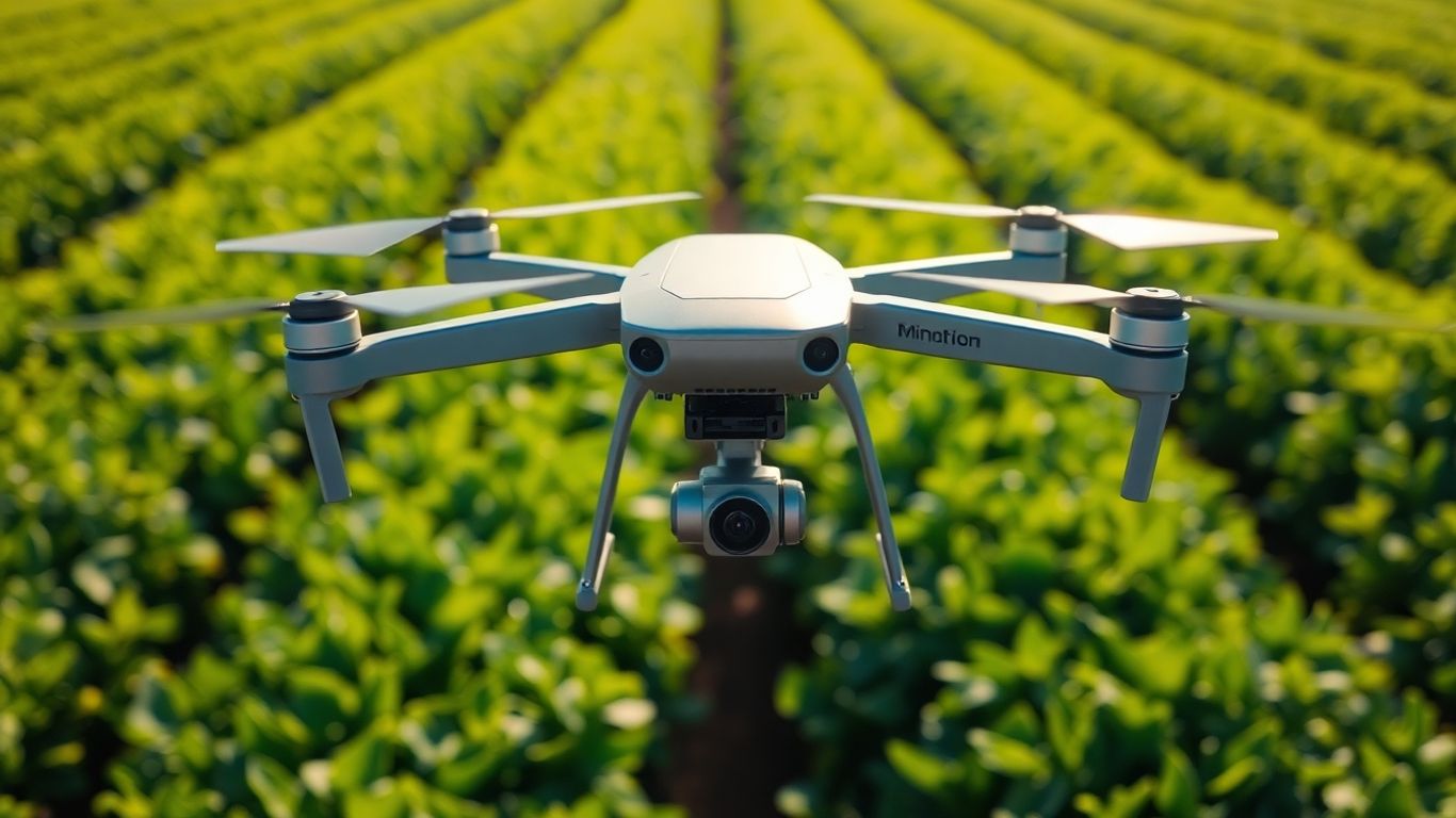
Drones have really started to make waves in the farming world, and it’s not just for fun anymore. These types of unmanned aerial vehicles are becoming serious tools for farmers looking to get more out of their land. While they aren’t going to replace the big tractors anytime soon, they’re fantastic for those tricky spots that are hard to reach with regular equipment.
Improving Crop Management with Drones
Think about it – you can get a bird’s-eye view of your entire field, spotting problems you might miss from the ground. This high-level look helps farmers manage their crops better. It’s like having super-vision for your farm.
Scouting and Mapping Difficult-to-Access Areas
Some parts of a farm are just a pain to get to, especially if the ground is wet or the terrain is rough. Drones can fly right over these areas, taking pictures and creating maps. This is one of the first things farmers tried with drones, and it’s still a big deal because it’s pretty straightforward and doesn’t cost a fortune.
High-Resolution Imaging for Farm Analysis
These aren’t just blurry photos. Drones can capture really detailed images, giving you a much clearer picture of what’s going on with your crops than you’d get from a satellite or a plane. Some software can even analyze these images to figure out crop health, how well seeds are sprouting, or if there are a lot of weeds.
Diagnosing Field Issues with Drone Data
It’s not just about seeing problems; it’s about understanding them. By looking at the data from drone images, farmers can figure out what’s wrong with their fields much faster. This means they can act quickly to fix things, which is always good for the harvest.
Challenges in Drone Spray Application
Spraying with drones is getting more attention, but it’s not perfect yet. There are a few things that can mess with how evenly the spray lands. Things like how fast the drone is flying, how much liquid it’s carrying, and even the wind can make a difference. Right now, the spray tends to be heaviest right under the drone, and it’s hard to know exactly how wide the spray pattern is.
Ensuring Spray Swath Consistency
Getting the spray to spread out evenly is a big deal. With drones, it’s tricky because the rotors, the drone’s speed, and the wind all play a part. This means the amount of product applied can change across the field, and knowing the exact spray width is still something that needs work.
The Role of Drones in Wet Field Conditions
When the ground is too wet to drive on, drones can still get the job done. This is a huge advantage. Farmers can apply fertilizers or other treatments even when their regular equipment would get stuck or damage the crops.
Filling Gaps Where Large Equipment Cannot Reach
Basically, drones are great for filling in the blanks. They can get to those odd corners, small patches, or areas that are just too difficult for big machines. They open up new ways to manage parts of the farm that were previously hard to deal with. This ability to access difficult areas is a key reason why drones are becoming more popular in agriculture.
While the technology is improving rapidly, there’s still research happening to make sure drone spraying is as effective and safe as possible. The goal is to have clear guidelines on how and when to use them for the best results.
Drone Software And Processing Tools
So, you’ve got your drone, you’ve flown it around, and now you’ve got a bunch of photos or videos. What do you do with them? Well, that’s where drone software and processing tools come in. Think of it like this: the drone is your camera, but the software is what turns those raw images into something actually useful, whether it’s a detailed map or a slick video.
Mapping and Processing Software Options
When you’re dealing with aerial imagery, especially for things like mapping or surveying, you can’t just look at the pictures. You need specialized software to stitch them together, analyze them, and make sense of the data. This is where programs designed for photogrammetry and data analysis shine. They take all those overlapping photos from your drone and create a 3D model or a highly accurate map.
Understanding DroneDeploy Capabilities
DroneDeploy is one of those big names in the drone software world. It’s pretty popular for a reason. It’s designed to make it easier to plan your flights, capture data, and then process it into maps and models. You can use it for all sorts of things, from checking on construction sites to monitoring crop health. It’s got a lot of features that help automate the process, which is nice when you’re dealing with a lot of data.
Exploring Pix4D for Photogrammetry
Pix4D is another major player, and it’s really focused on photogrammetry – that’s the science of making measurements from photographs. If you need super accurate maps or 3D models, Pix4D is often the go-to. They have different versions of their software, some for desktop and some that work in the cloud. They also have a ton of free tutorials, which is a lifesaver when you’re trying to figure out how to get the best results from your drone data.
Utilizing SiteScan for ArcGIS
If you’re already working within the Esri ecosystem, SiteScan for ArcGIS might be a good fit. It’s designed to integrate drone data directly into ArcGIS, which is a widely used platform for geographic information systems (GIS). This means you can take your drone-captured imagery and immediately start using it with other geographic data you might have, making analysis and decision-making a lot smoother.
The Importance of Data Security in Processing
This is something people sometimes overlook. When you send your drone data off to be processed, especially if you’re using cloud-based services, you need to think about where that data is going and who has access to it. Not all processing companies have the same level of security. It’s worth doing a little digging to make sure your information is protected, especially if you’re dealing with sensitive projects or proprietary data.
Free Tutorials for Drone Software
Learning to use this software can feel a bit overwhelming at first. Luckily, most of the major software providers know this and offer a lot of free resources. Pix4D, for example, has a whole section on their website dedicated to tutorials and support articles. These guides can walk you through everything from basic flight planning to advanced processing techniques. It really helps to have these available when you’re trying to get the most out of your drone investment.
The Impact of Software on Image Quality
It’s not just about the drone’s camera; the software you use to process the images plays a huge role in the final output. Good software can correct for distortions, improve color accuracy, and create sharp, detailed maps or models. Bad software, or using software incorrectly, can lead to blurry images, misaligned maps, or data that just doesn’t look right. So, picking the right tool and learning how to use it properly makes a big difference.
Analyzing Drone Imagery for Prescriptions
This is where things get really interesting, especially in fields like agriculture or environmental management. Once you have your processed drone imagery, you can analyze it to create specific ‘prescriptions.’ For example, in farming, this could mean generating variable rate application maps that tell a sprayer exactly how much fertilizer or pesticide to apply to different parts of a field. It’s about using the data to make very precise, targeted decisions.
Community And Learning Resources For Drones
So, you’ve got a drone, or you’re thinking about getting one. That’s awesome! But sometimes, figuring out the ins and outs can feel a bit overwhelming, right? Don’t sweat it. There’s a whole bunch of places to get help and connect with other people who are into drones just like you.
The Value of Drone Clubs and Online Forums
Honestly, one of the best things you can do is find a drone club or join an online forum. These places are goldmines for information. People are usually super happy to share tips, troubleshoot problems, and just generally talk about all things drone. It’s like having a whole crew of experts ready to help you out. You can ask about anything, from why your drone keeps drifting to the best way to get those smooth cinematic shots. It’s a great way to learn from others’ experiences, both good and bad. For quadcopter fans, places like QuadcopterForum.com are a fantastic starting point.
Facebook Groups for Drone Enthusiasts
Facebook has become a pretty big hub for drone communities. You can find groups dedicated to specific drone models, types of flying (like FPV racing or aerial photography), or even just general drone discussion for your local area. Searching for terms like “drone enthusiasts,” “FPV pilots,” or your specific drone model will likely bring up a ton of active groups. These are great for quick questions and seeing what other people are up to.
The UNH Drone Academy Curriculum
If you’re looking for something a bit more structured, especially if you’re thinking about using drones for work, checking out programs like the UNH Drone Academy can be really beneficial. They often have structured learning paths that cover everything from basic flight to more advanced applications. It’s a good way to get a solid foundation in drone technology and operations.
Training for Commercial Drone Pilots
Thinking about making money with your drone? You’ll probably need to get your Part 107 certification from the FAA. There are tons of resources out there to help you study for the test. Many online courses and even some in-person workshops can guide you through the regulations and airspace rules. It’s not just about passing the test; it’s about flying safely and legally.
Hands-On Flight Training with Practice Drones
Reading about flying is one thing, but actually doing it is another. If you can, find opportunities for hands-on flight training. Some clubs or training centers might have practice drones you can use, or they can guide you through your first flights. Getting comfortable with the controls in a safe environment is super important before you go out on your own.
Resources for Obtaining Part 107 Certification
Getting your Part 107 license is a big step for commercial drone pilots. The FAA website itself has a lot of information, but there are also many third-party websites and courses that break down the material. Some offer practice tests, study guides, and even video lessons. It’s worth looking into a few different options to see which study style works best for you.
Understanding FAA Waivers for Drone Operations
Sometimes, you might need to do things that aren’t covered by the standard Part 107 rules, like flying at night or over people. For these situations, you might need to apply for a waiver from the FAA. Learning about the waiver process and what kind of information the FAA looks for is key if you plan on doing advanced operations. It takes time and careful planning.
Finding Safe Flying Locations with UAS Facility Maps
Knowing where you can and can’t fly is super important. The FAA provides resources like UAS Facility Maps that show controlled airspace around airports. Apps like B4UFLY also help you check your location for any restrictions before you take off. Always do your pre-flight checks to make sure you’re flying in a safe and legal spot. It’s better to be safe than sorry, especially with those potential fines.
Flying drones safely and responsibly is a big deal. It’s not just about following the rules; it’s about respecting airspace, people, and property. Taking the time to learn from communities, get proper training, and understand the regulations will make your drone experience much more enjoyable and productive. Plus, nobody wants to deal with a hefty fine from the FAA.
The Impact Of Drones On Various Industries
Drones in Cinematography and Visual Arts
Drones have totally changed how we shoot movies and TV shows. Before, getting those sweeping aerial shots meant renting helicopters or using expensive cranes, which was a huge hassle and cost a fortune. Now, a drone can get those same epic views, often with more stability and flexibility. Think about those breathtaking shots following a car chase or soaring over a vast landscape – drones make that accessible. They can get into tight spots, fly low to the ground, or hover perfectly still, giving filmmakers a whole new toolkit for storytelling. It’s not just about the big action scenes either; even smaller productions can now afford to add that professional, cinematic flair to their visuals.
Aerial Surveillance for Public Safety
Law enforcement and emergency services are finding drones incredibly useful. They can be sent up to get a bird’s-eye view of a crime scene, track a suspect from a safe distance, or assess a dangerous situation before sending in ground crews. Imagine a search and rescue operation in a difficult area; a drone can cover a lot of ground quickly, spotting lost hikers or assessing damage after a natural disaster. This technology helps keep officers and the public safer by providing real-time information and reducing the need for risky human intervention in certain scenarios.
The Potential of Drone Delivery Networks
This is one of those areas that still feels a bit like science fiction, but it’s getting closer to reality. Companies are experimenting with using drones to deliver packages, especially in remote areas or for urgent medical supplies. The idea is that drones could bypass traffic and reach destinations much faster than traditional methods. Of course, there are still big hurdles to overcome, like battery life, payload capacity, and regulations, but the potential to speed up deliveries and reach places that are hard to get to is huge.
Environmental Science and Conservation
When it comes to studying and protecting our planet, drones are becoming indispensable tools. They can fly over forests to monitor deforestation or wildfires, survey coastlines to track erosion, or map out habitats for wildlife. For conservationists, drones offer a way to gather high-resolution data without disturbing the environment or animals. They can even be used for tasks like planting seeds in hard-to-reach areas or monitoring the health of crops and ecosystems. It’s a much more efficient and less intrusive way to keep an eye on our natural world.
Revolutionizing Agricultural Practices
Farmers are really starting to see the benefits of drones. Instead of just walking fields, they can use drones to get a detailed look at their crops. This helps them spot problems like pests or diseases early on, or check if certain areas need more water or fertilizer. Drones can also be used for spraying pesticides or fertilizers more precisely, which means less waste and less chemical runoff. For smaller fields or tricky terrain, drones can do jobs that are difficult for big tractors, helping farmers manage their land more effectively and potentially increasing yields.
Real Estate Marketing and Property Visualization
Selling a house? A drone can make it look way more appealing. Instead of just a few photos, you can get a video tour that shows off the entire property, including the yard, the neighborhood, and how the house sits on the land. This gives potential buyers a much better feel for the place before they even visit. It’s especially useful for properties with large lots, waterfront access, or unique architectural features that are hard to capture with just ground-level photos. It’s a simple way to make a listing stand out.
The Rise of Drone Advertising Strategies
Forget billboards; think sky banners! Companies are starting to use drones for advertising in creative ways. This could involve flying banners with logos, creating light shows in the sky with synchronized drones, or even using drones to deliver promotional items. It’s a novel approach that can grab attention and create a memorable experience for potential customers. While still a developing area, the visual spectacle of drone advertising is hard to ignore.
Applications in Emergency Response Situations
When disaster strikes, drones can be incredibly valuable. They can be sent into dangerous areas, like collapsed buildings or flood zones, to assess the situation and look for survivors without putting first responders at immediate risk. Drones equipped with thermal cameras can help find people in the dark or through smoke. They can also be used to deliver essential supplies, like medicine or communication devices, to people who are cut off. In chaotic situations, the ability to get a quick, clear picture of what’s happening on the ground can make a big difference in coordinating rescue efforts.
Understanding Drone Flight Dynamics
The Mechanics of Quadcopter Flight
Ever wonder how those little quadcopters stay up in the air and zip around? It’s all about physics and a clever arrangement of rotors. A quadcopter, the most common type of drone you’ll see, has four propellers. These propellers spin at high speeds, pushing air downwards. This downward push creates an upward force, called thrust, which counteracts gravity and lifts the drone. The magic happens in how these rotors work together. By adjusting the speed of each individual rotor, the drone can control its movement. Speeding up two diagonal rotors while slowing down the other two allows the drone to tilt and move forward, backward, or sideways. It’s a constant, rapid adjustment that keeps it stable.
Achieving Stable Hovering and Maneuvering
Getting a drone to just hang in the air, perfectly still, is actually quite complex. It requires the drone’s internal computer to constantly monitor its orientation and make tiny, rapid adjustments to the speed of each of its four rotors. This happens hundreds of times per second! Think of it like balancing a broomstick on your hand – you’re always making small corrections. For maneuvering, the drone tilts by changing the speed of specific rotors. To move forward, the rear rotors spin slightly slower than the front ones, causing the drone to pitch forward and move ahead. The same principle applies for moving left, right, or backward. It’s a delicate dance of thrust and tilt.
The Role of Rotors in Drone Propulsion
At the heart of drone flight are the rotors, or propellers. These aren’t just simple fans; they’re carefully designed airfoils, much like airplane wings. As they spin, they create a difference in air pressure above and below them. This pressure difference generates lift. For most quadcopters, two rotors spin clockwise and two spin counter-clockwise. This arrangement helps to cancel out rotational torque, preventing the drone’s body from spinning uncontrollably. The size, shape, and material of the rotors all play a part in how efficiently the drone generates lift and how much power it consumes.
Factors Affecting Drone Speed and Agility
Several things influence how fast and how nimbly a drone can move. The power of the motors is a big one; stronger motors can spin the rotors faster, leading to more thrust and higher speeds. The weight of the drone also matters – a lighter drone will be more agile and faster with the same motor power. The design of the propellers is important too; some are built for speed, while others are optimized for lift or efficiency. Then there’s the drone’s internal software, which dictates how quickly it can respond to commands and make those crucial rotor adjustments. Think of a sports car versus a minivan – different designs for different purposes.
The Concept of Cinematic Mode Flight
Cinematic mode is a special setting found on many consumer drones designed to make video footage look smoother and more professional, like you’d see in a movie. When engaged, this mode significantly limits the drone’s speed and reduces its responsiveness to stick inputs. This means the drone won’t dart around quickly or make sudden, jerky movements. Instead, it glides gently and smoothly, allowing the camera to capture fluid, stable shots. It’s perfect for sweeping landscape views or following a subject at a relaxed pace. You trade some agility for that polished, steady look.
Navigating Obstacle Courses with FPV Drones
Flying an FPV (First-Person View) drone through an obstacle course is a whole different ballgame. You’re wearing goggles that show you exactly what the drone’s camera sees, making it feel like you’re actually in the cockpit. These drones are often smaller, faster, and more agile than typical camera drones. Pilots need quick reflexes and precise control to weave through gates, around poles, and over ramps. It takes a lot of practice to develop the spatial awareness needed to judge distances and angles accurately, especially at speed. Crashes are common, but they’re part of the learning process for many FPV pilots.
The Thrill of Drone Racing
Drone racing has become a popular competitive sport. Pilots use FPV goggles and high-speed, agile drones to race through complex aerial courses. These courses are often set up with gates, flags, and other obstacles that pilots must navigate as quickly as possible. Races can reach speeds of up to 80 mph or more, demanding incredible skill and reaction time from the pilots. It’s a high-octane activity that combines technology, athleticism, and a bit of daring. The drones themselves are often custom-built or heavily modified to perform at peak levels.
Synchronized Drone Movements for Light Shows
Imagine a sky filled with hundreds of drones, each carrying a light, moving in perfect unison to create dazzling patterns and images. This is the magic of synchronized drone light shows. It requires sophisticated software to choreograph the movements of each individual drone. The drones communicate with each other and a central control system to maintain precise formations and execute complex aerial ballets. It’s a testament to the advanced control systems and communication technology available today, turning a swarm of individual aircraft into a single, cohesive visual display.
So, What’s the Final Word on Drones?
Well, it’s pretty clear that drones aren’t just a passing fad. They’ve gone from being a cool gadget to something genuinely useful in a bunch of different areas, from taking amazing photos and videos to helping out farmers and even delivering packages someday. Of course, there are rules to follow, and it’s super important to fly safely and be aware of your surroundings. But with all the new tech coming out, it feels like we’re only just starting to see what these flying machines can really do. It’s definitely a space worth keeping an eye on, whether you’re a hobbyist or just curious about the future.
Frequently Asked Questions
What exactly is a drone?
Think of a drone as a flying robot! It’s an unmanned aerial vehicle, or UAV, that can be controlled remotely or fly on its own using special computer programs. They come in all shapes and sizes, from tiny ones that fit in your hand to larger ones used for serious jobs.
Are drones the same as remote-controlled airplanes?
Not quite. While both are controlled from the ground, drones, especially quadcopters, are designed differently. They often have cameras and can hover in one spot, kind of like a helicopter, which regular remote-controlled planes can’t do. Plus, drones are used for much more than just flying for fun.
Why are there so many rules for flying drones?
Safety first! The Federal Aviation Administration (FAA) makes rules to keep the sky safe for everyone, including regular airplanes and people on the ground. These rules help prevent accidents and make sure drones are used responsibly.
Do I need a special license to fly a drone?
It depends on how you use it. If you’re just flying for fun as a hobby, you usually don’t need a license, but you still have to follow FAA rules. If you want to fly drones for work, like for filming or delivering packages, you’ll need to get a special pilot certificate called a Part 107 license.
What’s the deal with drone weight limits?
The FAA has different rules based on how much a drone weighs. For hobbyists flying for fun, there’s a big rule: if your drone weighs less than 250 grams (about half a pound), you have fewer restrictions. Heavier drones often require more training and registration.
Can I fly my drone anywhere?
Nope! You can’t just fly anywhere. There are special zones, like near airports or over certain buildings, where flying is not allowed. Apps like B4UFLY can help you check if it’s safe to fly in your chosen spot before you take off.
What are some cool things people do with drones?
Drones are used for tons of cool stuff! They take amazing shots for movies and TV, help farmers check on their crops, monitor the environment, and even deliver packages. Some people also race drones or use them for incredible light shows.
How do drones know where to go?
Drones use a few technologies to guide them. They often rely on GPS to know their location, and use radio signals or Wi-Fi to communicate with the remote control. Some advanced drones can even sense obstacles and avoid them automatically.
What’s ‘Return-to-Home’ (RTH) on a drone?
This is a super handy safety feature! If your drone’s battery gets low or it loses its signal, the RTH button tells it to fly back to where it took off from and land safely. It’s like an emergency button for your drone.
How do drones help farmers?
Drones are like super helpers for farmers! They can fly over fields to see exactly what’s happening with the crops, map out areas that are hard to reach, and even spray treatments precisely where needed. This helps farmers grow more food more efficiently.
What is ‘Cinematic Mode’ on a drone?
Cinematic Mode is like a special setting that makes drone videos look super smooth and professional. It slows down the drone’s movements, making turns and flights less jerky. This is great for getting those sweeping, movie-like shots.
Can drones be used for advertising?
Yes, they can! This is sometimes called ‘Skyvertising.’ Companies use drones to carry banners, create light patterns in the sky, or fly in formation to promote their brands. It’s a unique way to grab people’s attention.