
Drones vs. GPS: What Happens When They Can’t See Each Other?
Drones are changing how we work and explore, especially in places where normal GPS signals just don’t work. Here are some of the main things to remember about these special drones.
Key Takeaways
- GPS-denied drones use onboard sensors instead of GPS to figure out where they are and how to fly.
- Technologies like SLAM help these drones map their surroundings in real-time, even without GPS.
- These drones are perfect for inspecting things like inside wind turbines, bridges, mines, and ships where GPS signals are blocked.
- They make operations safer by letting drones go into dangerous or hard-to-reach spots, keeping people out of harm’s way.
- The future looks bright for autonomous drones, with AI and new rules likely to let them fly even more places without GPS.
Understanding GPS-Denied Drones
What Constitutes a GPS-Denied Drone?
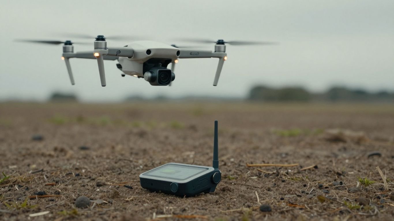
So, what exactly makes a drone "GPS-denied"? Basically, it’s a drone built to fly and operate without relying on the Global Positioning System. Most drones you see out there, the ones for fun or even basic professional tasks, depend heavily on GPS to know where they are and to stay steady in the air. But when you take these drones into places like inside a big metal building, a dense forest, or underground, that GPS signal just disappears or gets all wonky. That’s where GPS-denied drones come in. They use a bunch of other sensors, like cameras and fancy laser scanners, to figure out their position and keep themselves flying straight. It’s all about making sure the drone can still do its job even when the sky’s GPS signal is a no-show. This is super important for things like drone detection radar systems that need to track everything in the airspace.
The Evolution of Drone Navigation
Think about how drones used to be. Early models were pretty basic, and honestly, a bit of a handful to fly without GPS. They’d drift around and crash a lot. But technology has come a long way. Now, we’ve got drones that can switch into these non-GPS modes, and they’re getting smarter all the time. The need for drones avoiding GPS jamming or just plain signal loss has pushed this evolution. We’re seeing more and more autonomous drones that can handle themselves in tough spots. It’s not just about recreational flying anymore; it’s about making drones useful in real-world situations where GPS just isn’t reliable. This shift is paving the way for more advanced applications, moving beyond simple aerial photography.
Why Traditional GPS Fails in Certain Environments
Traditional GPS is great when you’re out in the open, but it has some serious blind spots. Imagine trying to get a GPS signal inside a giant steel tank or deep within a mine. It’s not going to happen. The metal blocks the signals, and the sheer depth or density of the environment just swallows them up. Even dense tree cover can mess with GPS. This is a big deal for tasks like inspecting infrastructure or searching for people in difficult terrain. When GPS fails, drones can become unstable, making them useless or even dangerous. This is why the development of GPS-independent drone flight is so critical for expanding their capabilities. It’s not just about convenience; it’s about enabling drones to perform vital tasks in places we couldn’t send them before, like in complex urban areas where signals can degrade. The ability to operate reliably in these conditions is a game-changer for many industries, including public safety and infrastructure inspection, where knowing the drone’s exact position is paramount. You can see how this is a big step up from just basic drone identification methods.
The Technology Behind GPS-Denied Navigation
So, how do these drones manage to fly around without a GPS signal? It’s all about using their own senses, kind of like how we do. Instead of relying on satellites way up in space, they use a bunch of fancy onboard sensors to figure out where they are and where they’re going. This is a big deal for autonomy, letting drones do more complex jobs on their own, even when things get tricky.
Leveraging Onboard Sensors for Location
Think of a drone’s sensors as its eyes and ears. They gather all sorts of information about the drone’s surroundings and its own movement. This includes things like:
- Inertial Measurement Units (IMUs): These track the drone’s acceleration and rotation, helping it stay stable.
- Barometers: These measure air pressure to help determine altitude.
- Cameras: These are used for visual odometry, essentially tracking how the drone moves by looking at the changes in the images it sees.
All this data works together to create a virtual map and keep the drone oriented, even without GPS. This is super important for countering GPS denial attacks, where an enemy might try to jam or spoof the GPS signal. By relying on its own sensors, the drone can keep flying and completing its mission.
Simultaneous Localization and Mapping (SLAM)
This is where things get really clever. SLAM is a technique that allows a drone to build a map of an unknown environment while simultaneously keeping track of its own location within that map. It’s like drawing a map of a new place as you walk through it, and also knowing exactly where you are on the map you’re drawing. This is a huge step for drone autonomy, allowing them to explore and operate in completely new or complex areas. For military applications, this means drones can scout enemy territory or navigate through damaged buildings without a reliable GPS feed. Companies like Spleenlab are developing advanced solutions that use SLAM for robust GPS-denied navigation.
The Role of LiDAR in 3D Mapping
LiDAR, which stands for Light Detection and Ranging, is another game-changer. It works by shooting out laser beams and measuring how long it takes for them to bounce back off objects. This creates a highly detailed 3D point cloud of the environment. LiDAR is fantastic for creating precise maps, especially in complex structures or areas with lots of obstacles. It can even see through things like dust or light fog, which is a big plus. When combined with SLAM, LiDAR allows drones to build incredibly accurate 3D models of their surroundings in real-time. This level of detail is invaluable for inspections, search and rescue, and even battlefield reconnaissance where understanding the terrain in three dimensions is critical. The ability to generate these detailed maps autonomously is a key aspect of advanced drone capabilities.
Critical Applications for GPS-Denied Drones
Inspections in Confined and Metallic Structures
When you’re trying to get a drone into tight spots, especially inside big metal things, GPS just doesn’t cut it. Think about inspecting the inside of a boiler or a pressure vessel. These places are like Faraday cages for GPS signals. That’s where drones built for GPS-denied environments shine. They use onboard sensors, like cameras and LiDAR, to figure out where they are and how to move around. This means you can get detailed 3D models of the inside of these structures, which is super helpful for spotting problems before they become big issues. It’s a game-changer for industries that deal with a lot of enclosed metal equipment.
Navigating Complex Industrial Facilities
Big factories, power plants, or even underground mines are full of places where GPS signals get blocked or bounce around confusingly. Drones that can operate without GPS are perfect for these kinds of jobs. They can fly autonomously through these mazes, mapping out areas, checking equipment, or even looking for safety hazards. This kind of autonomy is key, especially when you consider the risks involved in sending people into these potentially dangerous spots. Plus, with advanced AI, these drones can learn the layout of a facility and perform tasks more efficiently over time. This is especially important for things like anti-GPS spoofing for UAVs to keep operations secure.
Securing Sensitive Infrastructure Operations
When it comes to places like military bases, nuclear power plants, or critical government facilities, security is everything. Relying on GPS for drone operations in these areas can be a concern, not just because of signal jamming, but also due to potential data security risks. Many government agencies prefer using drones that don’t depend on external signals for navigation. This allows for secure data collection and inspection without the worry of external interference or signal loss. The ability for these drones to operate autonomously and reliably, even in heavily shielded environments, makes them ideal for maintaining the integrity and safety of sensitive sites. It’s all about having a reliable system that can perform its mission without external dependencies, which is a big deal for national security.
Industries Benefiting from GPS-Denied Drones
Mining and Underground Exploration
Think about trying to map out a new tunnel or check the stability of existing shafts deep underground. Traditional drones? Forget about it. The earth above, plus all the rock and metal, just blocks any GPS signal. That’s where GPS-denied drones really shine. They use their own sensors, like LiDAR, to build a 3D map as they go, letting us see what’s happening without putting people in harm’s way. This kind of tech is a game-changer for safety and efficiency in mining operations, allowing for detailed surveys and inspections in places that were once off-limits.
Energy Sector: Wind Turbines and Power Plants
Inspecting a giant wind turbine, especially the inside parts, is tricky business. All that metal and the complex machinery can mess with GPS signals something fierce. A drone that can’t rely on GPS might lose its bearings, which is a big problem when you’re flying near expensive equipment. Drones built for GPS-denied environments can handle these tight spots, using onboard sensors to stay on course. This means more thorough inspections of turbines and power plants, catching potential issues before they become major problems. It’s all about getting the data you need, safely and accurately, even when signals are weak or non-existent. This technology is also vital for securing sensitive infrastructure operations.
Maritime and Infrastructure Inspections
When you need to check the inside of a ship’s cargo hold or a fuel tank, you’re dealing with a lot of metal and no sky. Regular drones just won’t work. GPS-denied drones, however, are perfect for these jobs. They can fly into these dark, confined spaces, using their sensors to map the area and spot any damage or wear. It’s not just ships, either. Think about bridges with all their rebar, or tunnels – places where GPS signals are unreliable. These drones allow for detailed inspections that used to be dangerous, time-consuming, and expensive. The ability to operate autonomously in these challenging environments is transforming how we maintain critical infrastructure. This autonomy is key, especially when you consider the potential for battlefield use where GPS might be jammed or unavailable. The data collected can be incredibly precise, aiding in everything from structural assessments to search and rescue missions in collapsed buildings, much like how drones are being used in advanced firefighting efforts [38d9].
Advantages of Autonomous Flight Without GPS
Flying a drone without relying on GPS opens up a whole new world of possibilities, especially when you think about how much more autonomous these machines can become. This independence from external signals means drones can operate in places where GPS just doesn’t work, or worse, where it’s actively blocked. Think about military operations in contested airspace, or even just getting a drone to work reliably inside a giant metal structure. It’s not just about convenience; it’s about mission success.
Enhanced Operational Safety
When a drone can’t see the sky, it can’t get a GPS fix. This is a big deal for safety. Instead of relying on a signal that might be jammed or simply unavailable, these drones use onboard sensors to keep themselves stable and on course. This is a huge plus for search and rescue missions, where losing a signal in a dense forest or a collapsed building could mean missing a vital clue or putting the drone itself at risk. The ability to fly without GPS means the focus stays on the task at hand, not on whether the drone is about to drift off course. It’s about making sure the drone can do its job safely, even when things get tricky. This kind of tech is really changing how we approach search and rescue operations.
Improved Data Accuracy and Detail
Without GPS, drones are forced to rely on more precise, localized sensing methods. This often involves technologies like LiDAR and advanced computer vision, which can create incredibly detailed 3D maps of the environment. This isn’t just about knowing where the drone is; it’s about capturing high-resolution data that ground-based methods might miss. For inspections, this means getting a much closer look at structural integrity or potential defects, even in complex, cluttered spaces. The data collected is often more reliable because it’s not subject to the same signal interference that can plague GPS. This level of detail is becoming increasingly important for everything from infrastructure checks to battlefield reconnaissance.
Unrestricted Operation in Challenging Terrains
GPS-denied navigation is all about breaking free from limitations. Whether it’s the inside of a mine shaft, the complex network of pipes in a power plant, or the canyons between tall buildings in a city, these drones can go where others can’t. This capability is powered by advancements in edge AI, allowing the drone to process sensor data in real-time and make decisions on the fly. It means a drone can navigate through a maze of metal structures without losing its bearings, or follow a path it recognizes visually even if the terrain is completely unfamiliar. This freedom from GPS allows for operations in environments that were previously inaccessible or too dangerous for robotic systems.
Future Trends in Drone Autonomy
So, where are we headed with drones that can fly without a clear view of the sky? It’s a pretty exciting space, honestly. We’re seeing a massive push towards making these machines even smarter and more independent. Think about it: drones that can figure things out on their own, even when things get tricky.
AI and Deep Learning Integration
This is where things get really interesting. Artificial intelligence, or AI, is like giving drones a brain. Instead of just following pre-programmed paths, AI allows them to learn from their surroundings and make decisions in real-time. This is super important for complex jobs where conditions change constantly. For example, a drone inspecting a collapsed building might need to find a safe path through rubble. AI helps it do just that, avoiding obstacles it wasn’t specifically programmed to see. The integration of AI is rapidly transforming drones from remote-controlled tools into truly autonomous agents. Machine learning, a part of AI, means drones can get better at tasks over time, just by doing them. This is a game-changer for everything from search and rescue to detailed industrial checks.
The FAA’s Vision for GPS-Independent Flight
The Federal Aviation Administration (FAA) is also looking ahead. They understand that for drones to be truly useful in more situations, they can’t always rely on GPS. This is especially true for operations that go beyond what a person can see, like long-distance deliveries or monitoring large areas. The FAA is working on rules and standards that will allow for more complex drone flights, even when GPS signals are weak or unavailable. This involves developing new ways for drones to know where they are and how to fly safely, perhaps using a combination of sensors and communication systems. Getting these regulations sorted is key to letting drone technology reach its full potential, and it’s something many industries are watching closely, especially those looking at drone use for public safety like police departments.
Expanding Use Cases for GPS-Denied Drones
Because drones are getting so good at flying without GPS, we’re seeing them pop up in more and more places. Imagine drones that can fly inside active volcanoes, or deep within mines to map out new resources. They’re also becoming vital for inspecting things like wind turbines or bridges, where getting close can be dangerous for humans. The military is also a big user, employing drones for reconnaissance in areas where GPS might be jammed or unavailable. This ability to operate in tough spots means drones can gather information that was previously impossible to get, or at least very risky to obtain. It’s not just about flying; it’s about what they can do once they’re up there. This includes things like detailed mapping of underground tunnels or providing real-time video feeds from inside large, metallic structures that would block GPS signals. The future looks like drones being able to handle almost any environment, providing data and performing tasks that were once science fiction.
| Application Area | Key Benefit | Technology Focus |
|---|---|---|
| Military Reconnaissance | Operating in GPS-jammed zones | AI, Sensor Fusion |
| Underground Mining | Mapping complex, unlit environments | LiDAR, SLAM |
| Infrastructure Inspection | Accessing confined, metallic structures | Onboard Sensors, Visual Odometry |
| Disaster Response | Navigating debris-filled areas | AI, Collision Avoidance |
Conclusion
Drones that can fly without GPS are no longer a niche technology; they’re becoming a vital tool across many industries. As these GPS-denied drones get smarter and more capable, they’ll continue to open up new possibilities for safe, efficient, and detailed data collection in places we couldn’t reach before. It’s pretty exciting to think about where this technology will take us next.
Frequently Asked Questions
What exactly is a GPS-denied drone?
Think of a regular drone like a car that needs road signs (GPS) to know where to go. A GPS-denied drone is like a car with a super smart driver who can see the road, buildings, and other cars to figure out its way, even if there are no signs. It uses cameras and other sensors on board to understand its location and fly safely.
Why can’t drones just use GPS everywhere?
GPS signals are like radio waves, and they can get blocked or messed up. Big metal buildings, tunnels, underground areas, or even dense forests can stop the signals from reaching the drone. In these spots, a normal drone would get lost or stop working right.
How do these drones know where they are without GPS?
They use a bunch of cool tech! They have cameras that look at things around them, like walls or objects, and compare what they see to maps they’re building. They also use things like LiDAR, which is like a laser scanner, to measure distances and create a 3D picture of the area. This helps them know their position and move around.
What is SLAM?
SLAM stands for Simultaneous Localization and Mapping. It’s a fancy way of saying the drone is doing two things at once: figuring out where it is (localization) while also building a map of the place it’s in (mapping). It’s like drawing a map of your house as you walk through it for the first time.
What kind of jobs are GPS-denied drones good for?
They’re awesome for inspecting things that are hard to get to or dangerous for people. This includes checking inside big pipes, wind turbines, mines, or even inside ships. They can also be used for tasks like searching for people in collapsed buildings after a disaster where GPS signals are gone.
Are these drones safe to use around important places like power plants?
Yes, in fact, they are often preferred for sensitive areas. Some people worry that GPS might need an internet connection, which could be a security risk. Since GPS-denied drones don’t rely on outside signals, they are seen as a more secure option for inspecting places like nuclear power plants or military bases.