Drone No-Fly Zones: What You Need to Know
Thinking about flying your drone? That’s awesome! But before you take off, it’s super important to know where you *can’t* fly. It might seem like a lot, but understanding drone no-fly zones explained is key to staying out of trouble and keeping everyone safe. We’re talking about everything from airports to prisons, and even some parks. Let’s break it down so you can fly smart.
Key Takeaways
- Airports are strictly off-limits for drones unless you get special permission. This is to avoid any accidents with real planes.
- Temporary Flight Restrictions (TFRs) pop up for events like big sports games or emergencies, and you need to know about them.
- Locations like prisons and Washington D.C. have very specific and strict rules about drone use, often banning them completely.
- National Parks and even some local parks and schools might have their own rules, so always check before you fly.
- Tools like the B4UFLY app and LAANC can help you figure out where it’s safe and legal to fly your drone.
Understanding Drone No-Fly Zones Explained
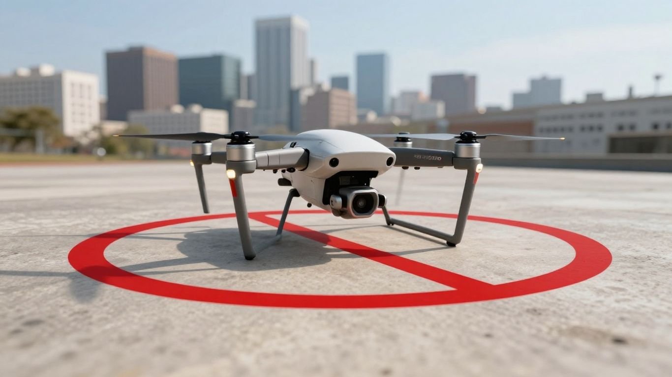
So, you’ve got a drone, and you’re itching to take it for a spin. That’s awesome! But before you launch, it’s super important to know about "No Drone Zones." Think of them as specific areas where flying your drone isn’t allowed, or at least, not without getting special permission first. These restrictions are in place for a bunch of reasons, mostly about keeping things safe and secure. Understanding these drone flight restrictions is key to staying out of trouble.
What Constitutes A No Drone Zone
Basically, a "No Drone Zone" is any area where the FAA or local authorities have put up a restriction on drone operations. This can be permanent or temporary. The FAA uses this term to make it clear that you can’t just fly anywhere. You need to know where can I fly my drone and where you absolutely cannot.
- Restricted Airspace: This is airspace the FAA has specifically said drones can’t enter. It’s often around airports or military bases.
- Local Restrictions: Sometimes, it’s not the FAA but your city or state government that says "no drones allowed." These rules often apply to taking off or landing in places like parks or public facilities. It’s important to remember that a "No Drone Zone" sign usually means you can’t take off or land there, even if you might be allowed to fly over it (though that’s rare).
- Temporary Flight Restrictions (TFRs): These are put in place for short periods, like during major events or emergencies. The FAA will announce these, and they act as temporary no-fly areas for drones.
It’s really up to you, the pilot, to know the rules of the sky. Ignorance isn’t a great excuse when it comes to aviation regulations.
The FAA’s Role in Defining Restricted Airspace
The Federal Aviation Administration (FAA) is the main agency that manages U.S. airspace. They set the rules for pretty much everything that flies, including drones. When they designate an area as restricted, it’s usually for safety reasons. This includes things like keeping drones away from airports to prevent collisions with airplanes. They also have a hand in defining some of the larger restricted areas, like those around Washington D.C. or over national parks. You can check out resources like the B4UFLY app to see these areas.
Local Government Authority Over Drone Operations
While the FAA handles the big picture of airspace, local governments have a say too. Cities and states can create their own rules about where drones can take off and land. This is why you might see signs in local parks or near schools saying "No Drone Zone." These local rules are often about privacy and preventing disturbances. It’s always a good idea to check with your local city or county government if you’re unsure about the rules in your area. They might have specific drone operating limitations explained on their websites.
How to check controlled airspace before launch
Before you even think about powering up your drone, you need to check the airspace. It’s not complicated, but it does take a few minutes. Here’s a quick rundown:
- Use an App: The easiest way is to use a drone app like the FAA’s B4UFLY. These apps show you real-time information about airspace restrictions, including FAA-controlled airspace and temporary flight restrictions. They’re designed to tell you exactly where you can and cannot fly.
- Check FAA Resources: The FAA website has information on controlled airspace and other restrictions. While apps are more user-friendly for quick checks, the official FAA site is the source of truth.
- Understand Airport Airspace: Pay special attention to areas around airports. These are almost always controlled airspace, and you’ll need authorization to fly near them. Knowing the rules for flying drones near airports is critical.
Remember, flying in FAA drone no-fly areas without permission can lead to hefty fines and other penalties. A little bit of pre-flight planning goes a long way.
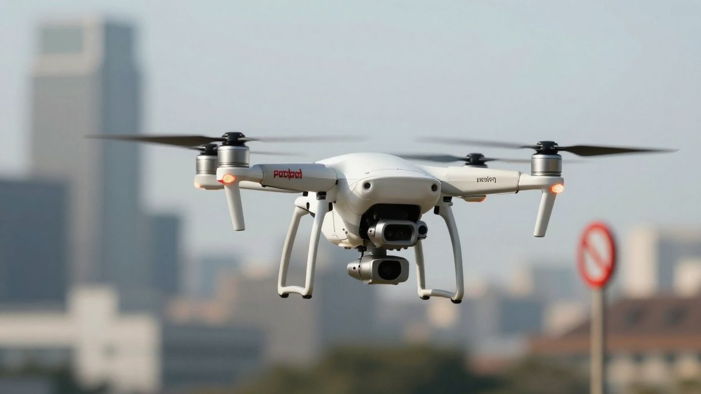
Navigating Airspace Restrictions Around Airports
Why Airports Are Critical No Drone Zones
Airports are probably the most important places to avoid with your drone. Seriously, the airspace around them is super restricted for a good reason. Think about it: you’ve got big, fast airplanes taking off and landing all the time. The last thing anyone needs is a small drone getting in the way. It’s not just about annoying the pilots; a collision, even with a tiny drone, could be really bad news for a passenger jet. The FAA makes it clear that flying near airports without permission is a big no-no. It’s all about keeping those massive metal birds and everyone inside them safe. So, if you see an airport, just keep your drone far away.
Understanding Airport Airspace Classes
Airports have different zones around them, and they’re not all the same. The FAA calls these ‘airspace classes,’ and they basically tell you how restricted the area is. You’ll hear about Class B, C, D, and E airspace, and they all have different rules. Generally, the closer you are to the airport, the stricter the rules. Think of it like an upside-down pyramid – it’s wider at higher altitudes the further you get from the airport, but right near the runways, it’s a much tighter zone. Each class has specific altitude limits and requirements for communication with air traffic control. For recreational flyers, the main takeaway is that most of this airspace is off-limits unless you get specific approval. It’s up to you to know which class applies to the airport you’re near. You can check out resources like the B4UFLY app to get a general idea, but always double-check official charts if you’re serious about flying nearby.
Securing Authorization for Airport Vicinity Flights
Okay, so you need to fly near an airport, but you’re not sure if you can. Don’t just send it! The FAA has a system for this, and it’s called LAANC, which stands for Low Altitude Authorization and Notification Capability. It’s a pretty neat system that lets you request authorization to fly in controlled airspace, like around airports, pretty quickly. You can usually get an answer in seconds or minutes, not days. This is available for both recreational pilots and those with a Part 107 license. You’ll typically use an app that supports LAANC to submit your request. They’ll look at your proposed flight path and altitude and decide if it’s safe. If approved, you’ll get a notification, and you can fly within those specific parameters. It’s a game-changer for drone pilots who need to operate in these sensitive areas, but remember, you must have that authorization before you even think about taking off. Flying without it is a serious violation. You can find more information on how to get this authorization through the FAA’s website.
Temporary Flight Restrictions And Special Events
Identifying Temporary Flight Restrictions (TFRs)
Sometimes, the sky isn’t as open as you think, even if there isn’t a permanent no-fly zone marked on a map. That’s where Temporary Flight Restrictions, or TFRs, come in. These are basically temporary no-drone zones put in place by the FAA for all sorts of reasons. Think of them as pop-up restrictions. They can pop up for major events, but also for things like presidential movements, emergency responses after a disaster, or even just unusual weather conditions that might mess with your drone’s sensors. It’s your job as a pilot to know if a TFR is active before you fly. Checking for TFRs is super important, and you should do it at least 24 hours before any planned flight. The FAA keeps a list of active TFRs, and you can usually find it on their website, often filterable by state or type. Ignoring a TFR can lead to some serious trouble, like fines or even losing your pilot certificate. It’s not worth the risk.
Drone Prohibitions During Major Sporting Events
Got tickets to the big game? You might want to leave your drone at home. The FAA has specific rules about flying drones around major sporting events, especially those involving professional leagues like the NFL, MLB, or NASCAR, and even big college games. Generally, you can’t fly your drone within an hour before the event starts and for an hour after it ends. This isn’t just about the stadium itself; it covers a wider area. Why? Well, imagine a drone getting too close to the helicopters that might be covering the event or, worse, interfering with emergency services. It’s a safety thing, plain and simple. These events often have TFRs automatically put in place, so keep an eye out for those specific notices.
Special Flight Rules Areas (SFRA) Explained
Some places have airspace rules that are a bit more complex than a simple no-fly zone. Washington D.C. is a prime example, with what’s called a Special Flight Rules Area, or SFRA. This area has layers of restrictions. There’s a core zone, usually around 15 miles from the city’s main airport, where drone flight is pretty much a no-go unless you have special government authorization. Then, there’s a larger ring, maybe out to 30 miles, with slightly less strict rules, but you still have to follow standard FAA regulations like flying below 400 feet and keeping clear of other aircraft. These areas are designed with national security and air traffic safety in mind, so it’s vital to understand the specific boundaries and rules if you plan to fly anywhere near them. You can find details about these areas on the FAA’s website, and it’s always best to check the B4UFLY app for the most current information before you even think about launching.
Restrictions In Sensitive Locations
Drone Prohibitions At Prisons And Correctional Facilities
Flying drones near prisons and correctional facilities is a big no-no. Why? Well, unfortunately, drones have been used to smuggle contraband into these places. Because of this, the FAA, along with the Department of Justice and Department of Homeland Security, has put strict rules in place. Generally, you need to stay at least 400 feet away from the boundaries of these facilities. It’s all about security and preventing illegal activities. Some places have even gotten pretty creative with anti-drone tech, so it’s best to just steer clear.
Navigating Restrictions In Washington D.C.
Washington D.C. is a whole different ballgame when it comes to drone flying. It’s a Special Flight Rules Area (SFRA), and it’s pretty serious. There’s an inner ring, about 15 miles around Reagan National Airport, where flying is basically prohibited unless you’re on official government business or involved in national security. Outside of that, but within a 30-mile radius, you have a bit more leeway, but still need to follow standard rules like staying below 400 feet and registering your drone if it’s over 0.55 lbs. It’s a complex area, so always check the latest FAA advisories before even thinking about flying near the capital.
Understanding Rules For National Parks
When it comes to National Parks, the FAA doesn’t have a blanket ban, but the National Park Service (NPS) does. Back in 2014, they declared that drones are restricted in all areas managed by the NPS. This covers all national parks, monuments, battlefields, and even seashores. The NPS might grant permission for drone flights, but usually only for specific research or scientific purposes. So, unless you’re conducting official research, leave your drone at home when visiting these beautiful natural spaces. It’s about protecting the environment and the wildlife, as well as the visitor experience. You can find more information on drone policies directly from the National Park Service.
Flying near sensitive locations requires extra diligence. Always assume there are restrictions and verify them through official channels before takeoff. Ignorance of the rules is not a valid defense and can lead to significant penalties.
Local Laws And Private Property Considerations
State And City Park Drone Regulations
So, you’ve got your drone, you’re ready to fly, but wait – what about the local rules? It’s not just about the big federal regulations; many states and cities have their own specific laws about where and how you can fly. This is especially true for public spaces like parks. Some city parks might allow drones, while others have outright bans. State parks can be even more restrictive. It’s always a good idea to check the specific park’s website or look for signage before you take off. Ignoring these local rules could mean a fine or even having your drone confiscated. It’s a bit of a patchwork, so doing your homework for the specific area you plan to fly in is key.
Drone Operations Near Schools
Schools are generally a no-go zone for drones, and for good reason. Think about it – kids, privacy, and the potential for distraction. Most places have rules against flying drones over school grounds, especially during school hours. This is to protect students and staff. Even if there isn’t a specific sign, it’s best to assume it’s restricted. Flying near a school could be seen as a privacy violation or even a safety concern, leading to trouble with the authorities. Always err on the side of caution and keep your drone well away from educational institutions.
Privacy Laws And Flying Over Private Property
This is where things can get a little tricky. The Federal Aviation Administration (FAA) says you can fly over private property as long as you’re in public airspace and following all other drone rules, like staying below 400 feet and keeping your drone in sight. However, that doesn’t mean you can just hover over someone’s backyard. Many states have privacy laws that come into play. If you’re flying low, capturing images where someone has a reasonable expectation of privacy (like through a window or a fenced yard), or generally being a nuisance, you could be breaking state or local laws. It’s a good practice to be mindful of people’s privacy and avoid flying directly over private residences at low altitudes. If you’re unsure, it’s best to check out resources like Texas statutes and federal laws for more detailed information on drone operations. Remember, while the FAA controls the airspace, property owners have rights regarding their land, especially concerning privacy and potential nuisances. Flying drones over private property is permitted by the FAA, but operating at lower altitudes can lead to legal disputes and neighborly conflicts.
It’s important to remember that even if a local law about drone use hasn’t been formally challenged in court, it can still be enforced. So, being aware of and respecting these local ordinances, even if you disagree with them, is the safest bet to avoid potential penalties.
Tools And Resources For Drone Pilots
Alright, so you’ve got your drone, you’re excited to fly, but where can you actually go? It’s not just about knowing the rules, it’s about having the right tools to check airspace before you even think about taking off.
Utilizing The B4UFLY App
First up, let’s talk about the B4UFLY app. Think of this as your go-to buddy for checking where you can and can’t fly. It’s super handy, especially if you’re just flying for fun. The FAA put this out to help recreational flyers stay out of trouble. It shows you all the restricted areas, like near airports or over certain facilities. It’s pretty straightforward to use; you just open it up, and it gives you a clear picture of the airspace around you. It’s a good habit to check this before every flight, seriously. You can find out more about these guidelines on the FAA’s B4UFLY service.
The Low Altitude Authorization and Notification Capability (LAANC)
Now, what if you need to fly in an area that’s usually restricted, like near an airport? That’s where LAANC comes in. This is the Low Altitude Authorization and Notification Capability. It’s basically a system that lets you request permission to fly in controlled airspace. It’s not just for the pros, either; both commercial pilots and recreational flyers can use it. The cool thing is, it’s usually pretty fast. You can often get an authorization in just a few seconds through apps that use the LAANC system. It makes getting clearance much easier than it used to be, which is great for flexibility without messing with safety.
FAA-Recognized Identification Areas (FRIAs)
Lastly, let’s touch on FRIAs, or FAA-Recognized Identification Areas. These are specific zones that the FAA has set up. The main thing to know about FRIAs is that if you’re flying within one, you don’t need to have your drone equipped with Remote ID technology. This can be a big deal for some pilots. It’s basically a way to fly in certain designated areas without needing that extra piece of equipment.
Knowing these tools can save you a lot of headaches. It’s always better to be prepared and check the airspace before you launch. Flying safely means being informed.
Here’s a quick rundown of what to check:
- B4UFLY App: For general awareness of no-fly zones.
- LAANC: For requesting authorization in controlled airspace.
- FRIAs: For flying without Remote ID in designated areas.
Remember, staying updated on these resources is part of being a responsible drone pilot. It helps keep the skies safe for everyone, including manned aircraft and other drone operators. And hey, if you’re flying at night, there are special rules for that too, which you can read about here.
Wrapping Up: Fly Smart, Fly Safe
So, there you have it. Flying a drone is pretty awesome, but it comes with rules. Knowing where you can and can’t fly is super important, not just to avoid trouble with the law, but to keep everyone safe. Always check things like airports, stadiums, and even national parks before you take off. Apps like B4UFLY are your friend here. Remember, it’s up to you to know the rules of the sky. A little bit of planning goes a long way in making sure your drone adventures are fun and problem-free. Happy flying!
Frequently Asked Questions
What exactly is a ‘No Drone Zone’?
A ‘No Drone Zone’ is basically a spot where flying your drone isn’t allowed. The rules for these zones can be different depending on the location. The Federal Aviation Administration (FAA) uses this term to help people know where they can’t fly. You can use tools like the B4UFLY app to check if the area you want to fly in has any restrictions.
Why are airports considered ‘No Drone Zones’?
Airports are super important places for planes. Flying drones near them is dangerous because a drone could accidentally hit a real airplane. This could cause a lot of damage and put people at risk. So, the airspace around airports is usually off-limits for drones unless you get special permission.
Can I fly my drone over someone’s house?
Generally, you can fly your drone over private property as long as you follow FAA rules, like staying below 400 feet and keeping your drone in sight. However, you can’t use your drone to spy on people or invade their privacy. Some places also have their own local laws about flying over private property, so it’s smart to check those too.
What are Temporary Flight Restrictions (TFRs)?
Temporary Flight Restrictions, or TFRs, are like temporary ‘No Drone Zones’ that pop up for a limited time. They might be put in place for big events like major sports games, or for other reasons like presidential visits or security concerns. The FAA will announce these TFRs, and you must follow them.
Are there special rules for flying drones in places like national parks or prisons?
Yes, there are often strict rules for places like national parks and prisons. National parks usually don’t allow drones to protect wildlife and visitors, though sometimes research is permitted. Prisons ban drones to prevent smuggling. Washington D.C. also has very tight drone restrictions because of its important government buildings.
How can I find out where I can and cannot fly my drone?
There are helpful tools available! The FAA’s B4UFLY app is a great place to start. It shows you where recreational flying is allowed and where it’s restricted. You can also look into the Low Altitude Authorization and Notification Capability (LAANC) system if you need authorization to fly in certain controlled areas.