Drones: Your New Inspection Buddies
So, you’ve heard about drones, right? They’re not just for cool aerial shots anymore. These flying gadgets are becoming serious workhorses, especially when it comes to checking on things like bridges, roofs, and wind turbines. Think of them as your new inspection buddies, making tough jobs safer and a lot less of a headache. We’re going to look at how these drone inspection services are changing the game.
Key Takeaways
- Drones are making infrastructure checks, like for bridges, much safer and more efficient than old methods.
- Using drones means fewer risks for workers who would normally have to get close to dangerous spots.
- Companies need to plan carefully, assess risks, and understand regulations before starting drone inspection services.
- New tech like AI helps drones fly themselves and avoid problems, even without GPS.
- Drone inspections aren’t just for bridges; they’re great for roofs, solar panels, and wind turbines too.
Revolutionizing Infrastructure Inspections With Drones
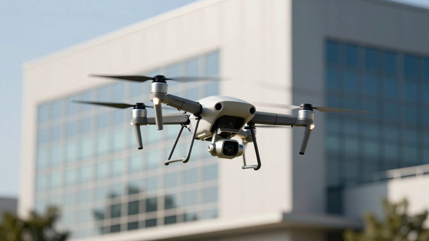
Forget the old ways of inspecting things like bridges, roofs, and wind turbines. Drones are changing the game, making these jobs safer and way more efficient. Think about it: instead of sending people up high or into tight spots, we can now send a drone. It’s a big deal for infrastructure maintenance.
Bridge Inspection Advancements
Inspecting bridges used to be a real headache. Inspectors often had to get into precarious positions, sometimes dangling from ropes or using specialized trucks that blocked traffic for ages. Now, drones can get up close and personal with bridge structures, capturing detailed images and data without putting anyone at risk. This technology is a game-changer for keeping our bridges safe. The North Carolina Department of Transportation, for example, got special permission to fly drones beyond the pilot’s sightline for bridge checks. This means they can inspect more bridges faster and with less disruption to drivers. It’s a huge step forward for remote sensing for infrastructure.
Scaling Drone Inspection Programs
Getting a drone program off the ground and making it work for lots of inspections isn’t just about buying a few drones. It’s about having a plan. You need to figure out the risks, what kind of data you actually need, and how the drones will fly. For instance, when inspecting something like a solar panel farm, you need to cover a lot of ground. Drones can do this quickly, spotting issues that might be missed otherwise. It’s about making sure the drones can handle the job, whether it’s a quick roof check or a detailed survey of a pipeline.
Navigating Regulatory Landscapes
Flying drones for work, especially for things like pipeline surveys or wind turbine checks, comes with rules. The Federal Aviation Administration (FAA) has regulations, and sometimes you need special permission, like waivers, to fly in certain ways. This is where understanding the rules and having a solid plan, often called a Concept of Operations (CONOPS), becomes really important. It’s not just about the tech; it’s about flying smart and legally. Working with experienced aerial surveying companies can help sort through these complexities, making sure your drone operations are compliant and effective across different types of infrastructure.
Enhancing Safety and Efficiency in Inspections
Let’s face it, traditional inspections can be a real pain. Think about climbing up on a wobbly ladder to check a roof, or dangling precariously from a bridge to spot a crack. It’s not just uncomfortable; it’s downright dangerous. Drones are changing all of that, making inspections safer and way more efficient across the board.
Reducing Risks for Inspectors
The biggest win here is keeping people out of harm’s way. Instead of sending inspectors up on rickety scaffolding or into tight, hard-to-reach spaces, a drone can do the heavy lifting. For instance, inspecting a tall cell tower or a sprawling solar farm used to involve a lot of climbing and exposure to the elements. Now, a pilot can operate the drone from the safety of the ground, getting eyes on every nook and cranny without putting themselves at risk. This is a game-changer for industries like construction and energy, where falls are a major concern. It means fewer injuries and a more secure work environment for everyone involved.
Improving Data Accuracy and Detail
Drones aren’t just about safety; they’re also about getting better information. They can get up close and personal with structures, capturing high-resolution images and videos that human inspectors might miss. Imagine checking a wind turbine blade for tiny cracks or assessing the condition of a pipeline snaking through rough terrain. A drone equipped with specialized sensors can provide incredibly detailed data, allowing for more precise assessments. This level of detail helps in identifying potential problems early, before they become major issues. It’s like having a super-powered magnifying glass for infrastructure.
Minimizing Disruption to Public Services
We’ve all been stuck in traffic because of roadwork or utility maintenance. Drones can significantly cut down on that disruption. For bridge inspections, instead of closing lanes for hours or even days to set up equipment, a drone can often complete the assessment in a fraction of the time. This means less traffic congestion and fewer headaches for commuters. Similarly, inspecting roofs or solar panels on commercial buildings can be done with minimal impact on business operations. The ability to conduct inspections quickly and efficiently means public services can continue with less interruption, which is a win for everyone.
Here’s a quick look at how drones are making a difference:
- Bridges: Get detailed views of undersides and hard-to-reach supports without lane closures.
- Roofs: Inspect for damage, wear, or installation issues from a safe distance.
- Solar Panels: Identify faulty panels or debris accumulation across large arrays.
- Wind Turbines: Examine blade integrity and tower structure for wear and tear.
- Pipelines: Survey long stretches of infrastructure in remote or difficult terrain.
The shift towards drone-based inspections isn’t just about adopting new technology; it’s about fundamentally rethinking how we approach safety and efficiency in critical infrastructure assessments. By reducing human risk and improving data quality, drones are proving to be indispensable tools for modern maintenance and oversight. This move towards automated data capture is a big step forward for many organizations looking to scale their inspection programs [007a].
This improved data collection and reduced operational impact are key reasons why more organizations are looking into drone services for their inspection needs. It’s a smart way to manage assets and keep things running smoothly.
Key Considerations for Drone Inspection Services
So, you’re thinking about using drones for inspections? That’s smart. But before you just send one up, there are a few things to really think about. It’s not as simple as just buying a drone and going. You need a plan.
Understanding Operational Risks
Flying a drone, especially for work, comes with risks. Think about it: you’re operating a piece of technology in the real world, often near structures or people. For instance, inspecting a roof means you’re flying near a house, maybe with trees around. A mistake could mean property damage or worse. Bridges are another big one; they often mess with GPS signals, making flight tricky. And wind turbines? They’re tall, with moving parts. You absolutely need to know what could go wrong and how to stop it. This is where a good UAV site assessment comes in handy, looking at the area before you even fly.
- Pilot Training: Are your pilots skilled enough for complex maneuvers?
- Equipment Reliability: Is your drone well-maintained and suited for the job?
- Environmental Factors: How will wind, rain, or GPS issues affect your flight?
- Insurance: Do you have the right coverage if something goes wrong?
Understanding the potential hazards is the first step to flying safely and effectively. It’s about being prepared for the unexpected.
Defining Program Value and Data Needs
Why are you using drones in the first place? What problems are you trying to solve? For example, inspecting a solar panel array might be about finding hot spots with a thermal camera, something hard to do by hand. Pipeline surveys can cover miles of terrain quickly, spotting leaks or damage. Focus on what’s dangerous, time-consuming, or expensive with current methods and see how drones can fix that. Don’t try to do everything at once. Figure out what data you actually need – high-res photos, thermal images, 3D models – and make sure your drone setup can get it.
- Identify Pain Points: What tasks are currently difficult, risky, or costly?
- Determine Data Requirements: What specific information do you need from the inspection?
- Quantify Benefits: How will drone use save time, money, or improve safety?
Developing Concepts of Operation
This is basically your flight plan and rules. How will you fly? What airspace are you in? What regulations do you need to follow? For example, flying a drone for commercial purposes, like inspecting a bridge for a government agency, requires specific certifications and possibly waivers from aviation authorities. You can’t just fly anywhere, anytime. You need to know the rules for your area and your specific task. Thinking about your entire operation, not just one flight, helps you figure out what approvals you might need. This is where understanding the regulatory landscape becomes really important, especially if you plan to fly beyond visual line of sight (BVLOS). Getting the right permissions can make or break your program’s ability to scale. Investing in professional-grade drones with advanced sensors can also be a significant upfront cost, sometimes ranging from $5,000 to $20,000 or more, depending on the specialization needed for tasks like detailed mapping or industrial inspections [0921].
- Flight Procedures: Define standard operating procedures for different inspection types.
- Regulatory Compliance: Research and adhere to all local, state, and federal drone laws.
- Airspace Management: Plan flights considering air traffic and restricted zones.
- Data Management: Establish protocols for storing, processing, and sharing collected data.
The Technology Behind Autonomous Inspections
So, how do these drones actually pull off these amazing inspection feats? It’s all about the tech packed inside. We’re talking about smart systems that let drones fly themselves, even in tricky spots where a human pilot would have a tough time. This onboard intelligence is what really makes autonomous drones game-changers for inspections.
Think about it. For a bridge inspection, you’ve got metal structures that can mess with GPS signals. Drones equipped with advanced AI use multiple cameras to see their surroundings in 360 degrees. This lets them build a real-time 3D map of where they are and where they’re going. It’s like they have their own eyes and a brain, figuring out how to avoid bumping into anything, even if the GPS is spotty. This is a big deal for things like inspecting under bridge decks or inside wind turbine towers where visibility and signal can be a problem.
Here’s a quick look at what makes them tick:
- AI-Powered Obstacle Avoidance: This is the "brain" of the operation. Using computer vision and machine learning, the drone constantly scans its environment. It can predict movements and make smart decisions to steer clear of obstacles, whether it’s a tree branch, a piece of equipment, or part of the structure being inspected. This means fewer crashes and more successful flights.
- Autonomous Flight Capabilities: Instead of a pilot manually controlling every move, the drone can be programmed to follow a specific path or task. It can fly itself to a designated point, orbit an asset, or perform complex maneuvers without constant human input. This allows for consistent data collection and frees up the operator to focus on what the drone is seeing.
- Sensor Technology for Data Capture: What good is flying if you can’t see what you’re looking for? Drones are fitted with high-resolution cameras, thermal sensors, and other specialized equipment. These sensors gather detailed visual data, detect temperature anomalies on solar panels, or spot subtle structural issues on roofs and pipelines. The quality of the data captured is key to the inspection’s success.
These technologies aren’t just for bridges, either. Imagine inspecting a sprawling solar farm, where drones can autonomously fly row by row, checking for hot spots. Or think about roofing assessments, where a drone can map out an entire roof surface, identifying damage or wear. For wind turbines, autonomous flight allows for close-up inspections of blades without putting people at risk. Pipeline surveys also benefit, with drones able to cover long distances and capture imagery in remote or hazardous terrain. This kind of automation is what allows drone inspection programs to scale up effectively.
The ability for drones to fly autonomously, especially in challenging environments like those found under bridges or within complex industrial sites, significantly reduces the risk to human inspectors. It also means that inspections can be performed more frequently and with greater detail than ever before, leading to better maintenance decisions.
This advanced technology is paving the way for more efficient and safer inspections across a wide range of industries. It’s not just about replacing manual labor; it’s about doing the job better, faster, and with less risk. You can find leading autonomous drone solutions in the USA that are driving these advancements.
Ultimately, these autonomous capabilities are designed for rapid, high-quality data capture, which is the core of any successful inspection program. This allows for scalable and holistic solutions that truly improve how we monitor our infrastructure.
Expanding Drone Applications Beyond Bridges
While bridges are a big win for drone inspections, that’s just the start. Think about all the other places drones can go where sending people is tricky, slow, or just plain risky.
Roofing Assessments
Inspecting roofs, especially on large commercial buildings or industrial facilities, used to mean sending someone up there with a ladder or even renting a lift. Now, a drone can get a bird’s-eye view in minutes. It can spot missing shingles, water damage, or wear and tear that might be hard to see from the ground. This means quicker assessments and less downtime for businesses. It’s all about getting a clear picture without the usual hassle.
Solar Panel Monitoring
Solar farms are huge, and keeping tabs on every panel is a big job. Drones equipped with thermal cameras can quickly identify malfunctioning panels that are overheating or not producing power efficiently. This helps operators fix issues before they become major problems, keeping the energy flowing. It’s a smart way to maintain large solar installations.
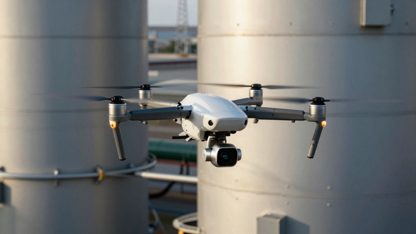
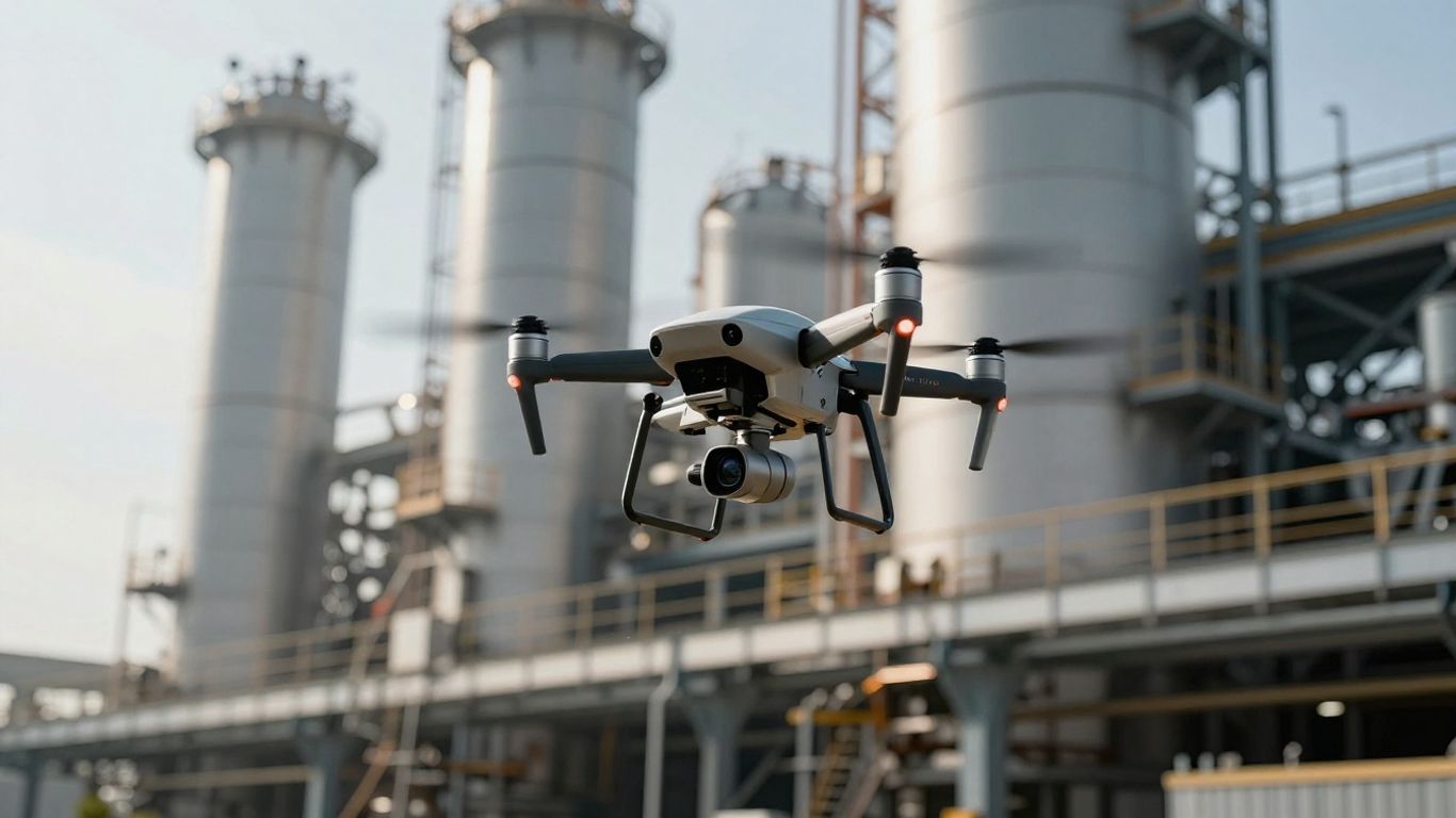
Wind Turbine and Pipeline Surveys
Wind turbines are massive structures, and inspecting their blades for cracks or damage requires getting up close. Drones can do this safely, capturing high-resolution images that human inspectors might miss. Similarly, pipelines, whether for oil, gas, or water, often stretch for miles across difficult terrain. Drones can fly along these routes, looking for leaks or structural issues. This kind of aerial survey is a game-changer for industries that manage long, critical infrastructure. You can get a good look at pipeline integrity without all the ground crew.
Other Applications
Beyond these, drones are proving useful for:
- Tower Inspections: Cell towers, radio towers, and other tall structures can be inspected for structural integrity and damage.
- Building Facades: Checking the exterior of buildings for cracks, water intrusion, or other maintenance needs.
- Power Line Monitoring: Inspecting power lines and their supporting structures for faults or damage.
The key is identifying tasks that are currently dangerous, time-consuming, or expensive for humans. Drones can often step in and perform these tasks more safely and efficiently, providing detailed data that helps prevent bigger problems down the line. This allows teams to focus on repairs rather than just the inspection itself.
Achieving Scalable Drone Operations
So, you’ve seen how drones can really change the game for inspections, right? But getting from a single successful test flight to a full-blown, everyday operation across your whole organization is a whole different ballgame. It’s not just about buying more drones; it’s about building a system that works, consistently and safely. The real trick to scaling is planning and smart execution.
The Importance of Training and Expansion
Think about it: flying a drone manually takes skill, and flying it in tricky spots, like under a bridge or around a tall tower, takes even more. When you’re looking to expand, you can’t just throw a few new pilots at the problem. You need a solid training program. This means not only teaching them how to fly but also how to handle specific inspection tasks, understand the unmanned aircraft data collection process, and follow safety protocols. For example, inspecting roofs on a large commercial building requires different techniques than surveying a wind turbine. Proper training ensures that your team can handle diverse scenarios, from detailed commercial drone photography on solar panels to navigating complex pipeline routes.
Here’s a quick look at what a good training expansion might cover:
- Basic Flight Proficiency: Mastering controls, understanding flight modes, and basic navigation.
- Inspection-Specific Techniques: Learning how to position the drone for optimal data capture on different assets like bridges, towers, and turbines.
- Data Management & Reporting: Understanding how to collect, organize, and report on the gathered information.
- Safety & Regulatory Compliance: Staying up-to-date with rules and best practices.
Sustaining a Drone Inspection Program
Keeping a drone program running smoothly long-term involves more than just initial training. You need to think about maintenance, software updates, and how you’ll manage your fleet. Are you going to have a central team, or will each department manage its own drones? This is where good fleet management software comes in handy, helping you keep track of everything from flight logs to pilot certifications. It’s about creating a sustainable rhythm so the program doesn’t fizzle out after the initial excitement.
When you’re looking to scale, it’s easy to get caught up in the technology. But remember, the people operating the drones and the processes you put in place are just as important, if not more so. A well-trained pilot using a slightly older drone can often outperform a poorly trained pilot with the latest model.
Partnering for Success
Sometimes, the best way to scale is to not go it alone. Partnering with experienced drone service providers can give you access to specialized knowledge, advanced technology, and ready-made operational frameworks. This can be especially helpful when you need to tackle a wide range of inspection types, from detailed roofing assessments and solar panel monitoring to extensive wind turbine and pipeline surveys. They can help you define your needs, develop your concepts of operation, and even navigate the tricky regulatory landscape. This collaboration can significantly speed up your path to a robust and scalable drone inspection program, allowing you to focus on the insights the data provides rather than the complexities of drone operations. You might find that working with experts can help you get the FAA clearance you need to manage all of your assets more effectively.
This approach helps mitigate risks, like potential crashes, which are a major concern for executives. By demonstrating a clear plan for risk mitigation and showing the tangible value of the data collected, you build confidence and secure the buy-in needed for sustained growth. Managing a fleet effectively is key, and drone fleet management software can be a game-changer for organizations looking to grow their operations.
The Future is Flying
So, there you have it. Drones aren’t just cool gadgets anymore; they’re becoming real workhorses for all sorts of jobs. From checking out roofs and tall towers to inspecting bridges and wind turbines, these flying buddies are making tough tasks safer and quicker. Think about it: no more risky climbs or dangerous setups. Plus, with smarter tech, they can even fly themselves in tricky spots. It’s pretty clear that drones are here to stay, and they’ll only get better at helping us get the job done right. Keep an eye out, because these machines are changing how we look at inspections, one flight at a time.
Frequently Asked Questions
What exactly can drones be used to inspect?
Drones are super helpful for checking out lots of different things! They’re great for looking at bridges, roofs, solar panels, wind turbines, and pipelines. Basically, anywhere that’s hard or dangerous for people to get to, a drone can probably help inspect it.
Are drones safer than having people inspect things?
Yes, definitely! Drones can go places that are risky for humans, like high up on bridges or roofs. This means fewer people have to put themselves in danger, reducing the chances of accidents and injuries.
How do drones get such good pictures and information?
Drones are equipped with special cameras and sensors that take really clear, detailed pictures and videos. Some drones even use smart technology, like artificial intelligence (AI), to help them fly safely and capture exactly the information needed for a thorough inspection.
Can drones fly anywhere, even without a GPS signal?
That’s a great question! Some advanced drones have smart AI brains that help them navigate and avoid obstacles even when the GPS signal is weak or gone, like when flying under a bridge. This allows them to do their job effectively in tricky spots.
Do I need special permission to fly a drone for inspection work?
Yes, you usually do. If you’re using a drone for work, like inspecting a roof or a bridge, you’ll likely need a special pilot certificate from the aviation authorities. There are rules to follow to make sure flights are safe and legal.
What’s the biggest challenge in using drones for inspections on a large scale?
One big challenge is making sure the drones can fly safely and effectively in all sorts of conditions, especially in places where GPS signals aren’t reliable. Another is getting approval to fly in ways that are most useful, like flying further away from the pilot. Plus, making sure people know how to fly them well is super important for success.