
WingtraOne Gen II Wingtra: A complete guide to capabilities, workflows, and surveying use cases

Key Takeaways
A successful aerial survey depends on more than the aircraft. Mission design, positioning, image quality, field discipline, and post-processing all shape the final result.
- VTOL flight combines vertical takeoff and landing with fixed-wing forward flight.
- Survey quality starts with clear coverage, resolution, and accuracy requirements.
- Positioning workflows, checkpoints, and consistent image capture help validate results.
- Weather, terrain, airspace, and recovery planning belong in every field procedure.
- The right buying decision depends on project volume, staffing, training, and deliverables.
What the WingtraOne Gen II Wingtra is designed to do
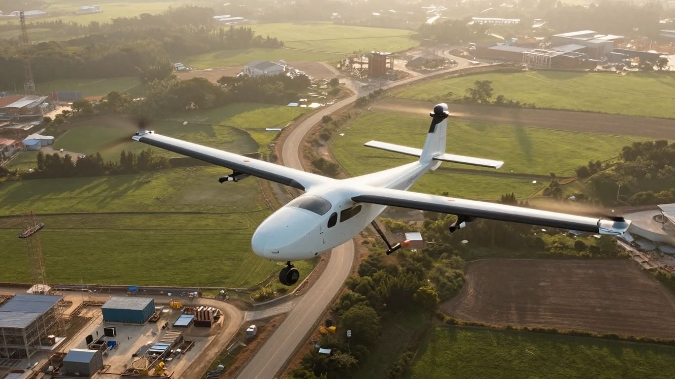
The WingtraOne Gen II Wingtra is intended for aerial mapping workflows that need broad coverage and dependable geospatial data. It combines vertical takeoff and landing with forward flight, allowing a survey team to work without a conventional runway. The aircraft should still be viewed as one part of a larger system: planning, positioning, image processing, and quality control are equally central to the outcome.
Fixed-wing and vertical-takeoff flight capabilities
A vertical-takeoff-and-landing aircraft can leave the ground and return without a launch rail or prepared strip. After takeoff, a fixed-wing configuration supports forward flight across the planned survey area, then transitions back for landing. This arrangement is useful when the field site has limited open space, although operators still need a clear and safe area for the aircraft’s vertical movements.
The WingtraOne Gen II is described as a VTOL mapping drone with a 59-minute flight time at 16 m/s in the cited product material. Flight time varies with conditions and configuration, so a plan should use the operating envelope supplied for the specific aircraft and payload rather than treating a headline figure as a guarantee.
Surveying, mapping, and inspection applications
A mapping aircraft is most valuable when the work can be translated into a repeatable capture and processing workflow. Typical projects include land surveys, construction documentation, corridor mapping, stockpile measurement, environmental recording, and infrastructure-related data collection. Inspection work may also benefit when the required output is an accurately located image set or model rather than a close-up pilot-controlled view.
The deliverable should be defined before the flight. An orthomosaic, point cloud, elevation model, or set of georeferenced photographs can each require different capture choices. For readers comparing planning approaches, this VTOL surveying guide offers a related reference point on balancing coverage, accuracy, and workflow design.
How it differs from conventional multirotor drones
The main distinction is the way the aircraft spends its time in the air. A multirotor can hover and maneuver slowly over a small area, while a fixed-wing aircraft generally covers ground by moving continuously along flight lines. VTOL removes much of the runway burden, but the fixed-wing portion still favors planned routes and efficient area coverage over stationary observation.
That difference affects field habits. A multirotor workflow may be convenient for compact sites, vertical façades, or highly localized inspection, while a fixed-wing mapping workflow can be more natural for larger areas. The comparison should be based on the geometry of the project and the required output, not on aircraft category alone.
The types of terrain and projects it suits best
Open land, construction areas, agricultural parcels, transport corridors, and broad infrastructure sites are natural candidates for an efficient aerial mapping workflow. The site does not need to be perfectly flat, but the team must account for elevation changes, obstacles, takeoff space, and the aircraft’s planned return path. Dense urban settings and confined spaces call for a more careful operational assessment.
A useful first question is whether the project can be expressed as a safe, repeatable survey area. If it can, the aircraft may fit well. If the work depends mainly on hovering beside structures or navigating tight interiors, another workflow may be more appropriate.
Key system components and configuration options
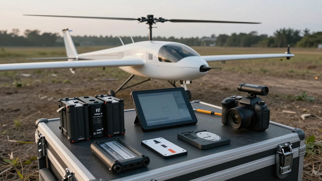
A survey system includes the airframe, payload, positioning equipment, control hardware, batteries, and the software used before and after flight. Treating these pieces as a package makes field preparation more predictable. It also prevents a common mistake: choosing a camera or accuracy workflow before checking whether the whole system supports the intended deliverable.
Airframe, propulsion, and launch requirements
The airframe’s vertical-takeoff design reduces the need for a conventional runway, but it does not remove site preparation. Operators need a clear launch and recovery zone, enough separation from people and objects, and a surface or layout that allows them to maintain visual awareness. Propellers, motors, landing areas, and the aircraft body should be inspected before each operation.
The propulsion system and battery configuration also influence planning. A survey team should know the expected takeoff behavior, transition sequence, recovery procedure, and reserve policy before arriving at the site. A simple field diagram showing the launch point, survey boundary, recovery direction, and emergency options can prevent confusion when conditions change.
Camera and payload considerations
Camera selection should follow the required ground sampling distance, spectral information, model detail, and area coverage. Higher-resolution imagery can support larger flight altitudes or more detail per image, but it may also affect storage, processing time, and battery planning. The lens, sensor, shutter behavior, and image geotags all matter to photogrammetric quality.
A payload decision is therefore a workflow decision. Confirm the sensor’s compatibility, mounting arrangement, calibration expectations, and output format before committing to a mission. Avoid assuming that a camera designed for one type of mapping automatically suits thermal, multispectral, close inspection, or elevation-focused work.
Ground control, communication, and positioning systems
Positioning may come from onboard GNSS workflows, a base station, ground control points, or a combination of these methods. The choice depends on the required accuracy, site conditions, available equipment, and the way the final data will be checked. A few independent checkpoints can be valuable even when the capture workflow is designed to reduce reliance on traditional ground control.
Communication links support mission supervision, status monitoring, and safe recovery. They should not be treated as a substitute for airspace awareness or visual observation. Teams new to centimeter-level mapping can also review this RTK drone mapping guide for a plain-language explanation of receivers, base stations, checkpoints, and processing.
Equipment needed for field operations
A field kit should cover both normal capture and reasonable interruptions. Alongside the aircraft and payload, bring charged batteries, a controller or tablet, spare propellers, chargers, cables, storage media, positioning equipment, survey markers, and weather protection. Keep a written checklist as well as a digital one, since a drained device should not erase the preparation process.
The checklist is also a useful place to record site-specific permissions and contact details. For broader operational reading, a separate workforce categories guide illustrates how structured classification can reduce administrative errors; the same principle applies here, even though the subject matter is different.
How to plan a WingtraOne Gen II Wingtra mission
Mission planning turns a broad site boundary into an executable flight. Start with the data product, then work backward through accuracy, resolution, overlap, altitude, speed, terrain, and operating constraints. A plan that looks efficient on a map can still fail if it leaves no margin for wind, recovery, or incomplete image capture.
Defining coverage, resolution, and accuracy requirements
Write down the area to be covered and the smallest feature that must be visible or measurable. Ground sampling distance helps connect camera choice and altitude to the expected image detail, while accuracy requirements determine how positioning and checkpoints should be handled. The survey boundary should include enough margin to avoid clipping the edges of the intended deliverable.
Also define what “accurate” means for the project. Absolute accuracy, relative consistency, vertical performance, and visual completeness are not interchangeable. A construction progress map may prioritize reliable change detection, while an engineering survey may require a more formal accuracy assessment and documented control.
Selecting flight altitude, speed, and overlap
Altitude and speed should be selected together with the camera’s exposure behavior and the required image detail. Overlap provides the matching information needed by photogrammetry software, but more overlap is not automatically better if it reduces coverage per battery or creates an unnecessarily large data set. Use the manufacturer and processing software guidance for the selected configuration.
The WingtraOne Gen II Wingtra product page describes lower image overlap as one way to maximize coverage per flight line, alongside high-quality optics. That claim belongs to the documented workflow for the product; in practice, the operator still needs to confirm settings against terrain, texture, lighting, and the intended processing method.
Accounting for terrain, obstacles, and weather
A flat polygon on a planning screen hides many operational details. Check slopes, trees, cranes, towers, power lines, buildings, water, restricted areas, and likely sources of signal interference. Terrain variation may change the relationship between the aircraft and the ground, affecting both image scale and the completeness of the model.
Weather deserves the same attention as geometry. Wind direction can affect the return leg and reserve calculation, while fog, rain, snow, extreme temperatures, and strong gusts may make a mission unsuitable. Establish a clear go/no-go threshold before launch rather than deciding under pressure at the field.
Creating repeatable flight plans for recurring surveys
Recurring surveys benefit from a controlled baseline. Save the boundary, altitude, speed, overlap, camera configuration, coordinate reference system, and checkpoint strategy, then document any changes made for the next visit. Repeatability makes comparison more meaningful and reduces the temptation to redesign every mission from scratch.
A recurring plan should still be reviewed on the day. New construction, vegetation, parked equipment, seasonal lighting, and altered airspace conditions can invalidate an otherwise familiar route. The best repeatable plan is consistent without becoming automatic.
Capturing high-quality mapping data
Data capture is where a carefully designed mission becomes a usable evidence set. Image sharpness, exposure, positioning, overlap, and complete coverage all contribute to the quality of the final model. Field teams should monitor the mission as it unfolds instead of assuming that an aircraft completing its route has necessarily produced a complete survey.
Ground control points and positioning workflows
Ground control points are surveyed locations visible in the imagery and used to tie the model to known coordinates. Checkpoints are held back from processing control so they can provide a more honest accuracy check. When a built-in positioning workflow is used, independent checkpoints remain useful for confirming that the result meets the project requirement.
Place markers where they are easy to identify and distribute them across the site, including near edges and areas with elevation change. Record their coordinates, descriptions, and collection method carefully. Poorly documented points can create uncertainty later, even when the images themselves are clear.
Image quality, lighting, and camera settings
Sharp images require suitable shutter speed, stable exposure, correct focus, and lighting that reveals surface texture. Bright glare, deep shadows, haze, and rapidly changing cloud can complicate matching. A short test or early image review can reveal problems before the aircraft has completed the entire area.
Image settings should be consistent throughout a block whenever possible. Check file naming, geotagging, sensor time, and storage capacity before launch. If the project involves surfaces with little texture, adjust the plan and expectations rather than assuming software will reconstruct detail that was never captured.
Managing battery capacity and flight endurance
Battery planning should include takeoff, transition, survey lines, return, landing, and a conservative reserve. Published endurance is a reference condition, not a promise for every payload, temperature, wind profile, or battery age. Record battery cycles and charging status so the team can spot declining performance over time.
A practical field sequence is easier to manage when batteries are labeled and rotated consistently:
- Charge and inspect each battery before transport.
- Confirm the planned reserve and return-to-home behavior.
- Track the battery used for every flight.
- Allow batteries to cool or warm within the approved operating range.
This small amount of discipline makes an aborted flight easier to diagnose and helps prevent a rushed decision late in the mission. It also supports clearer maintenance records when several crews share equipment.
Preventing gaps, distortions, and incomplete coverage
Before launch, review the boundary, line direction, terrain model, and likely obstruction zones. During capture, watch for missed lines, unexpected turns, poor positioning, or image warnings. After landing, inspect the image count and footprint rather than waiting until the entire project has been processed.
A gap may be caused by an obstacle, a communication interruption, an unsuitable exposure, or a planning error. Document the cause and, where practical, recapture a controlled extension that overlaps the affected area. Early data review saves rework because it catches a problem while the aircraft, crew, and site are still available.
Processing and delivering survey results
Processing converts photographs and positioning information into products that other people can measure, compare, and use. The workflow should preserve the original files, record the software and settings, and distinguish raw capture from edited or exported results. Clear naming and version control matter just as much as processing speed.
Importing imagery into photogrammetry software
Begin by copying the original imagery to a secure working location and checking that the transfer is complete. Import the photographs, camera information, coordinate reference system, and positioning files into the chosen photogrammetry package. If geotagging or post-flight corrections are required, complete those steps before alignment and record what changed.
Use a consistent project structure for recurring work. Store flight notes, control measurements, processing reports, and exports alongside—but separately from—the untouched source imagery. That arrangement makes it easier to reproduce a result or investigate an unexpected feature in the model.
Generating orthomosaics, point clouds, and digital models
The selected outputs should reflect the project question. An orthomosaic supports visual interpretation and plan-based measurement, while a point cloud or digital model can support terrain analysis, volumes, profiles, and three-dimensional review. Processing settings such as filtering, alignment quality, coordinate systems, and resolution should be documented.
Do not generate every possible output by habit. Large datasets can take substantial time and storage, and an unnecessary product may make review harder. Produce the formats that the client or internal team will actually use, then retain enough project information to create additional outputs later if needed.
Checking accuracy and identifying data errors
Quality control should combine visual inspection with measured checks. Review image alignment, seamlines, edges, control residuals, checkpoint differences, holes, spikes, warped structures, and areas with weak texture. Compare the result with known dimensions or independent observations where available.
Errors often have a pattern. A broad shift may suggest a coordinate or positioning issue, while local distortion can point to weak overlap, motion blur, reflective surfaces, or insufficient control. Do not hide uncertain areas with cosmetic edits; mark them, investigate them, and explain any limitations in the delivery notes.
Exporting results for CAD, GIS, and engineering platforms
Export settings should be agreed before delivery. Coordinate reference system, units, vertical datum, resolution, file format, and naming conventions can determine whether a technically correct dataset imports cleanly into a client’s platform. Include metadata and a short readme when the recipient may not know how the products were created.
A useful delivery package separates the main products from supporting material. Provide the orthomosaic, point cloud, digital model, or other requested output, then include checkpoints, accuracy notes, processing details, and a list of known limitations. This gives downstream users context instead of leaving them to infer it from the files.
Operational considerations in the field
A safe survey operation is planned around people, property, aircraft, weather, and failure modes. The pilot and support crew should know who has authority to pause or stop the mission. A calm, repeatable routine is usually more valuable than trying to maximize every minute of flight time.
Launching, monitoring, and recovering the aircraft
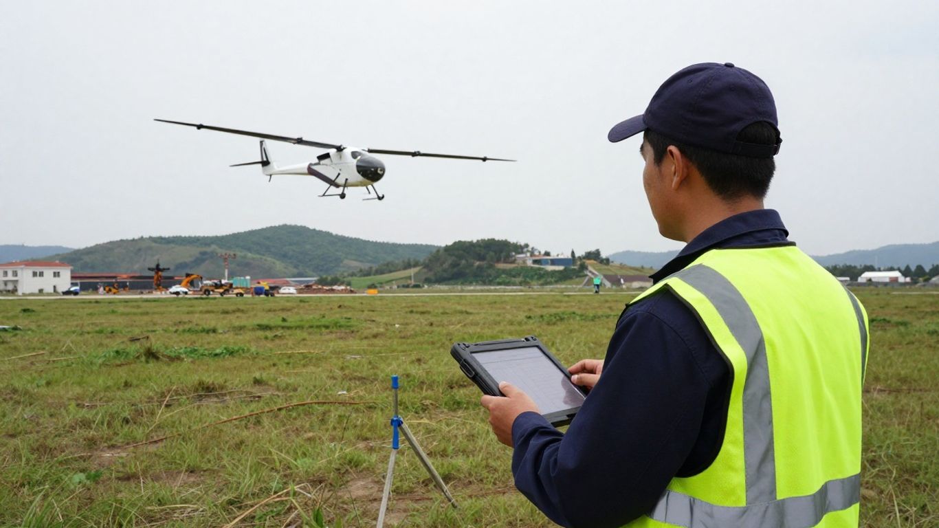
Before launch, confirm the aircraft state, payload, batteries, route, home location, communication link, and recovery area. Monitor the transition into forward flight and keep track of position, battery, warnings, and changing conditions. The operator should know how to pause, return, or land according to the approved procedure.
Recovery deserves as much attention as takeoff. Keep the landing zone clear, maintain awareness of people and vehicles, and be ready for a changed wind direction. After landing, secure the aircraft before reviewing data or beginning the next sortie.
Working safely near people, infrastructure, and airspace
Airspace rules and site permissions vary by jurisdiction, operation, and location. Check the applicable requirements before the field day, including restrictions near airports, roads, buildings, events, and critical infrastructure. Do not assume that an empty-looking site is free of airspace or privacy obligations.
Use barriers, spotters, briefings, and clear separation where appropriate. A written emergency plan should cover lost communication, an unexpected person entering the area, a nearby aircraft, and an unplanned landing. Safety controls should remain understandable to everyone on site, not only the pilot.
Handling wind, temperature, and changing conditions
Conditions can shift during a survey, especially across large or exposed sites. Watch wind at ground level and along the planned route, since the aircraft may encounter different conditions at altitude. Temperature can affect batteries and electronics, while haze or changing illumination can affect image consistency.
Set decision points for postponement, pause, and recovery before launch. If conditions cross those limits, stopping is a normal operational choice rather than a failed mission. The data can be recollected; a damaged aircraft or unsafe incident is much harder to undo.
Maintaining the aircraft and preparing for failures
Maintenance should follow the manufacturer’s instructions and the organization’s own flight records. Inspect the airframe, propellers, motors, connectors, batteries, payload mount, storage media, and software status. Record damage, unusual sounds, hard landings, and recurring warnings even when the aircraft appears ready to fly.
Failure preparation is practical rather than dramatic. Carry suitable spares, keep current procedures accessible, and train the crew on return-to-home, lost-link, emergency landing, and battery-related decisions. A short post-flight debrief can capture lessons while the details are still fresh.
Evaluating whether the WingtraOne Gen II Wingtra is right for your organization
The decision to adopt a mapping aircraft should begin with the organization’s work pattern. Consider project size, repeat frequency, required accuracy, terrain, staffing, processing capacity, and the formats clients expect. A capable aircraft may still be a poor fit if its workflow does not match the team’s operational reality.
Comparing fixed-wing VTOL and multirotor workflows
Fixed-wing VTOL workflows generally prioritize efficient area coverage while retaining vertical takeoff and landing. Multirotor workflows may be more natural for hovering, tight maneuvering, and compact sites. The relevant comparison is the complete operation: setup, capture, recovery, processing, and the amount of ground work required.
Run a small pilot project using representative terrain and deliverables. Measure not only flight duration but also setup time, number of sorties, image review, processing time, rework, and final usability. This produces a more honest comparison than comparing aircraft specifications in isolation.
Estimating productivity, staffing, and operating costs
Productivity includes the hours spent preparing permissions, placing control, traveling, launching, monitoring, processing, checking, and delivering. Staffing assumptions should include a backup plan for illness, weather delays, battery rotation, and data review. Costs also include training, insurance, software, batteries, repairs, storage, and replacement cycles.
A simple comparison table can make the assumptions visible before a purchase decision:
| Cost or productivity factor | What to measure | Why it matters |
|---|---|---|
| Area per sortie | Completed survey area | Shows practical coverage, not theoretical endurance |
| Field labor | Crew hours per project | Reveals staffing requirements |
| Processing time | Hours from capture to checked output | Affects delivery capacity |
| Rework rate | Missions or areas requiring recapture | Exposes workflow weaknesses |
| Equipment overhead | Batteries, maintenance, software, and storage | Shows the full operating cost |
The table is most useful when populated with the organization’s own records. Even a few representative projects can reveal whether the limiting factor is flight time, field access, processing capacity, or review effort.
Assessing training, software, and support requirements
Training should cover mission planning, aircraft handling, positioning, weather decisions, data management, photogrammetry, and safety—not just takeoff and landing. Software skills are particularly important because a well-captured dataset can still produce a poor deliverable if coordinate systems, control, or quality checks are mishandled.
Support requirements should be assessed before procurement. Ask who will maintain procedures, manage updates, answer field questions, review accuracy, and keep records current. For organizations working across cultures or communities, clear and accessible training materials also help make technical processes more inclusive; practical guidance on mental health training costs is a reminder that support and compliance expenses deserve a place in operational planning, even outside aviation.
Choosing the right projects and return-on-investment metrics
Start with projects where the workflow can be controlled and measured. Repeated site surveys, broad parcels, construction monitoring, and mapping work with consistent deliverables can provide stronger evidence than a one-off complex assignment. Define success using metrics such as cost per acre, turnaround time, recapture rate, checked accuracy, and client acceptance.
The WingtraOne Gen II Wingtra is presented in the cited material as a mapping drone designed for efficiency and precision, with a 61 MP camera and built-in multi-frequency PPK GNSS receiver. Those are product claims, not a guarantee of return on investment. The business case still depends on project mix, operator competence, regulatory permissions, processing workflow, and the value the organization places on timely survey data.
Conclusion
Aerial mapping works best when the aircraft, mission plan, field routine, positioning method, and processing workflow are designed as one system. The WingtraOne Gen II Wingtra can be considered within that broader framework, but the right choice comes from matching documented capabilities to real project requirements, then validating the decision with measured field results.
Frequently Asked Questions
What is aerial mapping used for?
Aerial mapping can support land surveys, construction documentation, corridor studies, environmental monitoring, stockpile measurement, infrastructure records, and other work that benefits from georeferenced imagery or three-dimensional data.
What does ground sampling distance mean?
Ground sampling distance describes the approximate size of each image pixel on the ground. A smaller value generally provides finer image detail, while the suitable value depends on the feature being measured and the required deliverable.
Are ground control points always necessary?
Not always. The need depends on the positioning workflow, accuracy requirement, site conditions, and processing method. Independent checkpoints are often useful for verifying the result even when fewer traditional control points are used.
How much overlap should a mapping mission use?
Overlap depends on the camera, altitude, speed, terrain, surface texture, and photogrammetry software. Use tested guidance for the selected configuration and adjust it when conditions make image matching more difficult.
What weather conditions can affect a survey?
Wind, rain, fog, snow, haze, extreme temperatures, and rapidly changing light can affect aircraft safety, battery performance, image quality, or model reconstruction. Establish operating limits before the mission.
What should a survey deliverable include?
A deliverable may include an orthomosaic, point cloud, digital model, georeferenced imagery, measurements, metadata, accuracy checks, and notes describing the coordinate system and any known limitations.
How can an organization measure mapping ROI?
Track total project hours, field labor, processing time, recapture rate, equipment overhead, turnaround time, and client acceptance. Compare those figures with the cost of the previous workflow and the value of faster or more consistent information.