
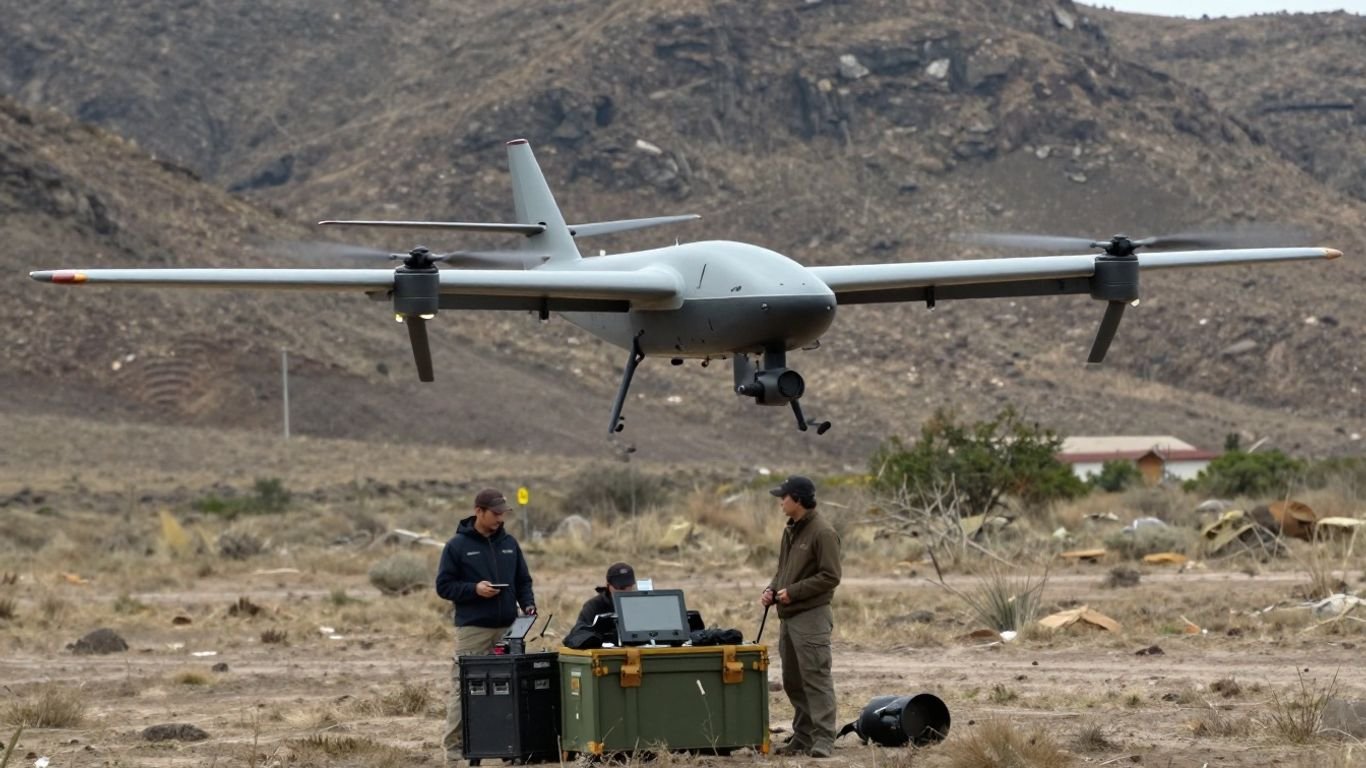
RQ-12 Wasp Micro / small ISR: capabilities, missions, and operational trade-offs

Key Takeaways
The RQ-12 Wasp occupies the compact end of the small-UAS market, where portability and immediate local awareness matter more than long endurance or heavy payloads.
- It is intended for short-range reconnaissance, surveillance, and situational awareness.
- The Wasp III and Wasp AE represent related but distinct stages in the platform’s development.
- Hand launch and compact ground equipment support deployment by small teams.
- Electro-optical and infrared options extend collection across day and night conditions.
- Weather, communications, battery life, and sensor limits remain central planning concerns.
Understanding the RQ-12 Wasp’s role in small ISR
Small ISR aircraft provide a nearby view that ground personnel cannot easily obtain on their own. They are most useful when a team needs timely information about terrain, routes, activity, or a target area without waiting for a larger aircraft. The RQ-12 Wasp Micro / small ISR category is therefore best understood as a tactical layer, not a replacement for every other intelligence system.
What the RQ-12 Wasp is designed to do
The Wasp is a miniature unmanned aircraft intended to provide reconnaissance, surveillance, and situational awareness for operators close to the point of action. Public descriptions of the Wasp III identify onboard cameras, real-time intelligence transmission, and GPS-supported autonomous operation from takeoff to recovery. Its value comes from bringing an aerial perspective to small units while keeping the aircraft and support equipment comparatively portable.
That role places the system between a handheld observation tool and a larger persistent UAS. It can help answer immediate questions—what is beyond a rise, whether a route is clear, or what has changed in a target area—without implying that it can deliver the coverage, payload capacity, or endurance of a much larger aircraft.
How micro and small UAS categories differ
“Micro” and “small” are practical categories as much as technical ones. A micro system generally prioritizes very low weight, rapid handling, and operation by a small team. A small UAS may still be portable, but it can offer more room for endurance, communications equipment, or payload flexibility.
The distinction matters during procurement. A team that needs an aircraft carried in a rucksack and launched in a confined area may accept shorter range and limited payload choices. A team seeking broad-area mapping or extended overwatch may need a different class of aircraft. The RQ-11 Raven offers a useful comparison point for readers considering how a compact hand-launched ISR aircraft fits within a wider family of tactical systems.
The evolution from Wasp III to Wasp AE
The Wasp III established the compact reconnaissance concept, with manual or GPS-based autonomous navigation and camera payloads intended for day and night observation. The later Wasp AE, designated RQ-12A in public references, extended the family toward all-environment operation and included the ability to support land and maritime use.
That evolution should not be read as a simple promise of unlimited operating freedom. “All environment” describes a broader operating concept, while actual mission suitability still depends on wind, precipitation, temperature, water conditions, communications, and operator procedures. The Wasp AE system is best considered an expansion of the original platform’s field utility rather than a removal of small-aircraft constraints.
Where the platform fits in an ISR architecture
An RQ-12 Wasp mission usually contributes local collection to a larger intelligence process. Operators may use its feed to refine a patrol route, check a suspected location, or support a decision already being made by a ground element. The aircraft’s information becomes more valuable when it is combined with reports, maps, other sensors, and a clear method for sharing observations.
This layered approach prevents a common planning error: asking a small aircraft to solve a problem that requires persistent or wide-area coverage. A Wasp can fill a near-field gap quickly, while other systems handle longer-range or more demanding collection tasks.
Core design and technical capabilities
The platform’s design reflects a straightforward field priority: carry a small aircraft, launch it without a runway, collect useful imagery, and recover it with limited support. That simplicity can be an advantage when teams are moving frequently. It also means that every decision about payload, battery, altitude, and communications has a visible effect on the mission.
Airframe, propulsion, and launch methods
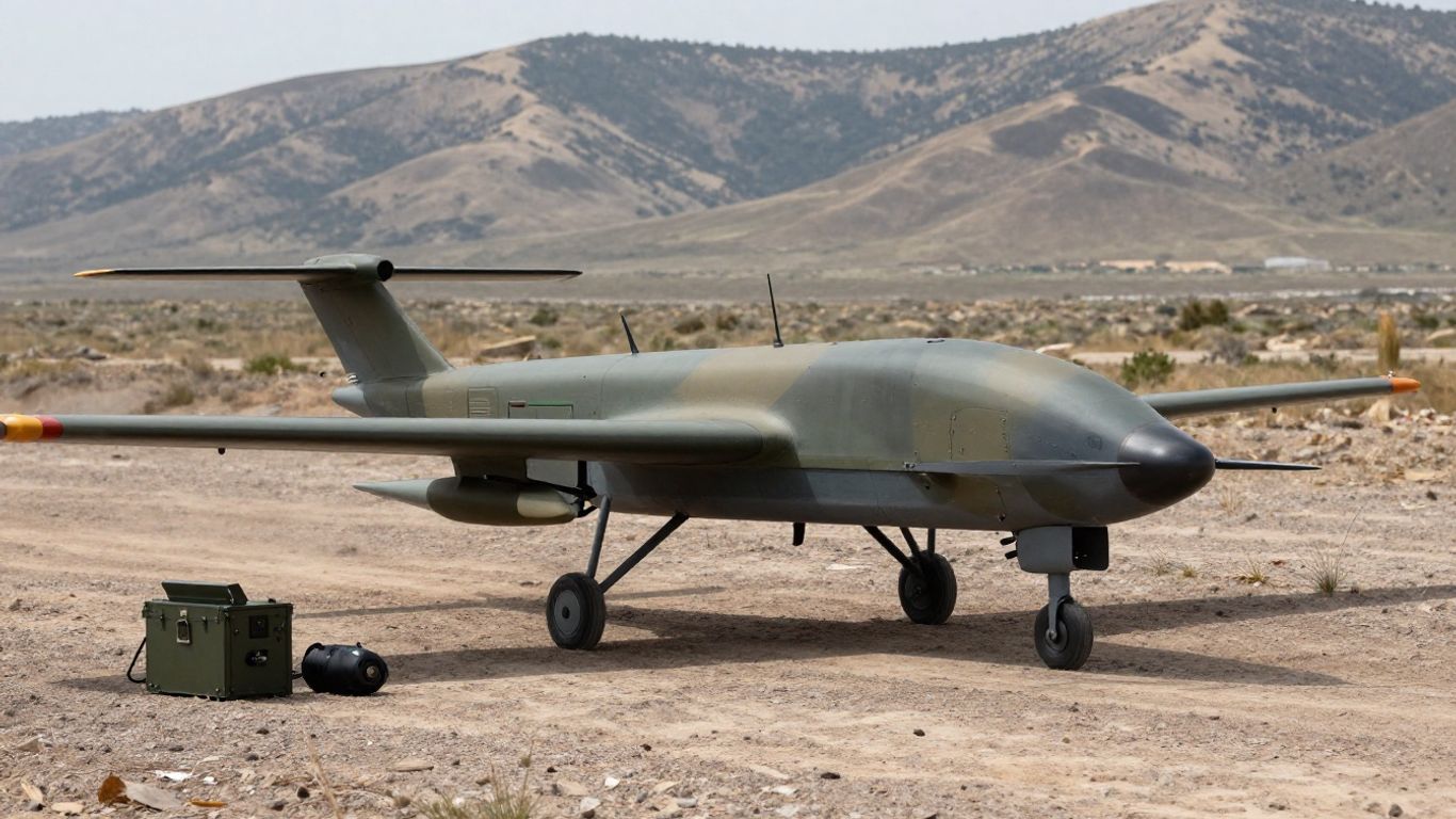
The Wasp family is associated with a lightweight fixed-wing airframe and hand launching. Public descriptions of the Wasp III place it at roughly 430 grams with a wingspan of about 29 inches, although configuration and variant details should be confirmed against the applicable technical documentation. Hand launch makes it practical in areas without a prepared runway, while recovery procedures vary by version and operating environment.
A small electric aircraft also brings a relatively simple field burden compared with systems that need fuel handling or larger support vehicles. That does not make preparation automatic: operators still need to inspect the airframe, confirm control surfaces and batteries, and check the launch and recovery area.
Endurance, range, and operating altitude
Endurance and range should be treated as mission-planning variables rather than headline figures. A published description of the Aqua Wasp cites approximately 50 minutes of endurance, but actual usable time depends on payload, wind, temperature, reserve requirements, flight profile, and communications conditions. The same caution applies to range and operating altitude, which are shaped by terrain, line of sight, local rules, and the selected configuration.
The practical question is not simply how long the aircraft can remain airborne. It is how much time remains for useful observation after launch, transit, station keeping, return, and a safety reserve. That calculation often determines whether a route should be shortened or a second battery prepared.
Electro-optical and infrared sensor options
Wasp configurations have been described with electro-optical and infrared camera options, supporting observation in visible light and lower-light conditions. Some public accounts also describe multiple onboard cameras on the Wasp III. Sensor choice affects what an operator can recognize, when the aircraft should fly, and how much information can be transmitted over the available link.
Infrared imagery can help distinguish heat differences when visible detail is poor, but it is not a substitute for clear identification in every setting. Vegetation, weather, distance, background temperature, and camera angle all influence interpretation. Sensor context matters as much as the nominal camera type.
Ground control and communications links
The aircraft depends on a ground control arrangement that lets operators manage flight and view sensor information. Public material describes real-time video transmission and a common ground control station associated with the Wasp family. The useful result is a connected loop between aircraft, operator, and ground unit, provided the communications link remains available.
A field team should document what happens when the link weakens or disappears. Preplanned behaviors, autonomous navigation functions, return procedures, and recovery responsibilities must be understood before launch. A technically capable aircraft still requires disciplined link management.
ISR missions supported by the Wasp
The Wasp is suited to missions where a small aircraft can answer a focused collection question. These missions tend to be local and time-sensitive rather than broad, persistent surveillance tasks. The strongest use cases connect a defined ground decision to a short, manageable period of aerial observation.
Day and night reconnaissance
Visible-light and infrared options allow operators to plan reconnaissance across different lighting conditions. Daytime flights may support route checks, terrain observation, and activity monitoring, while infrared collection can provide another view when illumination is limited. The quality of the result depends on distance, weather, camera configuration, and operator interpretation.
A sensible mission brief states what must be recognized, not merely that the team wants “surveillance.” That distinction keeps the aircraft’s limited flight time focused on information that can change an immediate decision.
Overwatch for patrols and convoys
A small UAS can provide a forward or lateral view for a patrol or convoy, helping personnel observe areas that are hidden from the ground perspective. The aircraft may be used to check a route segment, watch a crossing, or monitor a point of concern while the unit maintains movement.
Overwatch is not risk-free. The aircraft must be coordinated with movement speed, communications procedures, airspace restrictions, and the possibility that the feed may be delayed or lost. Its role is to improve awareness, not to guarantee that every threat will be detected.
Target-area observation and assessment
Before or after an operation, aerial observation can help teams assess a target area and compare conditions over time. The useful output may be a live view, recorded imagery, or an operator’s report tied to a location and time. A clear collection objective makes later analysis more reliable.
The aircraft should not be treated as an automatic identification system. The operator still has to distinguish relevant activity from background movement and communicate uncertainty to the people making decisions on the ground.
Border, perimeter, and maritime surveillance
Short-range aircraft can support observation along a boundary, around a facility, or near a maritime operating area. The Aqua Wasp’s publicly described water-landing concept illustrates how recovery options can affect use in environments where a normal landing surface is unavailable. Even then, water, wind, spray, and communications create additional planning demands.
For perimeter work, the system is most useful when patrol patterns and collection points are already understood. It can provide another angle on a defined area, but it is not a substitute for layered sensing, physical security, or sustained wide-area coverage.
How a Wasp mission is planned and operated
A successful sortie begins before the aircraft leaves the ground. Operators need a collection question, a route that matches the available time, a communications plan, and a recovery method. The smaller the team, the more important it is that responsibilities are clear and rehearsed.
Defining collection objectives and flight routes
Mission planning starts with the decision the imagery is meant to support. The team can then identify the area of interest, observation points, route hazards, expected lighting, and required reserve. A short route with a specific purpose is usually more useful than an ambitious flight plan that leaves little time for observation.
Terrain can block both the aircraft’s view and its communications path. Operators should consider ridgelines, buildings, trees, water, weather, and the position of the ground team before committing to a route. The plan should also identify when the aircraft will stop collecting and return.
Launching, controlling, and recovering the aircraft
Hand launching gives small teams flexibility, but it requires a safe launch area and a coordinated countdown. The operator must confirm aircraft status, control response, battery condition, and the initial flight path. Recovery requires equal attention because a rushed landing can damage a lightweight airframe or compromise the next sortie.
A useful field sequence separates aircraft handling from mission supervision whenever staffing allows. One person can focus on flight safety while another watches the collection objective and reports relevant observations to the ground unit.
Managing live video and sensor feeds
Live video can create a misleading sense of certainty. Operators may see movement without knowing its identity, or miss important detail because the aircraft is too far away, moving too quickly, or viewing the scene from a poor angle. Feed management therefore includes observation, recording where authorized, time and location notes, and clear reporting language.
The feed should be interpreted alongside the flight plan and other information. If an image is ambiguous, the report should preserve that ambiguity rather than turn an uncertain observation into a firm claim.
Coordinating operators with ground units
The ground unit needs to know what the aircraft can provide, when the feed is available, and how to request a change without creating confusion. Simple call signs, location references, and concise reporting formats reduce the burden on both the operator and the people moving below.
Coordination also covers the end of the mission. The team should confirm that the aircraft has recovered, sensitive data is handled properly, batteries are accounted for, and any maintenance issue is recorded before the next task.
Advantages of the RQ-12 Wasp for field operations
The platform’s main appeal is the relationship between capability and burden. A small team can potentially carry and operate it without the infrastructure associated with a larger UAS. That makes it relevant to missions where speed, access, and local awareness matter more than long-duration coverage.
Portable deployment by small teams
A compact aircraft that can be carried with other field equipment gives units more freedom in choosing where to operate. Hand launch reduces dependence on a runway, and a backpack-sized package can support movement through areas where vehicles or larger launch equipment are impractical.
Portability is useful only when the complete system is portable. Batteries, controllers, spares, antennas, recovery equipment, and protective cases all contribute to the real load. Procurement teams should assess the full field package rather than the airframe alone.
Lower logistical demands than larger UAS
Small electric aircraft generally require fewer support resources than larger systems. Teams may avoid fuel logistics, extensive launch infrastructure, and large operating crews. That can simplify deployment and allow reconnaissance to accompany units that are already moving.
Lower logistical demand does not mean zero demand. Battery charging, software, spare parts, weather checks, and trained operators remain necessary. The advantage is a reduction in scale, not the elimination of preparation.
Reduced visual and acoustic signature
A small aircraft may be less visually and acoustically prominent than a larger platform, although detectability varies with distance, wind, background noise, altitude, and observer attention. This can be useful when the mission depends on gathering information without drawing unnecessary attention.
Signature management should remain a planning consideration rather than an assumption. The aircraft can be seen, heard, tracked, or affected by electronic conditions, and the team should decide what level of exposure the mission can tolerate.
Flexible use in contested or remote environments
A portable system can reach places where larger aircraft or vehicles are difficult to employ. Remote terrain, temporary positions, and short-notice tasks all benefit from equipment that can move with the team. The platform’s flexibility is strongest when its limits are built into the plan.
For a compact ISR aircraft, that usually means short collection windows, conservative reserves, and clear alternatives if weather or communications make the original route unsuitable.
Limitations, risks, and operational trade-offs
The same qualities that make a small UAS easy to carry also constrain its performance. Lightweight construction, small batteries, modest payloads, and limited communications equipment leave less margin than a larger aircraft might have. A responsible evaluation therefore considers failure modes as carefully as best-case capability.
Weather and environmental constraints
Wind, rain, icing, dust, temperature, and turbulence can affect launch, flight stability, sensor quality, and recovery. Water operations introduce additional concerns, including spray, waves, and the reliability of recovery procedures. Environmental limits should be checked against the specific aircraft configuration and current conditions.
A forecast is only one input. Terrain can create gusts and channels, while changing light can reduce the usefulness of visible imagery. Crews should be prepared to delay, shorten, or cancel a sortie when conditions move outside the approved envelope.
Communications range and link reliability
A communications link can be weakened by distance, terrain, structures, interference, antenna orientation, or operating altitude. Loss of link may interrupt live video even when the aircraft continues flying, separating the operator from the information needed to guide the mission.
The most useful mitigation is procedural: plan conservative routes, understand autonomous behaviors, maintain recovery options, and avoid treating a nominal range as a guaranteed operational distance. Link performance should be measured in the environments where the system will actually be used.
Sensor limitations compared with larger aircraft
A compact airframe cannot carry the same sensor size, stabilization, processing capacity, or power budget as a larger aircraft. Resolution and recognition distance may therefore be limited, especially in haze, darkness, vegetation, or cluttered urban scenes.
This does not make the sensor ineffective. It means the aircraft should be placed close enough, high enough, or at the right angle to answer a defined question. If the question requires broad-area scanning or long-range identification, another collection method may be more appropriate.
Battery, payload, and endurance trade-offs
Battery capacity supports both propulsion and onboard equipment, so adding payload or demanding more maneuvering can reduce usable flight time. Carrying an infrared option, additional communications equipment, or other hardware may alter balance and endurance as well.
The field team should decide which matters most for the mission: time aloft, sensor choice, distance, or reserve. A simple planning table can make those trade-offs visible before deployment.
| Planning priority | Likely benefit | Typical cost |
|---|---|---|
| Longer reserve | More recovery margin | Less time collecting |
| Heavier payload | More sensing options | Reduced endurance or agility |
| Greater distance | Wider local reach | Higher link and battery demand |
| Lower altitude | More visual detail in some scenes | Greater terrain and detectability risk |
The table is not a substitute for flight testing or approved performance data. It is a prompt to discuss what the mission actually values instead of assuming every desirable feature can be maximized at once.
Airspace deconfliction and detectability concerns
Small size does not remove the need for airspace coordination. Crews must account for other aircraft, restricted areas, local rules, friendly movement, and the possibility that the UAS itself may be observed or interfered with. Deconfliction is part of mission safety, not an administrative afterthought.
A clear operating area, communications plan, and recovery window reduce avoidable risk. They also make it easier to explain when the aircraft should not be launched, even if the collection request is urgent.
Evaluating the RQ-12 Wasp for modern ISR needs
The right question is not whether a small UAS is impressive in isolation. It is whether the system can produce useful information, at the needed time and place, with a manageable burden and acceptable risk. Evaluation should connect specifications to actual missions and to the people who will operate, maintain, and interpret the system.
Comparing it with other small UAS
Comparison should begin with mission fit rather than a single range or endurance figure. A hand-launched fixed-wing aircraft may suit one team, while a different small UAS may be preferable when hovering, vertical landing, obstacle avoidance, or another payload is central to the task.
The Vesper Vantage Robotics guide provides another useful reference for thinking about portable ISR systems and how sensor configuration, control environment, and field use shape procurement decisions. The comparison should remain fair: each platform needs to be judged against the same collection objectives, environmental conditions, and support assumptions.
Measuring mission effectiveness and data quality
Effectiveness can be measured through practical outcomes: whether the aircraft reached the collection area, whether the feed was available when needed, whether imagery answered the original question, and whether the result changed a ground decision. A sortie that produces hours of video but no usable observation may be less valuable than a shorter, well-focused flight.
Teams should record failed launches, lost links, weather cancellations, unclear imagery, and recovery problems as well as successful missions. Those records reveal whether a platform’s apparent capability survives contact with real operating conditions.
Training, maintenance, and lifecycle considerations
Training must cover more than stick or route control. Operators need practice with mission planning, sensor interpretation, communications loss, weather judgment, recovery, data handling, and coordination with ground personnel. Rehearsal turns a collection of features into a repeatable field process.
Maintenance planning should include batteries, airframe inspection, software or firmware procedures, spare parts, controller condition, and storage. A platform that is easy to carry but difficult to sustain can create hidden costs across its lifecycle.
Selecting the platform for a specific operational need
Selection is strongest when a team writes down the mission before reviewing specifications. The following questions provide a practical starting point:
- What decision must the collected information support?
- How far and how long must the aircraft operate?
- Is visible, infrared, or another sensor option required?
- What launch, recovery, weather, and communications conditions are expected?
- Who will operate, maintain, interpret, and secure the resulting data?
These questions keep the evaluation grounded in use rather than novelty. A compact aircraft may be an excellent answer for local reconnaissance and a poor answer for persistent wide-area surveillance. The RQ-12 Wasp is most credible when its role is defined with that kind of discipline.
Conclusion
The RQ-12 Wasp represents a practical form of small ISR: portable, hand-launched, and oriented toward timely local awareness. Its value lies in focused reconnaissance and surveillance, while its constraints—weather, endurance, sensor scale, communications, and airspace coordination—shape every mission. Used with clear objectives and realistic expectations, it can provide a useful aerial layer for teams that need information close to the ground and close to the moment of decision.
Frequently Asked Questions
What does small ISR mean?
Small ISR refers to intelligence, surveillance, and reconnaissance conducted with compact systems intended to support local or short-range information needs. These systems typically prioritize portability and rapid deployment over heavy payloads or long endurance.
Why are hand-launched aircraft useful?
Hand-launched aircraft can operate without a runway or large launch vehicle. This makes them practical for teams working from temporary positions, remote areas, or confined spaces, provided the launch and recovery area is safe.
What is the difference between electro-optical and infrared imagery?
Electro-optical imagery records visible light, while infrared imagery detects thermal differences. Each can be useful under different lighting and environmental conditions, and neither guarantees clear identification in every scene.
How should teams plan a small-UAS mission?
They should define the decision the collection will support, select a manageable route, check weather and airspace, confirm communications and recovery procedures, and assign clear responsibilities to operators and ground personnel.
What can reduce a small drone’s endurance?
Payload weight, wind, temperature, maneuvering, flight distance, battery condition, and reserve requirements can all reduce usable endurance. The time available for actual observation is usually less than the aircraft’s maximum advertised flight time.
Are small UAS suitable for persistent surveillance?
Some small UAS can support repeated or extended observation, but persistence depends on endurance, battery rotation, communications, crew availability, and the required coverage area. A compact aircraft is not automatically a persistent system.
What should buyers evaluate beyond aircraft specifications?
Buyers should assess training, maintenance, batteries, spares, data handling, communications reliability, regulatory requirements, environmental limits, and the quality of information produced during realistic missions.