
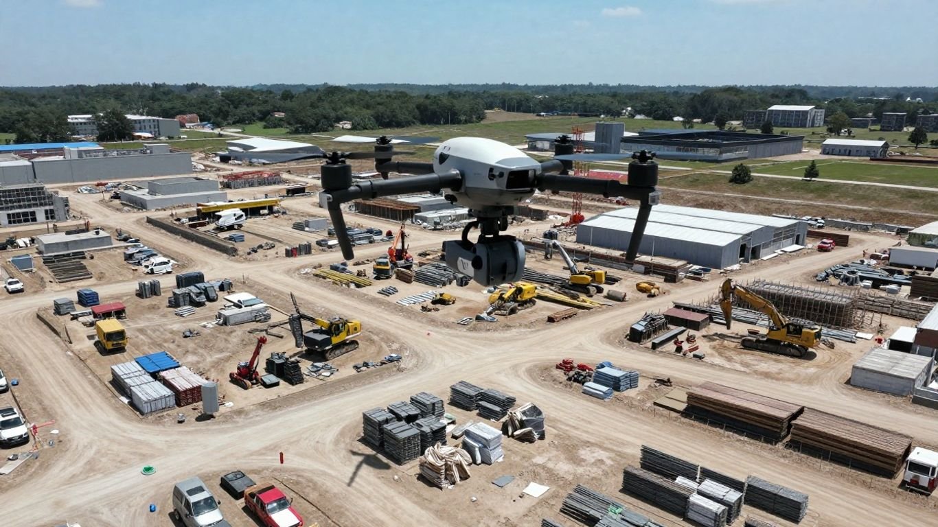
Drones on the Job: Seeing Construction Progress from Above
Remember the days of squinting at blurry photos or relying on someone’s word about how a construction site was progressing? Yeah, those days are pretty much over. Drones have completely changed the game, giving us a bird’s-eye view that’s not just cool to look at, but incredibly useful. We’re talking about real-time updates, super detailed visual records, and a way to catch problems before they even become problems. This isn’t science fiction anymore; it’s how smart construction projects are staying on track and on budget. Let’s look at how these flying cameras are making a big difference.
Key Takeaways
- Drones offer a clear, top-down view of construction sites, making it easier to track progress than old methods.
- Using drones helps spot safety issues and makes sure work follows the plan, reducing risks.
- Detailed photos and videos from drones create solid evidence for verifying work and settling disagreements.
- While there are rules and weather to consider, drones generally speed up data collection and improve accuracy.
- Implementing drone technology can save money and time, leading to smoother project management and better communication among teams, especially with construction progress drone reports.
Revolutionizing Construction Progress Tracking With Drones
Understanding Drone-Based Progress Monitoring
Forget those endless site walks and stacks of paper reports. We’re talking about a whole new way to see what’s happening on your construction site. Drones are changing the game, giving us a bird’s-eye view that was just a dream a few years ago. This technology allows for incredibly detailed construction site mapping with drones, making it easier than ever to track progress from start to finish. It’s about visualizing construction development from above with precision and clarity.
Think about it: instead of relying on scattered photos and verbal updates, you get consistent, high-resolution imagery and data. This aerial documentation provides a clear picture of site conditions, earthworks, and the placement of structures. It’s like having a constantly updated, super-accurate map of your entire project, accessible from anywhere.
- Regular Data Capture: Drones fly over the site on a set schedule, like weekly or bi-weekly.
- High-Resolution Imagery: They capture detailed photos and videos of every angle.
- 3D Modeling: Advanced drones can create 3D models of the site for even more detailed analysis.
- Progress Comparison: Software stitches these images together, allowing easy comparison of progress over time.
This shift means fewer surprises and more informed decisions. You can spot potential issues early, verify work completed, and keep everyone on the same page, no matter where they are.
The Shift From Traditional Methods to Aerial Documentation
For years, tracking construction progress meant boots on the ground, clipboards, and a lot of guesswork. You’d rely on daily reports, maybe a few cell phone pictures, and hoping your foreman’s description was accurate. It worked, sort of, but it was slow, prone to errors, and often lacked the detail needed for complex projects. Traditional methods often struggle to capture the full scope of work, especially on large or intricate sites. This is where aerial documentation with drones steps in, offering a more reliable and efficient alternative. It’s a move from subjective observations to objective, visual evidence.
Key Benefits of Implementing Drone Technology
So, why make the switch? The benefits are pretty significant. For starters, you get faster data collection. A drone can survey a large site in under an hour, something that would take days on foot. Accuracy improves dramatically too; high-resolution images and 3D models show details that ground-level photos often miss. This leads to better transparency, as visual reports are easy to share with clients and stakeholders, keeping everyone informed. Plus, you can detect problems early, reduce the need for costly site visits, and build a solid record for compliance or dispute resolution. It’s about working smarter, not harder, and getting a clearer picture of your project’s journey.
How Drones Enhance Construction Oversight
Capturing Comprehensive Site Data
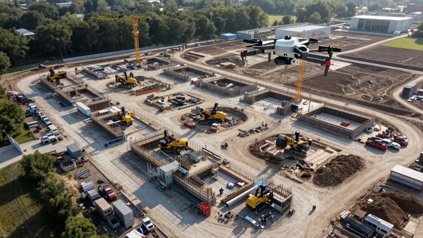
Forget those old clipboards and grainy photos. Drones are changing how we see what’s happening on a construction site. Instead of just walking around, you can send a drone up to get a real bird’s-eye view. This aerial perspective gives you a much clearer picture of the entire project, not just one small section. It’s like going from looking at a single puzzle piece to seeing the whole box lid.
These flying gadgets can capture tons of information. We’re talking high-resolution photos, smooth video footage, and even detailed 3D models. This kind of data is super useful for keeping track of everything. It helps you spot issues early and makes sure things are being built according to plan. Using drone surveying for building sites means you get a consistent record of progress.
- Regular Flights: Schedule weekly flights to get a consistent stream of updates.
- Detailed Imagery: Capture photos and videos that show exactly what’s been done.
- 3D Models: Create digital twins of your site for precise measurements and analysis.
The data collected by drones provides a level of detail that was previously hard to get without spending a lot of time and money. It’s about having a reliable record of what’s happening on the ground, or rather, from above.
Creating Detailed Visual Reports
So, you’ve got all this data from the drone. What do you do with it? You turn it into reports that everyone can understand. Instead of just text and numbers, you get visuals. Think of it like this: showing someone a picture of a problem is way easier than trying to describe it with words.
These visual reports can show progress over time, highlight areas that need attention, or even document the site before any work begins. This makes it easier to communicate with clients, stakeholders, and your own team. It cuts down on confusion and makes sure everyone is on the same page. This is where drone mapping really shines, turning raw data into something actionable.
- Progress Timelines: Show how the site has changed week by week with before-and-after comparisons.
- Issue Spotting: Clearly mark and document any problems or deviations from the plan.
- Client Updates: Provide clients with easy-to-understand visual summaries of project status.
Facilitating Real-Time Progress Analysis
One of the biggest wins with drones is getting information fast. You don’t have to wait days for a surveyor to get back with measurements or for someone to compile a report. The drone flies, the data is processed, and you can start looking at it pretty much right away. This means you can make decisions based on what’s actually happening now, not what happened last week.
This speed is a game-changer for managing a construction project. If there’s a problem, you can spot it and fix it before it becomes a bigger, more expensive issue. It helps keep the project on schedule and within budget. It’s all about having the most current information at your fingertips. This kind of quick analysis is a big step up from older methods of tracking progress.
| Metric | Traditional Method | Drone Method |
|---|---|---|
| Data Collection Time | 1-3 Days | 1-2 Hours |
| Report Generation | 2-5 Days | Same Day |
| Issue Detection | Delayed | Immediate |
The Practical Application of Drone Technology
Documenting Site Conditions Pre-Construction
Before the first shovel hits the dirt, getting a clear picture of the site is super important. Drones are fantastic for this. They can fly over the entire area and capture high-resolution photos and videos. This gives you a detailed record of what the land looks like before any work even begins. Think of it as a baseline. This initial documentation is key for planning and can save a lot of headaches down the line. It helps in understanding the existing terrain, identifying any immediate obstacles, and even checking for things like existing drainage patterns.
- High-resolution aerial photos
- Video walkthroughs of the site
- Mapping existing features
This pre-construction data is invaluable for setting project expectations and can be a lifesaver if any disputes arise later about site conditions.
Monitoring Earthworks and Volumetrics
Once construction is underway, especially during the earthmoving phase, drones really shine. They can accurately measure the volume of stockpiles (like dirt or gravel) and track how much material has been moved. This is way faster and often more precise than traditional methods. You can program a drone to fly the same path repeatedly, giving you consistent data week after week. This helps in managing resources, tracking progress against plans, and keeping costs in check. It’s all about having real-time numbers to make smart decisions.
| Material Type | Initial Volume (m³) | Current Volume (m³) | Change (m³) |
|---|---|---|---|
| Topsoil | 5,000 | 2,500 | -2,500 |
| Gravel | 10,000 | 12,000 | +2,000 |
This kind of data helps in managing your site’s inventory and progress. For more on how drones simplify oversight, check out drone-based progress monitoring.
Tracking Underground Utilities and Foundations
While drones can’t see through the ground, they play a vital role in documenting what’s happening just below the surface and during foundation work. They can map the exact location of underground utilities before excavation begins, reducing the risk of accidental damage. During foundation pouring and curing, drones can provide visual confirmation of the work, checking for any visible issues or inconsistencies. This aerial perspective helps in verifying that the work is proceeding according to plan and specifications, offering a clear record for quality control and compliance. It’s about having eyes on every critical stage, even those that are hard to access or inspect manually.
The ability to capture consistent, georeferenced data from above means that every stage of the project, from initial site prep to the final pour, is documented. This creates an irrefutable record that can be referenced for years to come, aiding in everything from future maintenance to dispute resolution.
Improving Safety and Compliance with Aerial Views
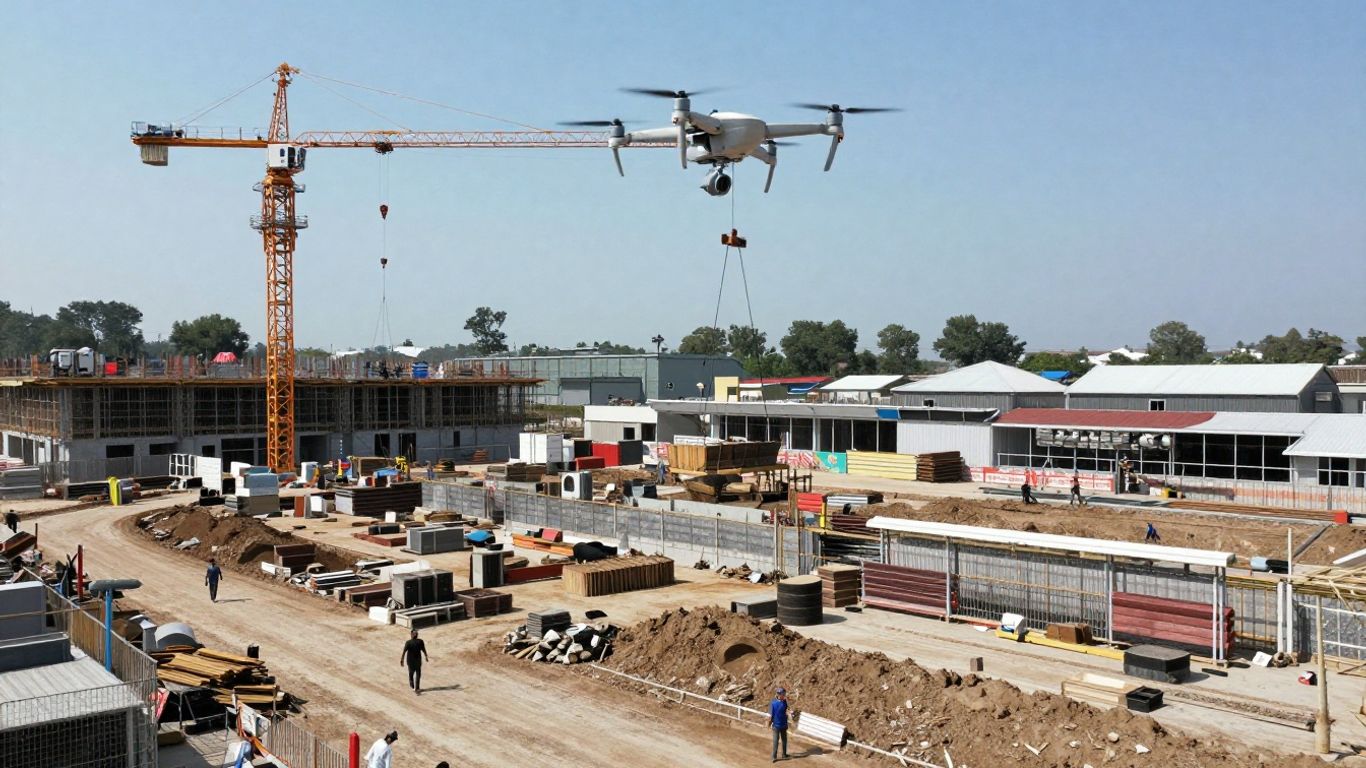
Construction sites can be tricky places, and keeping everyone safe while making sure all the rules are followed is a big deal. Drones are really changing how we look at this. Instead of sending people into potentially risky spots, we can now get a bird’s-eye view of the whole operation. This means we can spot hazards before they become problems and keep a clear record of everything that’s happening.
Identifying Safety Hazards from Above
Think about it: a drone can fly over areas that are hard to reach on foot, like steep slopes, unfinished structures, or areas with lots of equipment. This aerial site monitoring services capability lets us see potential dangers, such as missing guardrails or unstable ground, without putting our team at risk. It’s like having an extra set of eyes that can cover the entire site quickly. We can also check if everyone is wearing the right safety gear, like hard hats and vests, from a safe distance. This proactive approach helps prevent accidents before they even happen.
Ensuring Compliance Through Visual Records
Keeping track of compliance can be a headache. Drones help by creating detailed, timestamped visual records of the site. This footage serves as solid proof that work is being done according to regulations and project plans. If there’s ever a question about whether a specific safety measure was in place or if a certain task was completed correctly, the drone footage provides an objective answer. This documentation is invaluable for audits and can help avoid legal issues down the line. It’s a way to show, not just tell, that you’re meeting all the requirements.
Reducing Risk in High-Access Areas
Some parts of a construction site are just plain dangerous to get to. Climbing scaffolding or walking across beams might be necessary sometimes, but it always comes with risk. Drones can inspect these high-access areas, like rooftops or the tops of structures, without anyone needing to put themselves in harm’s way. This significantly cuts down on the chances of falls or other accidents related to working at heights. It means fewer injuries and less downtime, which is a win-win for everyone involved.
- Regular Drone Flights: Schedule weekly or bi-weekly flights to capture consistent site views.
- Hazard Identification: Use captured imagery to spot unsecured edges, improper scaffolding, or missing safety barriers.
- PPE Verification: Visually confirm that workers are using appropriate personal protective equipment.
- Documentation Storage: Maintain a secure, accessible archive of all visual records for compliance and review.
Streamlining Project Management with Drone Data
Verifying Subcontractor Work Accurately
Keeping tabs on what everyone’s doing on a busy construction site can feel like juggling chainsaws. With multiple subcontractors on-site, it’s easy for things to get a bit fuzzy. This is where drones really shine. By flying consistent paths week after week, drones create a clear, timestamped aerial record. Project managers can use this visual timeline to check progress claims against what’s actually been built. It’s like having an independent witness for every stage of the project. You can easily compare what the drone sees from above with the plans, spotting any drift or discrepancies before they become big problems. This kind of objective data makes verifying work much simpler and fairer for everyone involved.
Resolving Disputes with Timestamped Evidence
Disagreements happen on construction projects. Sometimes it’s about when a certain piece of work was finished, or if it was completed according to the plan. Relying on memory or scattered notes just doesn’t cut it. Drone flights provide irrefutable, timestamped evidence. Each flight captures the site exactly as it was at that moment. This means if there’s a question about whether a foundation was poured before a certain date, or if a specific installation was done before bad weather hit, the drone data can provide a clear answer. This objective record helps settle disputes quickly and fairly, saving time and money that would otherwise be spent on arguments or lengthy investigations. It brings a new level of transparency to project documentation, making it harder for issues to be ignored or misrepresented. This objective record can be a lifesaver when you need to prove what happened and when. Having this kind of visual proof means everyone is working from the same set of facts, which is a huge step forward for project management. This helps keep projects on track and minimizes expensive rework. real-time project updates via drone
Enhancing Collaboration Across Project Teams
When everyone on the project team, from the site supervisor to the client, is looking at the same up-to-date visual information, collaboration gets a whole lot easier. Drones provide a shared perspective that breaks down communication barriers. Instead of relying on emails with attachments or lengthy phone calls, teams can refer to the latest aerial maps and videos. This common visual reference point helps everyone understand the project’s status, identify potential roadblocks, and coordinate their efforts more effectively. It means fewer misunderstandings and more productive teamwork. Imagine being able to quickly show a subcontractor exactly where their work fits into the bigger picture, or providing a client with a clear, easy-to-understand update without them needing to visit the site. This shared understanding speeds up decision-making and keeps the project moving forward smoothly. It’s about getting everyone on the same page, literally from above.
- Weekly Drone Flights: Schedule regular flights to capture consistent site imagery.
- Data Aggregation: Upload captured data to a central platform for easy access.
- Visual Reporting: Generate reports that clearly show progress and highlight any issues.
The ability to revisit past site conditions through drone imagery provides a powerful tool for learning and continuous improvement on future projects. It’s like having a project diary that never forgets.
Navigating Challenges in Drone Implementation
Understanding Regulatory Hurdles
So, you’re ready to get a drone up in the air for your construction site. That’s great! But before you hit that ‘launch’ button, it’s super important to know about the rules. The Federal Aviation Administration (FAA) has specific guidelines for flying drones, especially for commercial use. You can’t just fly anywhere, anytime. Things like where you can fly (altitude limits, proximity to airports), who can fly (pilot certification might be needed), and how you register your drone are all part of the picture. It can feel like a lot, but getting this right means you avoid fines and keep your operations smooth. Think of it like getting your driver’s license – a necessary step for safe operation. For the latest on what you need to know, checking out resources like Know Before You Fly is a good idea.
Addressing Weather and Operational Limitations
Weather is a big one. Drones are pretty tough these days, but they aren’t invincible. Strong winds can make flying unstable, heavy rain can damage electronics, and extreme cold or heat can mess with battery performance. This means you might have days where flying just isn’t an option. What happens then? You need a backup plan. Maybe you schedule flights for the best weather windows or have a team ready to go the moment conditions improve. Battery life is another thing to consider, especially on larger sites. You might need extra batteries or a plan for quick swaps to cover the whole area without interruption. It’s about being realistic with what the technology can do on any given day.
Managing Data and Ensuring Security
Flying a drone generates a ton of data – photos, videos, and sometimes even 3D models. This data is gold for tracking progress, but it needs to be handled properly. You’ll need a system for storing, organizing, and processing all those files. Without the right software, it can quickly become overwhelming. Think about how you’ll back up your data and who will have access to it. Security is also key. You don’t want sensitive project information falling into the wrong hands. Using secure cloud storage and access controls is a smart move. For really precise mapping, especially when you need to align data with existing survey markers, technologies like RTK drone mapping can be a game-changer, but they also add another layer to data management.
How Drones Create Weekly Jobsite Documentation
Getting weekly documentation from your drone is pretty straightforward once you have a system in place. First, you’ll want to plan your flight path. Most drone software lets you set up a repeatable route that covers the key areas of your site. This ensures you’re capturing the same views week after week, which is vital for comparing progress.
- Plan the Flight: Define the area to be covered and set waypoints for consistent coverage.
- Execute the Flight: Fly the drone along the planned route, capturing high-resolution images and video.
- Process the Data: Upload the captured media to your chosen software platform.
- Generate Reports: Use the software to create orthomosaic maps, 3D models, or progress videos.
This consistent, visual record is incredibly useful for spotting subtle changes or potential issues early on. It helps everyone on the team see exactly where things stand without needing to be on-site every single day. It’s like having a bird’s-eye view diary of your project’s evolution.
The Sky’s the Limit for Construction
So, we’ve seen how drones are really changing the game for construction projects. Instead of just guessing or relying on old photos, companies can now get a clear, up-to-date look at what’s happening from way up high. It makes spotting problems early way easier, keeps everyone in the loop, and honestly, just makes managing a big project feel a lot less chaotic. While there are a few bumps in the road, like figuring out the rules or dealing with bad weather, the benefits are pretty clear. Drones aren’t just a cool gadget anymore; they’re becoming a standard tool for building things smarter and faster.
Frequently Asked Questions
What exactly is drone progress tracking for construction?
It’s like giving your construction site a bird’s-eye view! Drones fly over the job site regularly, taking tons of pictures and videos. This helps everyone see exactly how the project is coming along from start to finish, without having to be there all the time.
How do drones make construction sites safer?
Drones can fly over dangerous areas, like high places or deep holes, to check for safety problems. This means fewer people have to go into risky spots, making the job site safer for everyone working there.
Can drones really help finish projects faster?
Yes! By giving a clear picture of what’s happening, drones help teams spot problems early. This means issues can be fixed before they cause big delays, helping the project stay on schedule and saving time.
What happens to all the pictures and videos from the drone?
Special computer programs take all the photos and videos and put them together. This creates detailed maps and reports that show progress over time. It’s like having a visual diary of the whole construction project.
Are there rules about flying drones on construction sites?
Yes, there are rules! You need to know about them and follow them. Things like getting permission to fly and making sure the drone is operated safely are important parts of using drones for construction.
What if the weather is bad, like rainy or windy?
Drones can’t fly safely in really bad weather. This might mean missing a few days of data collection. However, most of the time, drones can fly when it’s clear enough, and the information they gather is still way better than not having it.