
Drones + LiDAR: Mapping Made Easy
Drones equipped with LiDAR technology are changing how we map things. Forget spending ages out in the field; this tech makes getting super detailed 3D maps quicker and easier than ever. Whether you’re working in forestry, construction, farming, or even checking on power lines, drone LiDAR mapping is becoming a go-to tool. It gives you accurate data that helps make better decisions, saves time, and can even cut down on costs. Let’s look at how this tech works and why it’s becoming so popular.
Key Takeaways
- LiDAR uses lasers to create precise 3D maps, differing from photogrammetry which uses photos.
- Drones with LiDAR sensors can quickly collect detailed data for industries like forestry, construction, and archaeology.
- Precision agriculture benefits from drone LiDAR mapping for better crop management, irrigation, and farm planning.
- Inspections of infrastructure and processing insurance claims are streamlined with accurate 3D models from LiDAR drones.
- Choosing the right drone and LiDAR sensor depends on project needs, budget, and regulations for effective drone LiDAR mapping.
Understanding LiDAR Technology
LiDAR, which stands for Light Detection and Ranging, is a remote sensing method that uses pulsed laser light to measure distances. Think of it like radar, but with light. A LiDAR sensor shoots out laser pulses, and by measuring how long it takes for those pulses to bounce back off objects, it can create incredibly precise 3D maps of the surrounding environment. This technology has been around for a while, initially used on large aircraft for mapping rivers and terrain. However, recent advancements have made LiDAR sensors smaller and more affordable, making them perfect for mounting on unmanned aerial vehicles (UAVs).
LiDAR vs. Photogrammetry: Key Differences
When we talk about mapping with drones, you’ll often hear two terms: LiDAR and photogrammetry. They both create 3D models, but they do it in fundamentally different ways. Photogrammetry uses a series of overlapping photographs taken from a drone. Software then stitches these images together to build a 3D model. It’s great for capturing visual detail and color. However, photogrammetry can struggle with areas that have uniform surfaces, like a plain green field, or if there’s dense vegetation. The software might get confused trying to find distinct points to stitch together.
LiDAR, on the other hand, actively measures distances. This means it can penetrate through foliage to some extent, capturing ground elevation even under a tree canopy. It’s also less affected by lighting conditions. For applications like lidar scanning for land surveys where precise elevation data is critical, LiDAR often has the edge. Here’s a quick look at some key differences:
| Feature | LiDAR | Photogrammetry |
|---|---|---|
| Data Capture | Laser pulses measure distance | Overlapping photographs |
| Accuracy | Very high, especially for elevation | High, but can be affected by image quality |
| Vegetation | Can penetrate canopy to some degree | Struggles with dense foliage |
| Lighting | Not dependent on sunlight | Requires good lighting conditions |
| Output | Point cloud (precise 3D coordinates) | 3D mesh, textured model |
| Cost | Generally higher sensor cost | Lower sensor cost, higher processing time |
How LiDAR Drones Capture Data
Using a LiDAR drone for mapping is pretty straightforward once the system is set up. The drone flies a pre-planned flight path over the area you want to map. As it flies, the LiDAR sensor continuously emits laser pulses and records the returning signals. Each pulse provides a data point with precise X, Y, and Z coordinates, along with intensity information. This creates a dense ‘point cloud’ – a collection of millions or even billions of individual data points that represent the surveyed area in three dimensions. The drone also carries a GPS and an Inertial Measurement Unit (IMU) to record its exact position and orientation during the flight, which is vital for georeferencing the point cloud accurately. This raw data is then processed using specialized software to create detailed 3D models, digital elevation models (DEMs), and other useful outputs. Companies like Rock Robotic offer professional systems designed for this purpose.
The Evolution of LiDAR Sensors
LiDAR technology has come a long way. Initially, LiDAR systems were massive, expensive, and only feasible for mounting on large aircraft. This limited their use to government agencies and large corporations. Over the years, engineers have worked hard to miniaturize these sensors and reduce their cost. This evolution has been key to enabling the widespread adoption of LiDAR on drones. Early drone LiDAR systems were still quite costly, but today, there’s a range of sensors available, from high-end professional units to more accessible options. This democratization of the technology means more industries can now benefit from the precision and efficiency of drone-based LiDAR mapping. The continuous innovation means we’re seeing lighter, faster, and more capable sensors being developed all the time, pushing the boundaries of what’s possible in 3D mapping.
Revolutionizing Industries with Drone LiDAR Mapping
Applications in Forestry and Fire Management
LiDAR drones are really changing the game for folks working in forests and dealing with fires. Think about it: instead of hiking through dense woods, you can send a drone up. It maps out the forest canopy, telling you how thick the trees are and if they’re healthy. This is super useful for managing forests sustainably. For firefighters, this data is a lifesaver. They can use it to figure out how much fuel (like dry leaves and branches) is on the ground, which helps them predict how a fire might spread and where it’s most likely to get out of control. It’s all about getting a clear picture of the landscape before things get hairy.
Construction and Mining Site Surveys
When you’re building something big or digging into the earth, you need to know exactly what you’re working with. That’s where LiDAR drones come in. They create incredibly detailed 3D maps of construction sites and mines. This means planners can see the terrain with amazing accuracy, figure out the best way to move dirt, and plan where to put things. For mining operations, it helps track how much material has been extracted and plan future digs. This level of detail means fewer mistakes and less wasted money. It’s a big step up from older methods that took way longer and weren’t always as precise. This kind of detailed 3D mapping using drones is becoming standard practice.
Uncovering History with Archaeology
Archaeologists have a new best friend in LiDAR drones. Imagine trying to find ancient ruins hidden under thick vegetation or layers of soil. It’s tough work. But a drone with a LiDAR sensor can fly over an area and
Precision Agriculture with LiDAR Drones
Optimizing Crop Production
LiDAR drones are changing how farmers manage their fields. Instead of guessing, they get real data. This technology helps create detailed maps showing which parts of a field are producing the most crops and which areas might need more attention. Think of it like getting a report card for your land. This information helps farmers decide exactly where to apply fertilizers or pesticides, cutting down on waste and saving money. It also helps identify areas that get more or less sunlight, which is key for planning what to plant where. This data-driven approach leads to healthier crops and better yields.
Enhancing Irrigation Systems
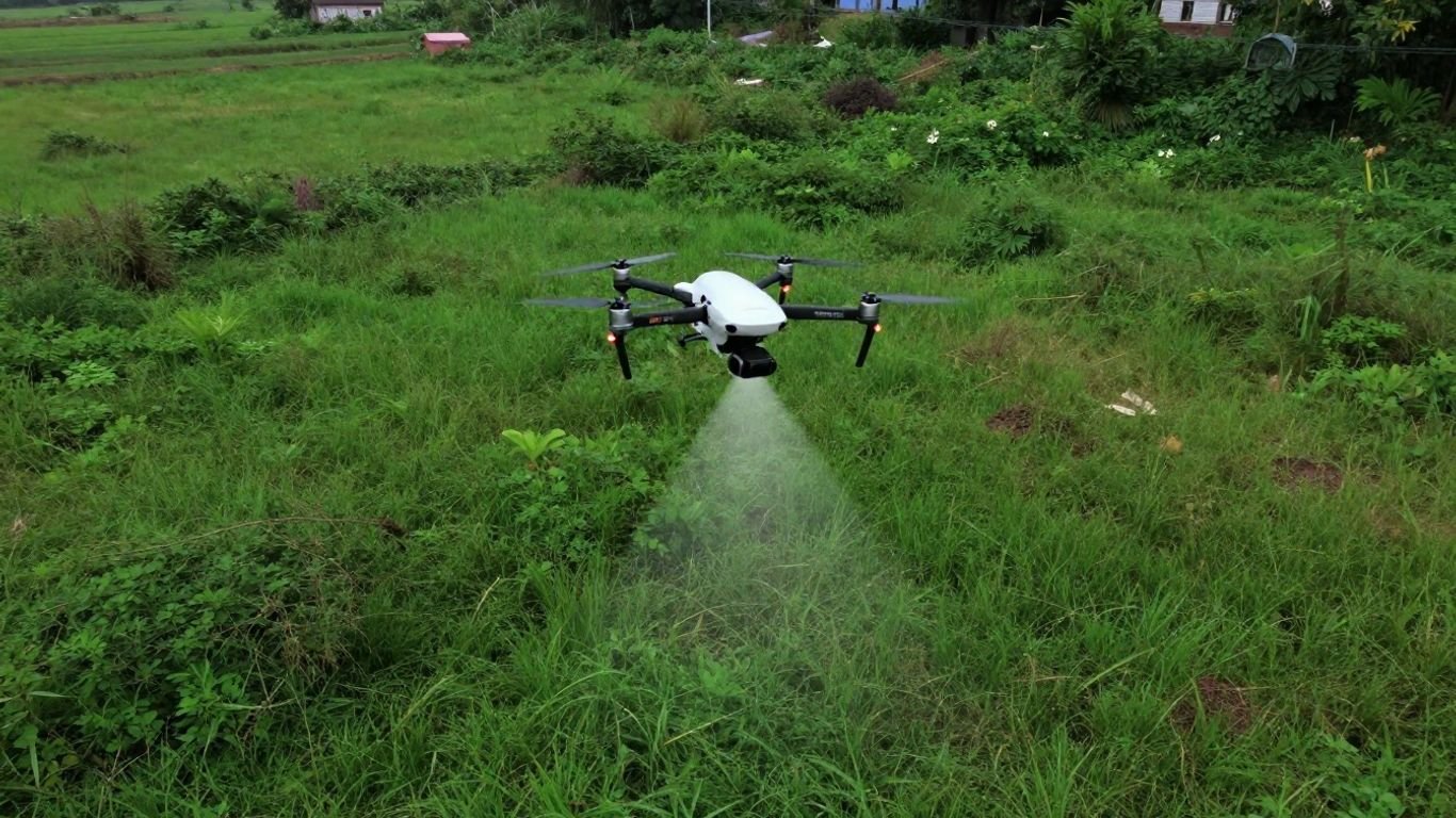
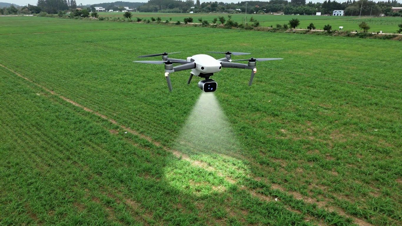
Getting water to crops just right can be tricky, especially on farms with complex layouts. LiDAR is a game-changer here. It can map out fields with incredible accuracy, even showing subtle changes in elevation that affect water flow. This is super useful for designing and maintaining irrigation systems, like the levees on a rice farm. What’s really neat is that LiDAR can collect this data even if the fields are wet, meaning farmers don’t have to wait for the ground to dry out before they can survey. This means quicker adjustments and more efficient water use, which is good for the crops and the environment. This kind of detailed mapping is a big step forward for smart farming.
Improving Livestock Management
Keeping tabs on livestock, especially in large open areas, has always been a challenge. LiDAR drones can help by providing a bird’s-eye view that’s impossible to get from the ground. They can help farmers locate grazing animals or monitor herds, even in difficult terrain or at night. This improved visibility can also play a role in protecting livestock from predators. It’s about using technology to keep a closer eye on animals and manage them more effectively.
Accurate Farm Mapping and Savings
Overall, using LiDAR drones for farm mapping means getting precise information quickly. A drone can scan an entire farm in a short amount of time, creating highly accurate maps. This detailed information helps farmers make smarter decisions about everything from planting to harvesting. By reducing guesswork and optimizing resource use, farmers can save time and money. It’s a big part of what’s known as precision agriculture, where technology helps make farming more efficient and productive. The ability to collect such detailed data from the air is a significant advancement for [geospatial data collection drones].
LiDAR technology works by sending out laser pulses and measuring how long it takes for them to bounce back. This creates a detailed 3D point cloud of the landscape, capturing elevation and surface features with high precision. Unlike photogrammetry, which relies on overlapping photos to create 3D models, LiDAR can see through vegetation to some extent and is less affected by lighting conditions, making it ideal for detailed terrain mapping.
Streamlining Inspections and Insurance
When it comes to keeping tabs on infrastructure and sorting out insurance claims, things used to be a real hassle. Think about inspecting a bridge or a tall building – someone had to climb all over it, often in less-than-ideal weather, just to get a look. Or imagine a big storm hits, and insurance adjusters have to drive around, knocking on doors to see who needs help. It took ages and wasn’t exactly the safest way to work.
Infrastructure Maintenance and Monitoring
Now, drones with LiDAR sensors are changing all that. They can fly around structures like power lines, pipelines, or wind turbines, creating super detailed 3D maps. This means we can spot tiny cracks or wear and tear way before they become big problems. It’s way faster and safer than sending people up there. Plus, you get a precise record of what things looked like, so you can track changes over time. This kind of detailed data helps plan maintenance better, cutting down on unexpected breakdowns and keeping critical services running smoothly. For example, inspecting power lines used to be a risky job, but now drones can do it from a distance, making things safer for everyone involved Power line inspections have evolved from dangerous manual methods to advanced drone technology.
Creating Historical Asset Records
One of the coolest things LiDAR brings to inspections is the ability to create a perfect digital twin of an asset. Imagine having a super accurate 3D model of a building, a bridge, or even a whole factory floor. You can save this model and compare it to future scans. This historical record is gold for maintenance planning and understanding how things age or degrade over time. It’s like having a time machine for your infrastructure, showing you exactly how it looked at different points in its life.
Revolutionizing Insurance Claims Processing
For insurance, LiDAR drones are a game-changer. After a natural disaster, instead of adjusters spending days or weeks driving around, a drone can map out a whole neighborhood in a fraction of the time. This means faster assessments and quicker payouts for people who’ve lost a lot. It also helps insurance companies get a clearer picture of the damage, leading to more accurate claim evaluations. Think about flood damage – a LiDAR scan can quickly show the extent of water intrusion and structural impact, making the claims process much smoother.
Ensuring Safety During Inspections
Safety is a huge win with drone LiDAR. We’re talking about avoiding dangerous heights, confined spaces, or hazardous environments. Instead of a person having to physically go into a risky spot, the drone can gather all the necessary data from a safe distance. This drastically cuts down on accidents and injuries in fields like construction and infrastructure monitoring Drones are revolutionizing infrastructure inspections, offering a safer, more efficient, and accurate alternative to traditional methods. It means workers can focus on fixing problems rather than risking their well-being just to get a look at them.
Choosing the Right Drone for LiDAR Mapping
So, you’ve decided LiDAR is the way to go for your mapping projects. That’s great! But now comes the big question: what drone should you actually put that fancy LiDAR sensor on? It’s not as simple as just grabbing the first drone you see. You need a platform that can handle the weight, fly long enough to cover your area, and, importantly, meet any rules and regulations you might run into.
Key Factors for Drone Selection
When you’re picking a drone for LiDAR, think about a few things. First, what’s the typical size of the areas you’ll be mapping? Bigger areas mean you’ll need a drone with longer flight times. Then there’s the terrain. Are you flying over flat fields or rugged mountains? This affects how stable the drone needs to be and how much payload it can carry. Don’t forget about regulations, especially if you’re working in certain countries or for government clients. Some projects might require a drone that’s made in the U.S., for example.
Here’s a quick rundown of what to consider:
- Payload Capacity: Can it safely lift your LiDAR sensor and any other gear?
- Flight Time: How long can it stay in the air on a single battery charge?
- Stability and Durability: How well does it handle wind and different weather conditions?
- Navigation Systems: Does it have reliable GPS and other sensors for accurate flight paths?
- Regulatory Compliance: Does it meet requirements like NDAA or Blue UAS if needed?
LiDAR vs. Photogrammetry: Key Differences
It’s worth quickly touching on why LiDAR is often chosen over photogrammetry for certain tasks. Photogrammetry uses overlapping photos to create 3D models. It’s great for capturing color and texture. LiDAR, on the other hand, uses laser pulses to measure distances. This means it can see through vegetation to the ground below, which is a big deal for forestry or terrain mapping. LiDAR also tends to be more accurate for precise elevation data, especially in challenging environments. While photogrammetry can be cheaper to start with, LiDAR often provides a more robust dataset for specific applications.
Choosing the right drone and LiDAR sensor is like picking the right tools for a job. You wouldn’t use a hammer to screw in a bolt, right? Similarly, you need the right combination of drone and sensor to get the best results for your specific mapping needs.
Understanding Drone and Sensor Integration
Once you’ve got a drone in mind, you need to make sure your LiDAR sensor will actually work with it. Think of it like plugging a new accessory into your computer. Some drones are designed to easily accept different payloads, while others are more limited. You’ll want to look at how the sensor connects to the drone – is it a simple mount, or does it require complex wiring? Also, consider the software. Does the drone’s flight planning software work well with the LiDAR system’s data collection software? Getting these two pieces to talk to each other smoothly is key to efficient data capture. For those looking for expert advice on pairing these systems, there are resources available to help you choose the right drone for your new drone-based LiDAR project.
Navigating Regulatory Compliance
This is a big one, especially in 2026. Depending on where you operate and who your clients are, you might have to deal with regulations like the U.S. NDAA (National Defense Authorization Act) or the Blue UAS program. These rules often dictate which drones can be used, particularly for government-related work. Drones made in certain countries might be restricted. If compliance is a major concern, you’ll be looking at U.S.-made platforms like the Inspired Flight IF800 Tomcat or the Freefly Astro Max. These are built to meet those stricter requirements and can still carry high-performance LiDAR payloads. If these regulations aren’t an issue for your work, then options like the DJI Matrice 350 RTK might be a more cost-effective choice, offering great performance and integration. Understanding these rules upfront will save you a lot of headaches down the line and help you build a successful drone business.
Advanced LiDAR Sensor Capabilities
High-Performance LiDAR Payloads
When you’re looking at LiDAR sensors for drones, the "high-performance" ones are really what make a big difference for serious mapping. These aren’t your basic sensors; they’re built to capture incredibly detailed data, even from higher altitudes. Think about flying a drone at the legal limit of 400 feet – a top-tier LiDAR system can still give you dense, accurate point clouds from that height. This means you can cover a lot more ground in a single flight, which is a huge time saver. Some of these advanced payloads are designed to concentrate their laser beams downwards, making sure most of the points hit the ground where you want them, rather than scattering off into the sky. This focused approach really boosts the quality and density of your map.
Versatile Ground and Aerial Deployment
One of the coolest trends in LiDAR technology is its flexibility. We’re seeing sensors that aren’t just for flying on drones anymore. Some advanced systems can be mounted on ground vehicles or even carried by a person for mobile mapping. This means you can use the same high-quality LiDAR equipment for different types of projects. Need to map the inside of a building or a complex industrial site where a drone can’t easily go? No problem, you can switch to a ground-based setup. This versatility means you can offer more services with a single investment, adapting to whatever the job requires. It’s a big step up from systems that are strictly aerial.
Maximizing Coverage and Efficiency
Getting the most out of your drone LiDAR mapping boils down to covering as much area as possible, as accurately as possible, in the shortest amount of time. High-performance LiDAR sensors, when paired with the right drone, are key to this. Imagine a project that used to take three days of flying; with the latest tech, you might be able to finish it in just one. This isn’t just about speed; it’s about efficiency and cost savings. Choosing a drone with enough payload capacity to comfortably carry a powerful LiDAR system, and a sensor that offers a wide field of view or can operate effectively at higher altitudes, directly translates to fewer flights, less processing time, and ultimately, a more profitable operation. For example, systems like the ROCK R3 Pro V2 show this adaptability, allowing for both aerial and ground use, which can really expand your service offerings.
LiDAR and photogrammetry both create 3D models, but they work differently. Photogrammetry uses overlapping photos taken from a drone to build a model. It’s great for capturing color and texture, making things look realistic. LiDAR, on the other hand, uses lasers to measure distances. It sends out pulses of light and measures how long they take to bounce back. This gives you a very precise measurement of every point it hits, creating a dense point cloud. LiDAR is generally better at capturing the exact shape and elevation of the ground, even through vegetation, because the laser can penetrate. Photogrammetry can struggle with areas that are heavily covered by trees, as it only sees the tops. However, photogrammetry is often less expensive and can provide more visually appealing, textured models. The choice between them really depends on what you need the final model for. For precise elevation data and detailed structural measurements, LiDAR often has the edge. For visually rich, textured models, photogrammetry might be sufficient. Sometimes, using both technologies together provides the best of both worlds.
Wrapping It Up
So, we’ve seen how drones and LiDAR are really changing the game for mapping. It’s not just about getting a picture anymore; it’s about creating detailed 3D models that help all sorts of industries, from farming to construction to archaeology. Picking the right drone and sensor combo is key, and it really depends on what you need to do. Whether you’re looking for speed, accuracy, or something that fits specific rules, there are options out there. By putting together the right drone and the right LiDAR gear, you’ll be set to gather great data and stay on top of things in this fast-moving field.
Frequently Asked Questions
What’s the difference between LiDAR and photogrammetry?
Think of LiDAR like using a laser pointer to measure things. It shoots out tiny laser beams and measures how long they take to bounce back, creating a super accurate 3D map of shapes and distances. Photogrammetry is more like taking a bunch of overlapping photos from different angles. A computer then stitches these photos together to build a 3D model. LiDAR is often more precise, especially for measuring exact distances and shapes, while photogrammetry is great for capturing colors and textures.
How do drones use LiDAR to collect data?
Drones equipped with LiDAR sensors fly over an area, and the sensor rapidly sends out laser pulses. As these pulses hit the ground, trees, buildings, or anything else, they bounce back to the sensor. The drone also records its exact location using GPS. By measuring the time it takes for the laser to return and knowing where the drone is, it can create a detailed 3D point cloud, which is like a giant collection of tiny dots representing the landscape.
Why are drones with LiDAR useful for farming?
LiDAR drones can help farmers grow more food and use resources better. They can create maps showing which parts of a field have the best soil or get the most sun, helping farmers decide where to plant and fertilize. They can also map out fields precisely for irrigation systems, making sure water goes exactly where it’s needed, even if the ground is wet. This all helps save money and time.
How can LiDAR drones help with inspections?
Imagine needing to check a tall bridge or a windy power line. Sending people up there can be risky and take a long time. LiDAR drones can fly close to these structures and create a detailed 3D map. This map lets engineers see any damage, wear, or problems without having to put anyone in danger. It also creates a permanent record to compare against future inspections.
What kind of drone is best for LiDAR mapping?
The best drone depends on what you need to map. You need a drone that’s strong enough to carry the LiDAR sensor and has enough battery life to cover your area. Some drones are better for big, open spaces, while others are designed for more complex or indoor jobs. It’s important to match the drone’s abilities with your project’s needs and any rules you have to follow.
Can LiDAR drones help with insurance claims?
Yes, absolutely! After a big storm or flood, insurance companies usually send people out to check the damage. LiDAR drones can quickly fly over a whole neighborhood or a large property and create a 3D map of the damage. This helps insurance adjusters understand the situation much faster and more accurately, making the claims process smoother for everyone involved.