
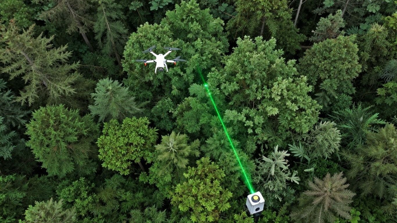
LiDAR vs. Drones: What’s the Diff?
So, you’re trying to figure out the difference between a LiDAR drone and a photogrammetry drone for your project? It can get a bit confusing, right? Both are super useful for mapping and surveying, but they work in really different ways. Think of it like using a flashlight versus just taking a picture – one actively sends out a signal, the other relies on existing light. We’re going to break down what makes each of these drone technologies tick, so you can stop scratching your head and start choosing the right tool for the job. Let’s get into it.
Key Takeaways
- LiDAR drones use laser pulses (active sensing) to measure distances and create 3D point clouds, while photogrammetry drones use cameras (passive sensing) to capture images for mapping.
- LiDAR is excellent at penetrating vegetation to map the ground beneath, making it ideal for forest surveys or bare-earth mapping.
- Photogrammetry excels at capturing detailed, realistic surface textures and colors, creating visually rich 2D and 3D maps.
- LiDAR drones often provide higher point density, allowing for more detailed terrain and object modeling, especially in complex environments.
- Photogrammetry can be more cost-effective for large, open areas where detailed surface texture is the primary need.
- Accuracy for both methods can reach centimeter-level, but LiDAR’s precision is less affected by lighting conditions than photogrammetry.
- Aerial LiDAR is better suited for very large-scale projects due to its wider coverage, while drone LiDAR is more efficient for smaller, detailed sites or frequent updates.
- The choice between a LiDAR drone vs photogrammetry drone depends heavily on project specifics like terrain, vegetation, required detail, budget, and timeline.
Understanding LiDAR Drone vs Photogrammetry Drone Technology
When you’re looking at getting data from above, especially with drones, two main technologies pop up: LiDAR and photogrammetry. They both give you maps and 3D models, but they work in pretty different ways. It’s not really about which one is ‘better,’ but more about which one fits what you need to do.
What is LiDAR?
LiDAR stands for Light Detection and Ranging. Think of it like this: it shoots out laser pulses and measures how long it takes for them to bounce back. This tells it the exact distance to whatever the laser hit. It’s an active system, meaning it provides its own light source (the laser) to get measurements. This is a big deal because it doesn’t rely on sunlight or ambient light to work. It’s often compared to radar or sonar, but uses light instead of radio waves or sound. The data it collects forms a ‘point cloud,’ which is basically a massive collection of 3D points representing the surveyed area.
How LiDAR Works
LiDAR systems, especially those on drones, have a laser scanner, a GPS unit, and an Inertial Measurement Unit (IMU). The laser scanner sends out millions of pulses per second. When these pulses hit an object – like a tree, a building, or the ground – they reflect back to a sensor. The GPS and IMU track the drone’s exact position and orientation in space. By combining the laser’s timing data with the drone’s location and orientation, the system can pinpoint the exact 3D coordinates of millions of points on the ground and on objects. This creates a highly detailed 3D map.
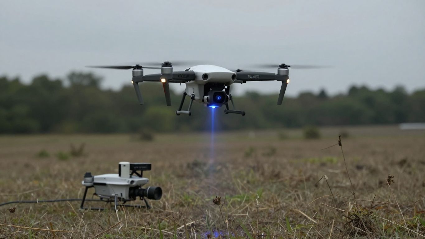
What is a LiDAR Drone?
A LiDAR drone is simply a drone equipped with a LiDAR sensor. These sensors can vary in size and complexity, but they all perform the same core function: emitting laser pulses and measuring reflections to create 3D data. You can find them mounted on various drone platforms, from smaller multirotor drones for detailed local surveys to larger fixed-wing drones for covering more ground. The integration of LiDAR technology with fixed-wing drones is particularly useful for large-scale projects.
The Evolution of LiDAR Technology
LiDAR isn’t exactly new, but putting it on drones is a more recent development. Originally, LiDAR was mostly used from aircraft or even ground-based scanners. The miniaturization of sensors and improvements in GPS and IMU technology have made it possible to mount powerful LiDAR systems on drones. This has made LiDAR data collection much more accessible and affordable for a wider range of applications, from power line inspections using specialized drones to environmental monitoring.
LiDAR’s Active Sensing Approach
As mentioned, LiDAR is an active sensor. This means it sends out its own energy (laser light) to measure the environment. This is a key differentiator from photogrammetry. Because it’s actively sending out signals, it can work day or night and doesn’t get as easily confused by shadows or varying light conditions. It’s all about direct measurement of distance.
LiDAR’s Role in Remote Sensing
LiDAR is a powerful tool in remote sensing, which is the science of gathering information about objects or areas from a distance, typically from aircraft or satellites. Unlike passive sensors that just capture reflected sunlight, LiDAR actively probes the environment. This allows it to gather precise elevation data, map terrain features, and even penetrate vegetation to see what’s underneath, which is a significant advantage in many remote sensing tasks.
LiDAR’s Application in 3D Mapping
LiDAR is fantastic for creating highly accurate 3D maps. The point clouds it generates can be processed to build detailed digital elevation models (DEMs), digital surface models (DSMs), and 3D city models. Because of its precision, it’s used in everything from urban planning and architectural design to geological surveys and disaster response. The ability to capture millions of data points quickly makes it ideal for complex 3D mapping projects.
LiDAR’s Core Components
A typical drone LiDAR system includes:
- LiDAR Scanner: The part that emits laser pulses and records the returning signals.
- GNSS/GPS Receiver: Tracks the drone’s precise location.
- IMU (Inertial Measurement Unit): Measures the drone’s orientation (pitch, roll, yaw).
- Onboard Computer/Data Logger: Processes and stores the collected data.
These components work together to ensure that every single laser point is accurately georeferenced, leading to a precise 3D model of the surveyed area.
The Fundamentals of Photogrammetry for Drones
What is Photogrammetry?
Photogrammetry is basically the science of making measurements from photographs. When we talk about drones, it means using a drone to take a bunch of pictures of an area from different angles. The trick is that these photos need to overlap a lot. Think of it like how your two eyes see slightly different views, which helps your brain figure out depth. Photogrammetry does something similar, using those overlapping images to build a 3D model of the ground.
How Photogrammetry Works
So, how does it actually work? A drone flies over an area, snapping pictures. These images are then processed by special software. This software looks for common points in multiple photos and uses them to calculate the position and shape of everything in the scene. It’s all about geometry and finding those shared features. The more overlap between images, the more accurate the final 3D reconstruction will be. This process allows us to create detailed maps and models that show not just elevation, but also the color and texture of the landscape.
The Role of Cameras in Photogrammetry
Cameras are the heart of photogrammetry. The type and quality of the camera on your drone make a big difference. High-resolution cameras capture more detail, which is super important for getting precise measurements. Think of it like using a really sharp pencil versus a dull one – you get a much clearer picture with the sharp one. The camera’s lens also plays a role in how the images are distorted, and software has to account for that.
Image Overlap in Photogrammetry
This is a big one. For photogrammetry to work well, you need significant overlap between your photos. Generally, you’re looking for about 75-85% overlap from front to back (forward overlap) and 60-70% overlap from side to side (side overlap). This ensures that every part of the ground is seen from multiple viewpoints. Without enough overlap, the software can’t stitch the images together properly, and you end up with gaps or inaccuracies in your 3D model. It’s like trying to assemble a puzzle with missing pieces – it just doesn’t work.
Geotagging and Base Station Data
To make your photogrammetry maps accurate in the real world, you need to know exactly where each photo was taken. This is where geotagging comes in. Most drone cameras automatically record the GPS coordinates for each picture. For even better accuracy, especially on larger projects, using a base station on the ground (like an RTK or PPK system) provides more precise location data for the drone’s camera. This helps tie your 3D model to real-world coordinates.
Photogrammetry’s Passive Data Collection
Photogrammetry is considered a passive data collection method. This means it relies on existing light, like sunlight, to capture images. It doesn’t send out its own signals. This is a key difference from technologies like LiDAR, which actively send out laser pulses. Because it uses visible light, photogrammetry can capture very realistic, full-color images of the surface. However, this also means it can struggle in low-light conditions or when trying to see through dense vegetation, as it can only capture what the camera can see.
Creating 2D and 3D Maps with Photogrammetry
After processing the overlapping images, you get two main types of outputs: 2D maps and 3D models. The 2D maps are often called orthomosaics – they’re like a super-detailed, geometrically corrected aerial photograph of the entire area. The 3D models, on the other hand, give you a digital representation of the terrain’s shape and elevation. These models can be viewed from any angle, providing a lot of insight into the landscape. You can even generate point clouds from photogrammetry, though they might not be as dense as LiDAR point clouds.
The Simplicity of Photogrammetry Data Capture
One of the big draws of photogrammetry is how straightforward the data capture process can be. Once you have your flight plan set up, the drone does most of the work. You don’t need highly specialized sensors beyond a good quality camera. This makes it a very accessible technology for many applications. The main challenge often lies in the processing of the large number of images, but software is getting more automated all the time. This makes it a cost-effective way to get detailed aerial data for many projects. Drone mapping utilizes photogrammetry, a process that stitches together overlapping aerial images to generate 2D maps and 3D models. This technology is fundamental to creating detailed aerial representations for various applications.
Key Differences Between LiDAR and Photogrammetry
Alright, let’s get down to brass tacks. When you’re looking at drone surveying, you’ll keep hearing about LiDAR and photogrammetry. They both map stuff, sure, but they go about it in totally different ways. It’s not just a minor tweak; the whole approach is different, and that matters a lot for what you end up with.
Active vs. Passive Data Collection
This is probably the biggest difference. LiDAR is what we call an ‘active’ system. Think of it like shining a flashlight – it sends out its own light (laser pulses, in this case) and measures how long it takes for that light to bounce back. This means it can work anytime, even in the dark. Photogrammetry, on the other hand, is ‘passive’. It’s like taking a picture; it relies entirely on existing light. So, you need good lighting conditions for photogrammetry to work well. LiDAR actively sends out signals, while photogrammetry passively captures what’s already there.
Laser Pulses vs. Camera Images
Following on from the active vs. passive point, LiDAR uses laser pulses. Millions of them, actually, fired out every second. These pulses hit surfaces and reflect back to a sensor. Photogrammetry uses cameras. It takes a bunch of overlapping photos, and then software stitches them together to create a 3D model. It’s like putting together a giant jigsaw puzzle, but with pictures.
Penetrating Vegetation: LiDAR’s Advantage
This is where LiDAR really shines, especially if you’re dealing with forests or areas with lots of plants. Because LiDAR uses laser pulses, these pulses can actually bounce off leaves and branches and then still reach the ground below. This allows LiDAR to map the actual ground surface, even under a thick canopy. Photogrammetry, however, can only see what the camera sees. If there’s a dense layer of leaves, the camera won’t see the ground, and neither will your photogrammetry model. So, for bare earth surveys in vegetated areas, LiDAR is usually the way to go. You can get detailed information about the ground even through foliage.
Detailing Terrain: Photogrammetry’s Strength
While LiDAR is great for seeing through things, photogrammetry is fantastic at capturing the surface details. Because it uses actual photographs, the resulting 3D models are often very realistic and visually rich. You get true-color textures and a life-like representation of the landscape. If you need to see the exact color of a building, the texture of a road, or the visual appearance of a site, photogrammetry often provides a more intuitive and detailed visual output. It’s excellent for creating visually appealing maps and models.
Point Clouds vs. Textured Models
This ties into the previous points. LiDAR primarily generates a ‘point cloud’. Imagine a massive collection of tiny dots in 3D space, each representing a point on a surface. It’s incredibly precise for measuring geometry. Photogrammetry, while it also creates point clouds, is more known for its ‘textured models’. These are 3D models that have realistic images draped over them, making them look like real-world objects. So, you get geometric data from LiDAR, and visually rich, realistic models from photogrammetry.
Data Acquisition Methods Compared
When it comes to actually getting the data, there are differences. LiDAR systems are generally more complex, involving lasers, scanners, and precise timing mechanisms. Photogrammetry is simpler in terms of hardware – usually just a good camera and a GPS unit. However, processing photogrammetry data can be quite intensive, requiring significant overlap between images and careful calibration. LiDAR data processing is also complex, but the initial capture is more about direct measurement. The choice between LiDAR mapping vs photogrammetry often comes down to the specific needs of the project.
Understanding Signal Types: Laser vs. Light
It’s worth reiterating the core difference in signals. LiDAR uses laser light, which is a specific, controlled wavelength. This allows for very precise distance measurements. Photogrammetry uses visible light, the kind we see with our eyes, captured by cameras. The way these different ‘lights’ interact with surfaces leads to the distinct outputs and capabilities of each technology. This difference in signal type is key when choosing between LiDAR and photogrammetry.
The Core Distinction in Measurement
At its heart, LiDAR is a direct measurement technology. It measures distances. Photogrammetry is an inferential technology. It infers shape and distance by analyzing multiple images from different viewpoints. This fundamental difference dictates their strengths and weaknesses. LiDAR gives you precise geometric data, while photogrammetry gives you precise visual data that can be used to derive geometry.
Accuracy and Precision in Drone Surveys
When we talk about how good the data from a drone survey is, we’re really looking at two things: accuracy and precision. Think of accuracy as how close the measurements are to the real thing, and precision as how consistent those measurements are with each other. Both LiDAR and photogrammetry drones can get you some really good results, but they get there a bit differently.
Centimeter-Level Accuracy Potential
It’s totally possible to get centimeter-level accuracy with both drone LiDAR and photogrammetry. The trick isn’t just the sensor itself, but the whole setup. You need good GPS (GNSS) and an accurate inertial measurement unit (IMU) on the drone, plus some ground control points (GCPs) on the ground to tie everything together. Without these, your data might look good, but it won’t be tied to real-world coordinates accurately. The quality of your workflow and how well you control the process are way more important than just picking one technology over the other.
LiDAR’s Precision in Point Density
LiDAR systems send out laser pulses, and they can do this thousands or even millions of times per second. This means you get a ton of data points, often hundreds of points per square meter, especially when the drone is flying low. This high point density is what gives LiDAR its precision. It can capture very fine details of the terrain, like small ditches, berms, or even the texture of a surface. This is super helpful for detailed site modeling.
Photogrammetry’s Accuracy with Ground Control
Photogrammetry relies on taking lots of overlapping photos. The software then figures out where those photos were taken and stitches them together to create a 3D model. While it can achieve great horizontal accuracy, its vertical accuracy can sometimes be a bit less precise than LiDAR, especially in areas with less varied terrain or tricky lighting. However, with enough ground control points and careful flight planning, photogrammetry can also deliver very accurate results. It’s often really good at capturing surface details that look natural because, well, it’s using actual photos.
Factors Influencing Survey Accuracy
Several things can mess with how accurate your survey data ends up being:
- Sensor Quality: The better the camera or LiDAR sensor, the more detail it can capture.
- GNSS/IMU Performance: How well your drone knows where it is and how it’s oriented makes a big difference.
- Ground Control Points (GCPs): Having accurately surveyed points on the ground is key for tying your data to reality.
- Flight Planning: How you plan your flight path, including overlap between photos or laser scans, matters a lot.
- Processing Software: The algorithms used to process the raw data play a role in the final output.
- Environmental Conditions: Things like fog, rain, or even strong winds can affect data quality.
Achieving Vertical Accuracy
Vertical accuracy is all about how well your data represents the height of the ground. For LiDAR, the high pulse rate and ability to penetrate some vegetation can help get a good picture of the ground’s elevation. Photogrammetry achieves vertical accuracy by having lots of overlap in images and using accurate GCPs to scale and orient the model correctly. Both methods can get you within a few centimeters vertically, but the path to get there differs.
Horizontal Accuracy Metrics
Horizontal accuracy refers to how well your data aligns with the real-world X and Y coordinates. Both LiDAR and photogrammetry can achieve excellent horizontal accuracy, often down to a centimeter or two. This is usually thanks to good GNSS receivers on the drone and well-placed ground control. The key is that the data is georeferenced correctly, meaning it’s placed in the right spot on the Earth.
Comparing Accuracy Standards
Different industries and projects have different needs for accuracy. For some, knowing something is within a meter is fine. For others, like construction or engineering, you might need accuracy down to the centimeter. It’s important to know what level of accuracy your project requires before you even start. This will help you choose the right technology and workflow. For instance, drone surveying accuracy can vary significantly based on these factors.
The final accuracy of your drone survey data isn’t solely determined by the sensor you use. It’s a combination of the hardware, the software used for processing, and most importantly, the quality control and planning that goes into the entire operation. Think of it like baking a cake: you can have the best ingredients (sensors), but if you don’t follow the recipe (workflow) or measure correctly (quality control), the cake won’t turn out right.
The Impact of Sensor Quality on Accuracy
Naturally, a higher-quality sensor will generally lead to more accurate data. A better camera will capture sharper images, and a more advanced LiDAR scanner will have a more precise laser and better detection capabilities. However, even the best sensor can be let down by poor planning or processing. It’s like having a top-of-the-line race car; you still need a skilled driver and a good track to win the race. Drone LiDAR technology offers a reliable way to collect precise elevation data, but its accuracy is still tied to the overall survey process.
LiDAR Drone vs Photogrammetry Drone: Vegetation Penetration
When you’re trying to map an area, especially one with lots of trees or thick brush, how the technology
Coverage and Scale: Aerial vs. Drone LiDAR
When we talk about LiDAR, it’s not just one thing. There’s a big difference between using a plane or helicopter versus a drone, especially when it comes to how much ground you can cover and the level of detail you get. Think of it like using a wide-angle lens versus a macro lens on a camera.
Aerial LiDAR for Large-Scale Projects
If you’ve got a massive area to map, like a whole watershed, a long pipeline route, or even multiple townships, then aerial LiDAR is usually the way to go. Planes and helicopters can fly higher, which means they can cover a much wider strip of land in a single pass. This makes them super efficient for getting regional-scale data. You can map tens of thousands of hectares in just a few days of flying. This is where the economies of scale really kick in, making it more cost-effective for those huge projects. It’s all about getting consistent data across a big footprint without spending weeks in the air. This is a key part of aerial surveying methods comparison.
Drone LiDAR for Detailed, Smaller Areas
Now, if your project is more localized – say, a mine site, a steep slope, or a specific piece of infrastructure – drone LiDAR is often the better choice. Drones fly much lower, allowing them to capture incredibly dense point clouds. This means you get super fine-scale detail that aircraft just can’t match when they’re up high. It’s perfect for things like mapping haul roads, checking stockpile volumes, or monitoring construction progress where every little detail matters. You can get this high-density data for smaller areas quickly, and if you need to re-survey, a drone can be deployed on-site within hours.
Comparing Swath Width and Altitude
Here’s a simple breakdown of how altitude and swath width play a role:
| Platform | Typical Altitude | Swath Width | Data Density | Best For |
|---|---|---|---|---|
| Aerial (Aircraft) | High | Wide | Lower | Large areas, regional consistency |
| Drone (UAS) | Low | Narrow | High | Small areas, site-specific detail, complex terrain |
Mobilization and Logistics Differences
Getting these systems into the field involves different steps. Aircraft need hangar space, fuel, and more involved flight planning. They’re a bigger operation. Drones, on the other hand, can be packed up and deployed relatively quickly by a small team, provided you follow all the regulations. This speed can be a big deal if you have a tight project window. You’ll need to consider things like battery management and ensuring you have certified pilots for drone operations.
Efficiency in Mapping Large Footprints
When you’re looking at efficiency for large areas, aerial LiDAR often wins. The ability to cover vast tracts of land quickly means less flight time and, for those big jobs, potentially lower overall costs compared to flying hundreds or thousands of drone missions. It’s about maximizing coverage per flight hour. Mapping large geographical areas is where this method truly shines.
Ideal Use Cases for Each Platform
So, when do you pick which?
- Choose Aerial LiDAR if: You need to map hundreds or thousands of square kilometers, require consistent data across a huge region, or have very tight deadlines for large-scale projects.
- Choose Drone LiDAR if: You need highly detailed data for a smaller site, need to capture complex terrain features, require rapid re-surveys for change detection, or have logistical constraints that favor a smaller, quicker deployment.
Regional Coverage with Fixed-Wing Aircraft
Fixed-wing aircraft are workhorses for regional mapping. They can stay airborne longer and cover more ground than helicopters, making them ideal for extensive projects like forestry inventories or large-scale infrastructure planning. They provide that broad, consistent view needed for big-picture analysis.
Local Coverage with Multirotor Drones
Multirotor drones are fantastic for getting into tight spots and capturing extremely high-resolution data over smaller areas. Their ability to hover and maneuver makes them perfect for detailed site surveys, inspections, or mapping areas with difficult access. Understanding these distinctions helps in choosing the right technology for specific mapping needs.
The choice between aerial and drone LiDAR isn’t always black and white. Often, a project might benefit from a hybrid approach, using aerial LiDAR for broad coverage and drone LiDAR for highly detailed areas within that larger footprint. It’s about getting the right data, at the right scale, for the right price.
Cost, Schedule, and Logistics Considerations
When you’re planning a survey project, the dollars and days involved are often the biggest deciding factors. It’s not just about getting the data; it’s about getting it within budget and on time. This is where the differences between aerial LiDAR and drone LiDAR really start to show.
Cost-Effectiveness for Large Areas
For mapping really big places, like entire regions or multiple towns, flying with a fixed-wing aircraft or helicopter is usually the more economical choice. Think of it like buying in bulk – the more ground you cover with one flight, the lower the cost per hectare. It’s all about economies of scale. You get a lot of data across a wide footprint without needing to mobilize and fly dozens or hundreds of individual drone missions. This makes aerial LiDAR a go-to for large-scale infrastructure projects or regional environmental studies.
Drone LiDAR for Frequent Re-Surveys
Now, if you’ve got a smaller site, maybe a construction zone, a mine pit, or a specific area that needs checking regularly, drone LiDAR often makes more sense. You can get a drone up in the air pretty quickly for a spot check or a follow-up survey after an event. The mobilization speed is a huge advantage here. Instead of waiting for a large aircraft to be scheduled and prepped, a drone team can often be on-site and collecting data within a day or two. This is great for projects where conditions change rapidly or frequent updates are needed.
Logistical Demands of Aircraft
Flying manned aircraft for surveys isn’t exactly like hopping in your car. You need hangars for storage, fuel, maintenance, and a whole flight planning process. Plus, you’ve got pilots and specialized crew. While they cover ground fast, the setup and ongoing operational demands are significant. It’s a bigger logistical footprint, but it’s necessary for the speed and scale they provide.
Logistical Demands of Drones
On the flip side, drones have their own set of logistical needs. You need a clear launch and landing zone, charged batteries (and usually a lot of them), and certified pilots who understand the regulations. While the equipment itself is smaller, managing the battery life, data transfer, and ensuring compliance with Transport Canada’s drone regulations takes careful planning. For operations that go beyond visual line of sight (BVLOS), you might even need a Special Flight Operations Certificate (SFOC), which adds another layer of planning.
Impact of Mobilization Speed on Schedule
This is where drones really shine for certain projects. If you need data now, a drone can often be deployed much faster than a traditional aircraft. Imagine a sudden landslide or a critical infrastructure inspection; getting a drone team on-site quickly can save valuable time and prevent further issues. For projects with tight deadlines, this rapid deployment capability can be a game-changer, shaving weeks off the overall schedule.
Economies of Scale in Aerial Surveys
When we talk about aerial surveys, the ‘economies of scale’ phrase comes up a lot, and for good reason. For projects spanning hundreds or thousands of square kilometers, the cost per unit area drops significantly with aircraft. A single flight can capture data over a vast territory, making it incredibly efficient for regional mapping. This is why large-scale environmental monitoring or national mapping initiatives typically rely on aerial platforms.
Balancing Cost and Data Density
There’s always a trade-off. Aerial LiDAR might be cheaper for large areas, but the point density might be lower compared to what a drone can achieve flying closer to the ground. Drone LiDAR can give you incredibly detailed data, like mapping individual trees or small features, but doing that over a massive area would become prohibitively expensive and time-consuming. You have to weigh what’s more important: broad coverage at a reasonable cost, or hyper-detailed data for a specific, smaller zone.
Project Timeline Influences
Your project timeline is a direct driver of which technology you’ll choose. If you have months to complete a large regional survey, aerial LiDAR is likely the way to go. But if you only have weeks, or even days, to get detailed information on a specific site, drone LiDAR’s speed and flexibility might be your only option. Sometimes, a hybrid approach, using aerial for the baseline and drones for critical details, offers the best balance for complex projects.
The choice between aerial and drone LiDAR isn’t just about technology; it’s about fitting the right tool to the project’s specific needs regarding budget, timeline, and the scale of the area being mapped. Understanding these logistical and financial factors upfront prevents costly mistakes and delays down the line.
Here’s a quick look at how the logistics and costs generally stack up:
| Factor | Aerial LiDAR (Aircraft) | Drone LiDAR (UAS) |
|---|---|---|
| Cost per Area | Lower for large areas (economies of scale) | Higher for large areas, cost-effective for small sites |
| Mobilization Speed | Slower (requires significant planning and prep) | Faster (can often deploy within days) |
| Logistical Needs | Hangar, fuel, extensive flight planning, larger crew | Launch/landing zone, batteries, certified pilot, permits |
| Schedule Impact | Can take longer for initial setup, but covers area fast | Quick deployment, ideal for rapid re-surveys |
| Ideal Use Case | Regional mapping, large corridors, national datasets | Site-specific surveys, frequent monitoring, detailed areas |
Ultimately, selecting the right platform hinges on a realistic assessment of your project’s scope, budget, and schedule. For instance, a mining company needing to validate haul road alignments in tough terrain might find drone LiDAR provides the necessary detail and speed, preventing costly rework.
Environmental Factors and Operational Constraints
LiDAR’s Performance in Adverse Weather
LiDAR systems, while robust, aren’t immune to Mother Nature’s moods. Heavy rain, dense fog, or even thick dust can scatter or absorb the laser pulses, making it tough for the sensor to get a clear return signal. This means that while LiDAR can often punch through light foliage, it struggles with atmospheric conditions that obscure visibility. Think of it like trying to see a laser pointer through a thick fog – the beam just gets lost. High-accuracy LiDAR sensors are crucial for gathering dependable environmental data, even in challenging operational settings. The quality of the laser beam and signal strength are key factors in their performance. This sensitivity can limit operational windows, especially in regions with frequent inclement weather. For projects where consistent data acquisition is key, understanding these limitations is vital for scheduling and risk management.
Photogrammetry’s Sensitivity to Lighting
Photogrammetry, on the other hand, relies entirely on visible light captured by cameras. This makes it highly dependent on good lighting conditions. Overcast days can lead to flat, shadowless imagery, which can make it harder for photogrammetry software to identify distinct features and create accurate 3D models. Conversely, very harsh, direct sunlight can create deep, dark shadows that obscure details on the ground. The ideal scenario for photogrammetry is bright, but diffused light, often found on a clear day with a bit of cloud cover, or during the ‘golden hours’ of early morning or late afternoon. This reliance on light means that photogrammetry projects might need more flexibility in scheduling to catch the best weather windows.
Impact of Fog, Rain, and Dust
When we talk about fog, rain, and dust, both technologies can face challenges, but in different ways. For LiDAR, these elements can interfere with the laser’s path, reducing the effective range and accuracy. Imagine trying to measure the distance to an object when the air is thick with moisture or particles – the laser pulse gets diffused. For photogrammetry, these conditions can make the imagery unusable. Fog obscures everything, rain can create reflections on surfaces and obscure details, and dust can make images appear hazy and less sharp. Neither technology is truly ‘all-weather’, but their vulnerabilities differ significantly. This means careful planning is needed, especially for time-sensitive projects.
Wind and Rain Limitations for Drones
Drones, regardless of whether they carry a LiDAR sensor or a camera, have their own set of operational limits. High winds are a major concern, as they can make it difficult for the drone to maintain a stable flight path, potentially leading to inaccurate data or even a crash. Rain can damage the drone’s electronics and affect sensor performance. Many drones are not designed to operate in heavy precipitation. This often means that drone operations are restricted to fair weather conditions, which can lead to project delays if the weather doesn’t cooperate. This is a significant factor when considering the overall project timeline and budget.
Aircraft Performance in Inclement Weather
Fixed-wing aircraft and helicopters used for aerial surveys generally have a higher tolerance for adverse weather compared to drones. They can often fly at higher altitudes, above much of the low-lying fog and clouds. However, they are not immune. Severe turbulence, heavy icing conditions, or thunderstorms can still ground aircraft. The key difference lies in the scale of operation and the altitude at which they fly. While a drone might be grounded by a light shower, an aircraft might still be able to operate, albeit with potential impacts on data quality if conditions worsen. This makes aircraft a more reliable option for large-scale projects that need to maintain a consistent schedule, even if the weather isn’t perfect.
Icing and Cloud Ceiling Restrictions
Icing is a particular hazard for manned aircraft, especially in colder conditions. Ice buildup on wings can drastically alter their aerodynamic properties, posing a serious safety risk. Therefore, aircraft operations are often restricted by cloud ceilings and the freezing level. If the planned flight path is within clouds or above the freezing level without de-icing capabilities, the mission may need to be postponed. Drones, operating at much lower altitudes, are less susceptible to widespread icing but can still encounter issues if flying through clouds or precipitation. Understanding these altitude-related constraints is critical for planning flight paths and mission timings.
Operational Windows for Drone Surveys
Drone surveys often have the most restricted operational windows. Beyond weather, there are daylight requirements for visual line-of-sight operations and specific airspace restrictions that need to be considered. The need for clear visibility, minimal wind, and dry conditions significantly narrows the time available for effective data capture. This means that drone projects might require more frequent, shorter survey flights over time, rather than one large campaign. This can be advantageous for projects needing frequent updates, like construction monitoring, but can be a bottleneck for projects requiring a single, comprehensive dataset.
Weather’s Influence on Data Quality
Ultimately, weather impacts the quality of the data collected, regardless of the platform. For LiDAR, atmospheric conditions can affect the precision and density of the point cloud. For photogrammetry, poor lighting or visibility can lead to less accurate or incomplete 3D models. It’s not just about whether you can fly, but whether the conditions will allow you to collect data that meets your project’s accuracy requirements. This means that even if a flight is technically possible, it might be postponed if the weather is suboptimal for achieving the desired data quality. Drones are revolutionizing bridge inspections by enhancing safety, reducing traffic disruption, and accessing hard-to-reach areas. Autonomous drone operations and Beyond Visual Line of Sight (BVLOS) technology allow for more efficient and detailed data collection. This data is then integrated with GIS and CAD software, enabling engineers to precisely identify issues, plan repairs effectively, and understand environmental impacts on structures. This technological shift offers a proactive approach to structural analysis and maintenance.
Regulatory Landscape for Drone Operations
Operating drones, whether for LiDAR or photogrammetry, isn’t just about having the right tech; it’s also about following the rules. Think of it like driving a car – you need a license, you have to obey traffic laws, and sometimes you need special permits for certain routes. Drone regulations are similar, and they’re constantly changing.
Transport Canada Drone Regulations
In Canada, the main authority is Transport Canada. They set the rules for pretty much all drone activity. These rules are designed to keep the skies safe for everyone, from commercial operators to recreational flyers. It’s pretty important to know these if you’re planning any kind of drone survey work up here.
Basic and Advanced Pilot Certifications
Just like with manned aircraft, drone pilots need to be certified. There are different levels, a ‘Basic’ and an ‘Advanced’ certification. Which one you need depends on where you’re flying. Flying in controlled airspace, or near airports, for example, usually requires the Advanced certificate. This shows you know how to handle more complex situations and understand the risks involved.
Special Flight Operations Certificates (SFOC)
Sometimes, even with an Advanced certificate, you might need an extra permit. This is called a Special Flight Operations Certificate, or SFOC. You’ll likely need one if you want to do something outside the standard rules, like flying a drone beyond the pilot’s visual line of sight (BVLOS) or flying in certain restricted airspaces. Getting an SFOC can take time, so it’s something to plan for well in advance of your project.
Beyond Visual Line of Sight (BVLOS) Operations
Flying BVLOS is a big deal in drone operations. It means the pilot can’t see the drone with their own eyes at all times. This opens up possibilities for covering larger areas more efficiently, but it comes with a lot more safety considerations and regulatory hurdles. You’ll almost always need an SFOC for BVLOS flights. This is where drone LiDAR can really shine for large projects, but the regulatory side needs careful handling.
Airspace Restrictions and Permissions
Not all airspace is created equal. You can’t just fly a drone anywhere. There are restricted zones, like around airports, military bases, or national parks. You also need to consider temporary flight restrictions (TFRs) that might pop up for events or emergencies. Getting permission to fly in certain areas, especially in urban environments or near critical infrastructure, is a key part of the planning process. It’s not just about the drone itself, but where it’s allowed to go.
Certified Pilots and Safety Protocols
Beyond just having a certificate, drone operators need solid safety plans. This includes things like:
- Pre-flight checks of the drone and equipment.
- Establishing safe take-off and landing zones.
- Having a plan for emergencies.
- Notifying people nearby if necessary.
These protocols are vital for preventing accidents and ensuring that your drone survey doesn’t cause problems for others. It’s about being a responsible operator.
Navigating Drone Permits and Compliance
Dealing with all these regulations can feel like a maze. It requires a good understanding of the rules and how they apply to your specific project. For commercial operations, especially those involving LiDAR or photogrammetry for mapping, compliance is non-negotiable. Failure to comply can lead to fines, equipment confiscation, or even legal action. Working with experienced professionals who understand these requirements is often the best way to avoid headaches and ensure your project stays on track.
Evolving Drone Regulations
It’s worth remembering that drone technology is moving fast, and so are the regulations. What’s allowed today might change next year. Authorities like Transport Canada are constantly updating their rules to keep pace with new technologies and operational capabilities. Staying informed about the latest changes is part of being a responsible drone operator in this dynamic field. For instance, rules around Remote ID are becoming more common for commercial use [0c83].
Real-World Scenarios: Where Each Technology Excels
Okay, so we’ve talked a lot about the techy bits, but what does this actually look like when you’re out there doing a job? It’s one thing to read about LiDAR versus photogrammetry, but seeing where each one really shines makes all the difference. Let’s break down some common situations.
Scenario A: Regional Corridor Mapping
Imagine you’ve got a massive project, like mapping out a new transmission line that stretches for, say, 150 kilometers across all sorts of terrain. Trying to do that with a drone would take ages. You’d be flying for weeks, and the cost would just skyrocket. This is where aerial LiDAR, usually from a fixed-wing aircraft, is the clear winner. It can cover huge areas quickly, giving you a consistent dataset across the entire corridor. It’s like using a wide-angle lens for the whole landscape. This approach is also great if you need to get the job done fast, because planes just cover ground way faster than drones do.
Scenario B: Mine Site Re-Design
Now, picture a mining operation. They need super-detailed information about a specific site, maybe to figure out where to put new haul roads or drill pads, especially on steep slopes. They need to know exactly how much dirt they’ll be moving (cut and fill). This is where a drone really gets to show off. Drone LiDAR can get incredibly close to the ground, capturing super-dense data. This means you get a really precise 3D model of the terrain, which is vital for safety and efficiency in mining. It’s like using a macro lens to capture every tiny detail of a specific spot. This kind of detailed mapping is also super useful for construction sites or anywhere you need to monitor changes frequently.
Infrastructure Projects and Corridor Analysis
For long, linear projects like pipelines or highways, aerial LiDAR is often the go-to. It provides that broad overview needed for planning and initial design. However, when it comes to detailed inspections of existing infrastructure, like bridges or power lines, drones equipped with LiDAR can get in close for highly detailed scans. This allows for precise measurements of structural integrity or vegetation encroachment without putting people in risky situations. It’s about getting the big picture from above and then zooming in with the drone for the nitty-gritty.
Mining Operations and Terrain Modeling
As mentioned with the mine site re-design, drone LiDAR is fantastic for mining. It’s used for everything from initial site surveys to tracking stockpile volumes and monitoring the impact of operations. The ability to quickly re-survey an area after blasting or excavation means mine managers have up-to-date information for planning and safety. Aerial LiDAR might be used for a larger regional survey, but for the day-to-day, detailed work on the ground, drones are indispensable.
Construction Site Monitoring
Construction sites are dynamic environments. Drones, whether using LiDAR or photogrammetry, are perfect for keeping tabs on progress. LiDAR can provide accurate volume calculations for earthworks, while photogrammetry can give visual progress reports. For complex sites with lots of vertical structures, LiDAR’s ability to capture precise geometry is a big plus. The speed at which drones can capture data means daily or weekly updates are feasible, helping to keep projects on schedule.
Steep Slope and Rugged Terrain Mapping
Mapping areas with steep slopes or rugged terrain can be tough and dangerous for ground crews. Both aerial and drone LiDAR can tackle this, but drones offer an advantage in their ability to fly closer and capture higher-density data in complex areas. This is particularly useful for geological surveys, landslide risk assessment, or planning access routes in mountainous regions. The precision of the data is key here.
Urban Environment Surveys
In cities, airspace can be complex, and there are often many structures. Drones can be used for detailed surveys of buildings, utility networks, or for creating 3D models of city blocks. LiDAR is particularly good at capturing the geometry of buildings and infrastructure. Photogrammetry can add the visual texture, creating realistic digital twins of urban areas. Careful planning and adherence to regulations are, of course, paramount in these environments.
Applications in Heritage Documentation
Preserving historical sites is another area where these technologies shine. Drones can capture detailed 3D models of ancient ruins, monuments, or historical buildings. LiDAR can penetrate light vegetation that might be growing over structures, while photogrammetry can provide realistic, textured models for virtual tours or detailed analysis. This helps in conservation efforts and allows for virtual exploration of sites that might be inaccessible or fragile.
When you’re choosing between aerial and drone LiDAR, think about the size of your area, how quickly you need the data, and the level of detail required. Sometimes, a combination of both is the best way to get exactly what you need without breaking the bank or the schedule.
Here’s a quick rundown:
- Aerial LiDAR: Best for large areas, regional coverage, and tight deadlines when speed across vast distances is key.
- Drone LiDAR: Ideal for smaller, detailed sites, frequent re-surveys, complex terrain, and when high point density is critical.
- Photogrammetry: Great for visual detail, texture, and creating realistic 2D/3D maps, especially when color is important and vegetation isn’t too dense. It’s often more budget-friendly for certain applications.
Ultimately, the best tool depends on the specific demands of your project. Understanding these real-world scenarios helps you make that informed decision. For those looking to get into this field, understanding the job market for drone pilots shows how these skills are in demand for specialized data collection [b0d9].
Data Density and Resolution Comparison
When we talk about how much detail you can get from your drone survey, it really boils down to data density and resolution. Think of it like looking at a picture: a low-resolution image looks blocky and fuzzy, while a high-resolution one shows every little detail. The same idea applies to the data collected by LiDAR and photogrammetry drones.
High Point Density from Drone LiDAR
Drone-based LiDAR systems, because they fly at lower altitudes, can pack an incredible number of data points into a small area. We’re talking hundreds, sometimes even thousands, of laser pulses hitting the ground for every square meter. This creates a super-detailed picture of the landscape. This high density is what allows LiDAR to pick up subtle changes in terrain, like small ditches or the exact shape of a building’s foundation. It’s like having a super-sharp focus on your subject.
Lower Point Density from Aerial LiDAR
Now, aerial LiDAR, which is flown from planes or larger aircraft, has to cover a lot more ground. To do this efficiently, it flies much higher. This means fewer laser points hit each square meter compared to a drone. While it’s still very accurate for large-scale mapping, you might miss some of the really fine details that a drone can capture. It’s more about the big picture, like mapping entire regions or large infrastructure corridors.
Capturing Fine-Scale Terrain Features
This is where drone LiDAR really shines. Because of its high point density, it’s fantastic at mapping intricate terrain. Think about mapping the exact contours of a steep slope for a construction project, or identifying small erosion gullies in agricultural fields. Photogrammetry can also capture these features, but LiDAR often does it with more consistent accuracy, especially if there are shadows or tricky lighting conditions.
Resolution Differences in Data Output
Resolution refers to the smallest object or feature that can be distinguished in the data. For LiDAR, this is often related to the laser beam’s footprint size and the pulse rate. For photogrammetry, it’s tied to the camera’s sensor and the Ground Sample Distance (GSD) – essentially, how much ground is covered by each pixel in the image. While both can achieve very high resolutions, the way they achieve it differs. Drone LiDAR can often provide a more consistent, high-resolution 3D model of the ground itself, even under vegetation.
Impact of Point Density on Analysis
More points generally mean more detailed analysis. With high-density LiDAR data, you can perform more sophisticated analyses, like creating very precise digital elevation models (DEMs) or detailed 3D city models. If you’re doing something like analyzing airflow around buildings or modeling flood risks, that extra detail from high-density data can make a big difference in the accuracy of your results. It allows for a much deeper dive into the physical characteristics of the surveyed area.
Achieving Ultra-High Point Density
To get the absolute highest point density, drone LiDAR is usually the way to go. This is particularly important for projects where even minor variations in elevation or surface detail matter. For example, in some specialized engineering applications or archaeological surveys, every centimeter counts. This level of detail can be achieved by flying the drone at lower altitudes and using LiDAR sensors with high pulse repetition rates. It’s about getting as much information as possible from a specific, often smaller, area.
Understanding Spatial Resolution
Spatial resolution is about the level of detail captured. For LiDAR, it’s often described by the density of points per unit area. For photogrammetry, it’s the GSD. A lower GSD (meaning more pixels per meter) in photogrammetry can lead to very high resolution, but it’s still a surface representation. LiDAR’s resolution is about the precision of its 3D measurements. Both can be excellent, but they capture different types of detail. For instance, photogrammetry excels at capturing the visual texture of surfaces, while LiDAR excels at capturing the precise geometric shape of those surfaces, even if they’re hidden under leaves.
The Trade-off Between Density and Coverage
There’s always a trade-off. To get super high point density with drone LiDAR, you’re typically covering a smaller area. To cover a large area quickly, you might use aerial LiDAR or a drone flying higher, which results in lower point density. The key is to match the technology to your project’s needs. Do you need a highly detailed map of a small construction site, or a general overview of a large forest? Understanding this balance helps you choose the right tool for the job. For example, cell tower inspections often benefit from the detailed, localized data a drone can provide, whereas regional mapping might favor aerial methods.
LiDAR vs. Radar in Airspace Security
When we talk about keeping our skies safe, especially from unwanted drones, two technologies often come up: LiDAR and radar. They both work by sending out a signal and listening for what bounces back, but that’s pretty much where the similarities end. For actual airspace security, radar is usually the go-to, and here’s why.
Radar’s Effectiveness in Detection
Radar uses radio waves, which are great for covering long distances. Think hundreds or even thousands of meters. This gives security teams a decent heads-up to figure out what’s going on and how to react. It’s like having a really good pair of binoculars that work no matter what.
LiDAR’s Limitations in Security Scenarios
LiDAR, on the other hand, uses laser light. It’s super precise and gives you a really detailed picture, which is awesome for mapping or for self-driving cars that need to see every little detail up close. But for spotting a drone from far away? Not so much. Its effective range is typically under 100 meters. That’s not a lot of warning time, especially if you’re trying to protect a large area like an airport or a critical facility. Plus, LiDAR needs a clear line of sight; if something is behind a building or a tree, the laser just can’t reach it.
Signal Types: Radio Waves vs. Laser Light
| Feature | Radar | LiDAR |
|---|---|---|
| Signal Type | Radio waves (long wavelength) | Laser light (short wavelength) |
| Range | Long-range | Short-range |
| Resolution | Lower spatial resolution | High spatial resolution |
Range Capabilities: Long vs. Short
As you can see from the table, radar’s strength is its range. It can scan a wide area continuously, giving you 360-degree coverage without needing to physically see the target. This makes it much more practical for monitoring large perimeters. LiDAR’s short range means you’d need a whole lot of sensors to cover the same area, which quickly becomes expensive and complicated.
Resolution Comparison: Lower vs. High
While LiDAR offers high resolution, which is fantastic for detailed mapping, radar’s lower resolution is perfectly adequate for detecting the general shape and movement of a drone. For security purposes, knowing that something is there and where it is, is often more important than seeing every tiny detail of its surface. You can get detailed comparisons of these technologies if you want to dig deeper.
All-Weather Performance of Radar
This is a big one. Radar works pretty much no matter what the weather is doing. Rain, fog, snow, dust – none of it really bothers radio waves. LiDAR, however, is sensitive to these conditions. Heavy fog or rain can scatter the laser light, making it difficult or impossible for the sensor to get a clear reading. For constant, reliable security, radar’s ability to perform in all weather conditions is a major advantage.
LiDAR Degradation in Adverse Conditions
Imagine you’re trying to protect a facility, and a thick fog rolls in. Your LiDAR system, which you might have relied on for detailed mapping, suddenly becomes almost useless for detecting incoming threats. Radar, meanwhile, keeps on working. This makes radar a much more dependable primary tool for drone detection, especially in environments where weather can change quickly.
Scalability and Cost-Effectiveness
Protecting a large area with LiDAR would require a dense network of sensors, each one adding to the cost and complexity. Radar systems, on the other hand, are more scalable. You can start with one unit and add more as needed, networking them together to expand your coverage area. This makes radar a more cost-effective solution for securing large sites like industrial facilities, campuses, or prisons. It’s just a more practical choice for real-world security challenges.
When it comes to keeping an eye on the sky for security purposes, especially against drones, radar has a clear edge. Its ability to see far, work in bad weather, and cover large areas makes it the more reliable and sensible option compared to LiDAR, which is better suited for detailed, close-up work.
The Role of SLAM Technology in LiDAR
Remember when LiDAR was mostly stuck on big, clunky tripods or expensive, fixed-wing aircraft? Things have changed a lot, and a big reason for that is something called SLAM. It’s a pretty neat trick that lets LiDAR sensors do a whole lot more.
Simultaneous Localization and Mapping (SLAM)
So, what exactly is SLAM? It stands for Simultaneous Localization and Mapping. Basically, it’s a system that allows a device, like a LiDAR sensor, to build a map of its surroundings while it’s figuring out where it is within that map. It’s like drawing a map of a maze while you’re walking through it, and also knowing exactly which room you’re in at any given moment. This is a huge deal because it means the sensor doesn’t need external help, like GPS signals, to know its position.
Enabling Handheld and Vehicle-Mounted LiDAR
Because SLAM doesn’t rely on satellites, it’s opened up a world of possibilities. You can now get LiDAR scanners that are small enough to hold in your hand or mount on a vehicle. This makes data collection way more flexible. Think about mapping out a complex building interior or a dense forest canopy; SLAM-equipped LiDAR makes these tasks much more manageable.
Mapping Without Satellite Access
This is where SLAM really shines. If you’re working underground, inside a building, or in a really dense urban canyon where GPS signals get blocked, traditional methods struggle. SLAM-based LiDAR, however, can still create accurate maps. It uses the environment itself to figure out its location. This is a game-changer for industries like mining or underground utility mapping.
Ideal for Indoor and Underground Environments
When you need to map places where GPS just doesn’t work, SLAM is your go-to. It’s perfect for:
- Mapping out the inside of factories or warehouses.
- Surveying tunnels and subway systems.
- Documenting underground infrastructure.
- Creating detailed models of complex building interiors.
Mapping Harsh or Inaccessible Locations
SLAM technology isn’t just for places without GPS; it’s also great for places that are just plain difficult or dangerous to get to. Imagine mapping out a collapsed mine shaft or the interior of a damaged industrial facility after an accident. A handheld or drone-mounted SLAM LiDAR system can get the job done safely and efficiently. This kind of capability is particularly useful in agriculture for detailed environmental mapping.
SLAM’s Contribution to Data Capture
Before SLAM, LiDAR was often a slower, more deliberate process. You’d set up a scanner, scan, move, set up again. SLAM streamlines this significantly. It allows for continuous data capture as the sensor moves, leading to faster surveys and more complete datasets, especially for dynamic environments.
Seamless Transitions in Mapping
One of the coolest aspects of SLAM is its ability to handle transitions. A system can start mapping outdoors using GPS, then move indoors without losing its positional awareness. It can even transition between different floors of a building. This creates a single, continuous map rather than separate, disconnected ones.
Advancements in LiDAR Sensor Technology
The integration of SLAM has pushed LiDAR sensor technology forward dramatically. We’re seeing smaller, lighter, and more powerful sensors become available. This means LiDAR is no longer just for large-scale aerial surveys; it’s becoming a tool for more localized, detailed, and accessible mapping projects, even on smaller drones that might be used for tasks like solar panel maintenance.
LiDAR Drone vs Photogrammetry Drone: Deliverables and Outputs
So, you’ve flown your drone and collected all that data. What do you actually get at the end of the day? This is where LiDAR and photogrammetry really show their different personalities.
Generating 3D Point Clouds
LiDAR’s main output is a point cloud. Think of it as a massive collection of tiny dots, each with a precise X, Y, and Z coordinate. This point cloud is incredibly detailed and represents the physical structure of the surveyed area. It’s the raw geometric data that LiDAR excels at capturing. Because LiDAR actively sends out laser pulses, it can get a lot of these points, even from surfaces that are hard to see directly.
Creating Realistic 2D and 3D Maps
Photogrammetry, on the other hand, uses overlapping photos to build its model. The output here is often a 3D mesh or a textured model. It looks more like a photograph you can walk around in. You get realistic colors and textures, which are great for visual representation. While photogrammetry can also generate point clouds, they might not be as dense or as accurate in areas with complex features or vegetation compared to LiDAR.
LiDAR’s Terrestrial Information Output
One of LiDAR’s big wins is its ability to provide bare earth data. Even if there’s a thick forest canopy, the laser pulses can often bounce off the ground beneath. This means you get a clear picture of the actual terrain, not just the tops of the trees. This is super useful for things like planning construction or understanding topography in heavily wooded areas. You can get a detailed idea of vegetation, infrastructure, and topography.
Photogrammetry’s Life-Like Perspectives
Photogrammetry gives you that
Choosing the Right Tool for Your Project
So, you’ve got a project, and you need some mapping done. But which technology should you pick? It’s not always a straightforward answer, and honestly, it can feel a bit overwhelming with all the options out there. The key is to match the tool to the job. Think of it like trying to hammer a nail with a screwdriver – it just doesn’t work well. You need to consider a few things before you commit.
First off, how big is the area you need to map? If you’re looking at something regional, like a whole watershed or a long pipeline route, then aerial LiDAR, often from fixed-wing aircraft, is usually the way to go. They can cover huge areas pretty quickly. But if you’re just mapping a single mine site, a construction zone, or a small parcel of land, a drone-based LiDAR system or even photogrammetry might be more suitable and cost-effective. Drones are great for getting detailed information on smaller spots.
Then there’s the timeline. Got a deadline breathing down your neck? Aircraft can often get large areas done faster than a fleet of drones. However, if you need a quick re-survey after a specific event, like a storm or a construction phase, a drone can be mobilized much faster. It’s all about what fits your schedule.
What about the terrain itself? Is it rugged mountains or dense forest? Aerial LiDAR can provide consistent data across vast, difficult landscapes. But for really complex sites with steep slopes, retaining walls, or tight spaces, drone LiDAR can get in closer and capture incredibly dense data where it matters most.
Here’s a quick rundown to help you decide:
- Large Areas (Regional/Multi-Township): Aerial LiDAR is generally more efficient.
- Small, Detailed Sites (Single Site/Few Sq Km): Drone LiDAR or photogrammetry is often better.
- Urgent Deadlines for Big Areas: Aircraft are typically faster.
- Rapid Re-surveys or Spot Checks: Drones offer quick deployment.
- Rugged or Dense Vegetation: Aerial LiDAR can provide broad coverage.
- Complex, Steep, or Confined Sites: Drone LiDAR excels at high-density detail.
Don’t forget about the final product you need. Are you looking for broad topographic models for hydrology, or do you need precise engineering-grade surfaces for cut and fill calculations? The type of data and its required density will heavily influence your choice. Sometimes, raw point clouds aren’t enough; you need classified data that integrates into your existing GIS or CAD software. This is where quality control and proper data processing become really important, regardless of the platform used. Making informed technology choices is key to project success.
The platform itself is only part of the equation. Accuracy and precision are built through a rigorous workflow, including proper sensor calibration, ground control points, and thorough data quality checks. Don’t assume one technology is inherently better; focus on the entire process.
And what about logistics? Getting a large aircraft into the air involves more planning and setup than deploying a small drone team. However, for massive projects, the economies of scale with aircraft can make them more cost-effective overall. It’s a balancing act between mobilization speed, operational complexity, and the sheer size of the area you’re covering.
| Project Factor | Aerial LiDAR Recommendation | Drone LiDAR Recommendation | Notes |
|---|---|---|---|
| Area Size | Large (Regional) | Small (Site-specific) | Scale dictates efficiency. |
| Detail Requirement | Moderate to High | Very High | Drones capture finer resolution. |
| Mobilization Speed | Slower | Faster | Drones deploy quickly for urgent needs. |
| Terrain Complexity | Good for broad coverage | Excellent for intricate sites | Drones navigate tight spaces better. |
| Cost (Large Area) | More Cost-Effective | Less Cost-Effective | Aircraft have economies of scale. |
| Cost (Small Area) | Less Cost-Effective | More Cost-Effective | Drones avoid large aircraft overhead. |
Ultimately, both aerial and drone LiDAR can produce excellent, actionable data. The best choice depends on a careful assessment of your project’s specific needs, scale, timeline, budget, and the desired outcomes. Sometimes, the most effective solution might even be a hybrid approach, combining the broad coverage of aerial LiDAR with the detailed precision of drone LiDAR for critical areas. Understanding the trade-offs helps you pick the right tool for the job.
Hybrid Approaches: Combining LiDAR and Photogrammetry
So, we’ve talked about LiDAR and photogrammetry separately, right? They each have their own superpowers. But what if you need both? Turns out, you totally can use them together, and it’s actually a pretty smart move for a lot of projects. Think of it like this: LiDAR is great at seeing through stuff, like dense trees, to get you that bare earth picture. Photogrammetry, on the other hand, gives you all the colorful, detailed surface information. Combining these two technologies can give you a much richer dataset than either could alone.
Complementary Strengths of Both Methods
LiDAR’s main gig is sending out laser pulses and measuring how long they take to bounce back. This makes it awesome for figuring out exact distances and creating highly accurate 3D point clouds, even when there’s a lot of foliage in the way. It’s like having X-ray vision for terrain. Photogrammetry, using regular cameras, captures images from multiple angles. When you process these images, you get a super detailed, visually realistic model. It’s fantastic for seeing surface textures, colors, and fine details that LiDAR might miss because it’s just a cloud of points.
Leveraging LiDAR for Bare Earth Data
When you’re dealing with a site that’s covered in trees, bushes, or thick grass, LiDAR really shines. It can cut through that vegetation to map the actual ground surface underneath. This is super important for things like planning construction, managing forests, or understanding historical landforms. Without LiDAR, you’d just see the top of the canopy and wouldn’t know what the ground looked like. This ability to get to the bare earth is a game-changer for many surveys.
Using Photogrammetry for Surface Detail
Once you have that bare earth model from LiDAR, photogrammetry can add the visual layer. Imagine you have a LiDAR point cloud of a building. It tells you the shape and dimensions precisely. Now, add photogrammetry’s textured model, and you get a realistic-looking building with its actual colors and surface materials. This is great for visual inspections, marketing materials, or just making the data easier for people to understand. It adds context that a raw point cloud sometimes lacks.
Comprehensive Survey Packages
Putting LiDAR and photogrammetry together means you’re not just getting one type of data; you’re getting a whole package. You can get the precise elevation data from LiDAR and the detailed visual information from photogrammetry, all from the same general area, sometimes even from the same flight. This means fewer trips out to the field and a more complete picture for your analysis. It’s about getting the best of both worlds.
Addressing Complex Project Needs
Some projects are just too complicated for a single technology. Maybe you need to map a dense forest area for logging (LiDAR’s strength) but also need to assess the health of the trees themselves, which requires visual or multispectral data (photogrammetry’s domain). Or perhaps you’re surveying a construction site where you need precise measurements of existing structures (LiDAR) and also want to document the site’s progress with realistic visuals (photogrammetry). Combining them allows you to tackle these multifaceted challenges head-on.
Maximizing Data Value
When you combine data from both LiDAR and photogrammetry, you create a dataset that’s more than the sum of its parts. You can use the LiDAR data to accurately measure volumes or slopes, and then use the photogrammetry data to visually identify specific features within those measurements. This synergy means you can perform more detailed analyses and make better-informed decisions. It’s about getting the most out of your survey investment.
Synergistic Data Acquisition
It’s becoming increasingly common to collect both LiDAR and photogrammetric data during a single drone mission. Modern sensors and software are designed to handle this. For example, some LiDAR sensors can also capture high-resolution imagery simultaneously. This makes the data acquisition process more efficient. You can process smartphone LiDAR and photogrammetry together to speed up 3D capture, opening up new possibilities.
The Future of Integrated Surveying
This trend towards combining technologies is only going to grow. As sensors get smaller, cheaper, and more capable, we’ll see even more sophisticated hybrid systems. The goal is always to get the most accurate, detailed, and useful information possible with the least amount of effort and cost. Combining LiDAR and photogrammetry is a big step in that direction, offering a more complete view of the world around us.
LiDAR Drone vs Photogrammetry Drone: Use Cases Across Industries
Both LiDAR and photogrammetry drones are making a big mark across multiple industries, but their strengths play out differently depending on what you’re trying to achieve.
Mining and Resource Extraction
LiDAR drones deliver high-density terrain models that are essential for mining survey accuracy beneath vegetation—something traditional cameras just can’t do. Typical jobs include:
- Measuring stockpile volumes
- Mapping pit walls and haul roads
- Tracking changes in surface elevation for compliance
Photogrammetry, meanwhile, is often used above-ground where visibility is clear, like for open-pit surface analysis, outcrop documentation, or progress photos for stakeholders.
Sometimes, combining both tools is the most reliable way to track volume changes and maintain safe working conditions in mines—each filling gaps the other leaves.
| Use Case | LiDAR Drone | Photogrammetry Drone |
|---|---|---|
| Stockpile Analysis | Penetrates dust/vegetation | Color detail, surface changes |
| Mine Site Mapping | Models under vegetation | Detailed surface texture |
| Compliance Surveys | Precise bare earth elevation | Fast visual site updates |
Architecture, Engineering, and Construction (AEC)
In construction, photogrammetry is a go-to for creating current, full-color site maps needed for regular updates and inspection. It helps:
- Monitor project progress
- Generate 3D renderings for planning
- Document as-built conditions
LiDAR sees use for:
- As-built surveys on sites with heavy equipment, clutter, or foliage
- Capturing accurate property boundaries through obstructed areas
Forestry and Environmental Monitoring
If you need to see beneath the tree canopy, LiDAR is your champion. Forestry teams use it to:
- Survey forest structure
- Calculate biomass and canopy height
- Generate bare earth models in heavily wooded zones
Photogrammetry works best for monitoring surface changes, erosion, and mapping habitats that aren’t blocked by thick trees.
Infrastructure Development and Management
For large projects like highways or utilities, LiDAR provides:
- Topographic mapping along corridors—even through brush
- Danger zone identification near powerlines
- Change detection after storms or construction
Photogrammetry excels at generating easy-to-read, colored site visuals for reports and stakeholder meetings.
Archaeology and Heritage Preservation
Archaeologists deploy LiDAR to uncover ancient structures, field systems, or ruins that are hidden under grass or forest. Photogrammetry is often chosen for detailed surface models of what’s already exposed—great for documentation and digital archiving.
Agriculture and Land Management
Photogrammetry is heavily used to create health maps with NDVI imagery, supporting:
- Crop health monitoring
- Plant count and spacing measurement
- Farm planning and irrigation studies
LiDAR plays a smaller but growing role in analyzing terrain for drainage, erosion, and precision planting—especially where the earth’s surface is hard to see due to tall crops or brush.
Disaster Response and Management
LiDAR can speed up the mapping of affected areas, helping first responders find routes through debris or trees. Photogrammetry provides current, color-rich data to document floodwaters, storm damage, or fire scars, which is critical for rapid response planning.
Urban Planning and Development
Urban planners use photogrammetry for cost-effective 2D and 3D mapping of neighborhoods and buildings—essential for visualization, shadow studies, and planning. LiDAR is brought in when precise elevations, slopes, or infrastructure modeling is required beneath city tree cover.
- Visual models by photogrammetry are usually quicker and more affordable.
- LiDAR is chosen where accuracy and vegetation penetration are put before surface detail and color.
To sum it up: different industries need different drone mapping methods. Some, like mining and forestry, thrive on LiDAR’s ability to "see through" obstacles, while sectors such as construction or agriculture often get more from photogrammetry’s color and surface detail. Figuring out what your project actually needs makes all the difference. For a deeper look at how both data types create 3D models, see this comparison of spatial data methods on this page.
Future Trends in Drone Surveying Technology
Surveying with drones keeps getting easier—and smarter. The technology is moving fast, and what felt super high-tech a few years ago is now just the basics. If you’re tracking where drone surveying is heading, here’s what’s on the horizon.
Advancements in Sensor Technology
Sensors are the heart of drone mapping—and they’re getting smaller, lighter, and much sharper. LiDAR sensors that once belonged only on aircraft are now available for smaller drones, making high-resolution mapping more widespread. Today’s innovations let drones scan with deep detail even in tricky environments like dense forests or mine sites. Miniaturization has opened the door to surveying hard-to-reach places, both indoors and underground—thanks to new technology like SLAM, which doesn’t need GPS. Whether it’s bare earth mapping or vegetation surveys, sharper sensors are setting the pace.
Increased Automation in Data Processing
Manual data crunching is fading fast. Drones now feed their data into software that processes terrain models and 3D maps with near-zero human oversight. This shift saves loads of time and takes the headache out of complex calculations. Automatic workflows also mean nearly real-time results, so field teams can adjust plans without delay. Just a few years ago, handling gigabytes of drone data took hours—now, seamless automation runs it all in minutes, or even live.
Integration with AI and Machine Learning
With artificial intelligence built in, drone surveys can go beyond just collecting data—they can interpret it. Smart algorithms are picking out surface types, identifying features like powerlines or vegetation, and even flagging risks or changes over time. AI doesn’t just speed up mapping; it pulls patterns out of massive datasets, helping teams spot trends that would be impossible otherwise.
- Targeted feature detection (roads, buildings, hazards)
- Automated change monitoring in repeated surveys
- Predictive analysis for land use or flood risk
Expansion of BVLOS Operations
Beyond Visual Line of Sight—that’s a big buzzword. Currently, many rules tie drone operators to flying only where they can see the drone. Soon, improved radar and communication systems will allow drones to safely travel much farther, opening up regional-scale mapping. This is a key jump for infrastructure or environmental projects, making surveys over huge footprints as simple as pushing ‘start.’ There’s still regulatory red tape, but the technology is just about ready to roll.
Development of Smaller, More Affordable LiDAR Systems
Cost used to be the main roadblock for LiDAR. As new models become more compact and much less expensive, smaller firms and even hobbyists are getting into high-resolution 3D mapping. Affordable LiDAR sensors mean more frequent and detailed surveys—even on a tight budget.
| Sensor Type | Typical Cost (2022) | Typical Cost (2026) |
|---|---|---|
| Airborne LiDAR | $100k+ | $40k–60k |
| Compact Drone LiDAR | $35k–55k | $10k–30k |
| Handheld SLAM LiDAR | $25k–45k | $7k–20k |
Enhanced Data Fusion Techniques
One trend that’s gaining traction is blending different data sources for a stronger result. So you’ll see LiDAR point clouds being matched up with crisp photography from photogrammetry. This delivers better visuals, safer classification of land cover, and helps fill in gaps each method might miss. Pairing sensors also helps capture tough subjects, like forests or urban clutter, with more reliability than ever before.
Real-Time Data Acquisition and Analysis
Real-time feedback is nearly here. Modern drones are beginning to transmit processed data directly to base stations with almost no lag. Project managers no longer have to guess or wait until back in the office to see site progress. This immediate insight helps keep projects on track and lets teams react fast to on-site issues.
The big shift: more connected drones and smarter sensors are making surveying a part of daily job routines instead of a rare, expensive event.
The Growing Importance of Drone Data
Every day, there’s more emphasis on turning all those data clouds into practical information—from construction to conservation. As regulations adapt and prices drop, drone-based mapping will move from niche to normal across industries. Professionals are now asking not just how to gather the data, but how to turn it into decisions, monitor sites, or track changes over months or years. According to drone-based LiDAR, technology keeps pushing the limits in measurement accuracy and project speed.
All said, choosing between LiDAR or photogrammetry isn’t the only future—blending both is becoming more common. As sensors, automation, and AI keep improving, drone surveying will soon be about smart solutions, not just flashy gear.
So, Which One Wins?
Alright, so we’ve looked at what LiDAR and drones bring to the table. It’s not really about one being ‘better’ than the other, you know? Think of it like tools in a toolbox. Sometimes you need a hammer, sometimes you need a screwdriver. LiDAR is awesome for getting super detailed ground information, especially if there’s a lot of trees or stuff in the way. Drones, on the other hand, are the versatile workhorses that can carry different kinds of tech, including LiDAR, and get into places easily. For big jobs, a plane with LiDAR might be faster. For smaller, tricky spots, a drone with LiDAR is often the way to go. The real trick is knowing what you need to map and then picking the right tool, or sometimes even using both, to get the job done right. It’s all about matching the tech to your specific project needs.
Frequently Asked Questions
What is the main difference between LiDAR and photogrammetry?
LiDAR uses lasers to measure distances and create 3D maps, while photogrammetry uses photos taken from different angles to make maps and 3D models. LiDAR is an active system, sending out its own signals, while photogrammetry is passive and relies on sunlight or other light sources.
Can LiDAR see through trees and thick plants?
Yes, LiDAR can send laser pulses through gaps in leaves and branches to reach the ground below. This helps create maps of the ground even when there is a lot of vegetation. Photogrammetry, on the other hand, only captures the top of the plants.
Which method is more accurate: LiDAR or photogrammetry?
Both methods can be very accurate, sometimes down to a few centimeters. However, LiDAR often gives better results in areas with lots of trees or uneven ground, while photogrammetry works best in open, clear spaces.
Is LiDAR more expensive than photogrammetry?
Usually, LiDAR equipment and surveys cost more than photogrammetry because the sensors are more advanced. But for some projects, the extra cost is worth it because LiDAR can collect more detailed data, especially in tough environments.
Can you use both LiDAR and photogrammetry together?
Yes! Many projects use both methods to get the best results. LiDAR is great for mapping the ground, and photogrammetry adds color and detail to the final map. Combining both gives a fuller picture.
How do weather conditions affect LiDAR and photogrammetry?
LiDAR can work in low-light or cloudy weather, but heavy rain, fog, or dust can make it less accurate. Photogrammetry needs good lighting, so it works best on sunny or partly cloudy days. Both can have trouble with strong winds.
What kinds of drones are used for LiDAR and photogrammetry?
Both fixed-wing and multirotor drones can carry LiDAR or camera systems. Fixed-wing drones are better for large areas, while multirotor drones are great for smaller, detailed spots.
Do I need a special license to fly drones for surveying?
In many countries, yes. For example, in Canada, you need to follow Transport Canada’s rules and may need a Basic or Advanced pilot certificate. Some jobs need extra permits, especially if you fly beyond your line of sight.
What are some common uses for LiDAR drones?
LiDAR drones are used in forestry, mining, construction, environmental studies, and even archaeology. They help map land, measure changes over time, and find hidden features under trees.
When is photogrammetry better than LiDAR?
Photogrammetry is usually better for projects that need high-quality images, like making 3D models of buildings or tracking changes on construction sites. It’s also a good choice when the area is open and doesn’t have a lot of trees.
How quickly can data be collected with these methods?
Both LiDAR and photogrammetry can gather a lot of data in a short time. LiDAR is faster for mapping large or complex areas, while photogrammetry is quick and easy for smaller, simpler spots.
What are point clouds and why are they important?
A point cloud is a group of points in 3D space that shows the shape of the ground or objects. LiDAR makes dense point clouds, which are great for detailed mapping. Photogrammetry also creates point clouds, but they usually have less detail, especially under trees.