

A complete guide to the Spirit drone by Ascent AeroSystems
Key Takeaways
- The Spirit Ascent AeroSystems drone features a specialized coaxial rotor system for stable flight in tight spaces.
- Its rugged, all-weather design allows for sustained operations in environments ranging from heavy rain to extreme heat.
- The platform utilizes a modular click-ring interface to accommodate diverse payloads including sensors and extra batteries.
- Operators benefit from an NDAA-compliant framework that streamlines acquisition for government and defense missions.
- Systematic field maintenance and battery management are essential for maximizing the operational lifespan of the unit.
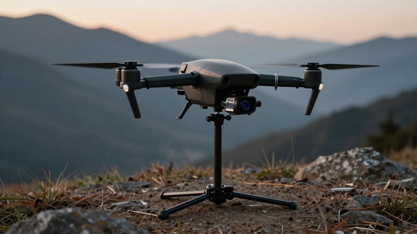
Overview and design philosophy
Selecting a versatile unmanned platform often requires balancing portability with environmental resilience. The engineering team prioritized a compact, durable frame that could handle mission-critical tasks without demanding a massive infrastructure footprint. This focus on simplifying the tactical workflow makes the system a practical option for various teams.
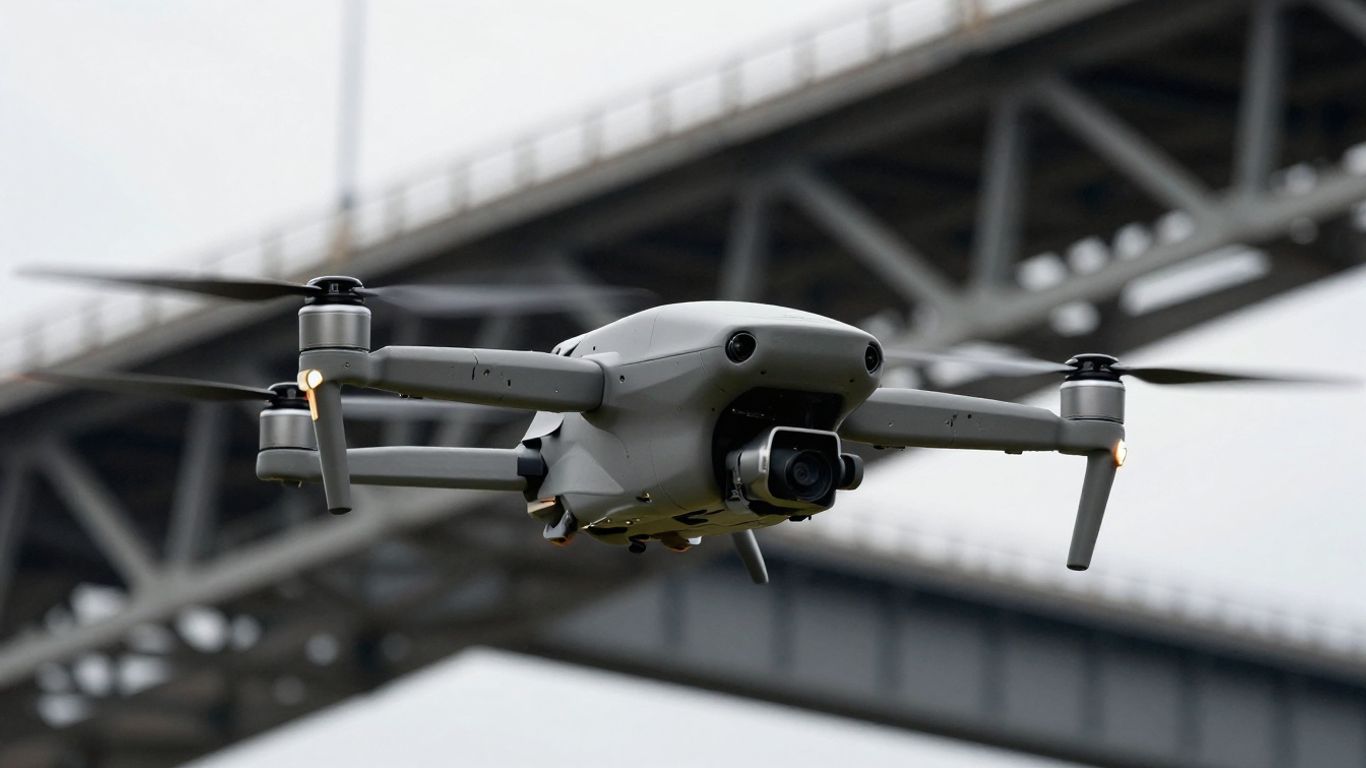
Coaxial aerodynamics for confined spaces
The core of the flight system is its coaxial rotor setup, which provides a level of stability not always found in traditional quad-rotor configurations. This design allows the aircraft to maintain control in turbulent or restricted zones where maneuvering space is minimal. By reducing the overall footprint while keeping power high, this Spirit Aerial System excels in challenging structural inspections.
Rugged architecture for extreme environments
Built with industrial-grade materials, the fuselage is designed to shrug off hazards that typically ground smaller aircraft. This rugged aerial system is capable of operating in adverse conditions, including sand, snow, and heavy rain, ensuring that mission schedules stay on track regardless of local weather. The all-weather construction ensures durability in demanding environments where mission completion is essential.
Man-portable design and rapid deployment capabilities
Physical agility is vital when moving through unpredictable terrain on foot. The design allows operators to assemble the aircraft and initiate flight with minimal delay, eliminating the need for complex, time-consuming setup protocols. This quick deployment cycle supports teams that need to get data back to command stations as efficiently as possible.
Technical specifications and performance benchmarks
Performance metrics clearly indicate that the platform is engineered for heavy lifting in tough environments. Data shows that users can achieve significant flight times while maintaining high speed across varied wind conditions, making it a reliable workhorse. The system’s ability to remain steady under pressure is a point of distinction for many field teams.
Endurance and battery life parameters
Battery capacity is balanced against weight to ensure the longest mission duration possible. Managing these power constraints requires intelligent integration, similar to the precision needed when implementing DFS bankroll management strategies to balance risk and reward effectively. Typical performance exceeds previous industry standards for drones of this, size class.
Maximum payload capacity and flexibility
The modular design utilizes a click-ring interface that allows users to swap modules rapidly. This adaptability means an operator can switch from a standard sensor package to specialized hardware or supplementary batteries in seconds. The following table highlights common configurations used for mission flexibility:
| Configuration Type | Payload Capacity | Primary Use Case |
|---|---|---|
| Standard ISR | 4.0 lbs | Daily Patrol |
| High-End Survey | 6.5 lbs | Terrain Mapping |
| Extended Flight | 2.0 lbs + Extra Batt | Data Collection |
By ensuring that payload integration feels simple, the platform lowers the barrier to entry for users who are not hardware engineers. Operators can reliably swap components without recalibrating their base hardware before every takeoff.
Imaging performance and GSD capabilities
High-resolution imagery is essential for creating accurate site representations. The platform supports a wide array of optical equipment, ensuring that ground sample distance requirements are met across diverse altitudes. This high-performance coaxial UAV platform gives integrators the tools they need to capture precise, actionable visual intelligence.
Communication range and data link stability
Maintaining contact with the craft over long distances is critical to mission success. The system uses a redundant communication link that prioritizes data integrity regardless of ambient electronic noise. When analyzing performance in the field, reliable links translate directly to better situational awareness for the end-user.
Tactical and industrial use cases
Versatility in the field is a major selling point for organizations that cannot afford to stock a different drone for every niche scenario. By providing a stable high-performance UAV for specialized tasks, the platform simplifies logistics. Whether checking high-tension power lines or conducting deep perimeter sweeps, the software handling is consistent and predictable.
Search and rescue operations
During critical rescue events, quick access to aerial views can dictate the success of the mission. The platform’s agility helps first responders cover large areas quickly, identifying survivors or hazards long before ground teams can reach the zone. If a primary system has issues, professionals should rely on an emergency repair protocol to ensure safety.
Infrastructure and facility inspections
Maintaining critical facilities requires frequent, repeatable imaging of structural elements. The flight systems provide a stable platform for high-resolution sensors, allowing analysts to spot degradation before it becomes a failure. These routine flights are essential for managing long-term physical assets effectively.
Military and defense utility
The defense sector demands equipment that is both robust and secure. This platform is frequently utilized for tactical reconnaissance, providing real-time data flow in complex or contested regions. Many teams utilize battlefield agility principles to ensure their unmanned assets remain relevant in an ever-shifting tactical landscape.
Precision mapping and surveying workflows
Geographically accurate surveys depend heavily on flight precision and reliable image capture. The platform’s coaxial stability ensures that photographs are aligned and geotagged with consistency, which is a major benefit for land planners. The following list outlines how the platform serves surveying operations:
- Automated flight paths covering predefined terrain geometries.
- Consistent height maintenance for uniform ground resolution.
- Integration with standard photogrammetry software modules.
- Support for real-time kinematic positioning for increased accuracy.
Following these workflows ensures that collected data remains consistent across different job sites and varied light conditions.
Integration with the Blue UAS framework
Operating within the Blue UAS framework signifies a high level of vetting and trust. For agencies that must follow strict procurement protocols, this verified status acts as a necessary gatekeeper for adoption. The certification process ensures that all integrated hardware meets specific security benchmarks that prevent unauthorized data access.
Regulatory compliance and security vetting
Compliance is not just about avoiding technical issues; it is about meeting the stringent legal requirements set for government contractors. By following regulatory compliance guidelines, the system gives purchasers peace of mind during the acquisition phase. The thorough vetting process covers everything from hardware provenance to the source code integrity.
Advantages for government and defense contractors
Contractors benefit from the pre-screened status, which removes much of the friction associated with traditional competitive bids. Using a proven platform means that integrators don’t need to re-verify components from the ground up. The result is a streamlined supply chain where the unmanned aerial systems arrive ready for immediate deployment.
Data privacy and cybersecurity standards
Protecting sensitive mission data is non-negotiable. Modern systems use advanced encryption protocols to secure storage and transmissions between the aircraft and the controller. Teams committed to data integrity often find that the built-in defenses provide a secure foundation for handling complex sensitive aerial data during active missions.
Operations and maintenance best practices
Operating the system effectively requires more than just piloting skills; it requires a disciplined approach to maintenance cycles. Overlooking minor signs of wear can lead to decreased flight time or, in extreme cases, unexpected failures. Adopting a structured preventive maintenance schedule is the best way to extend the service life of this platform.
Battery safety and cycle management
Batteries are the most expensive and volatile part of the system. Ensuring they are stored at proper temperatures and charged according to capacity charts prevents premature degradation. Never force a battery cycle if the health metrics indicate that the internal cells are nearing the end of their operational life.
Routine field maintenance and inspections
Even the best hardware needs physical checks after every flight. This typically includes ensuring all rotors are free from debris and that the landing gear assembly remains secure. If an operator discovers structural issues, they must follow established damage assessment steps before attempting further flight operations.
Firmware updates and flight software management
Software updates often fix minor bugs that could otherwise lead to flight instability. It is vital to test these updates on a secondary unit before deploying them company-wide. Keeping the software stack current ensures that the drone always has access to the latest security patches and flight characteristics.
Pilot training and certification requirements
Proficient piloting is the primary safety factor in any drone mission. Pilots must be fully trained not just on basic flight controls, but on emergency response and the specific nuances of a coaxial rotor system. Ongoing education, similar to how parents engage with resources like Trail Life Connect, is key to ensuring that every crew member understands the full capability range of the aircraft.
Conclusion
Choosing a reliable aerial platform involves balancing complex technical specifications with the practical needs of daily operations. The Spirit Ascent AeroSystems platform stands out as a clear example of how thoughtful engineering can create a, adaptable tool for demanding sectors like defense and infrastructure. By prioritizing modularity, security, and environmental stability, this system enables operators to focus on their missions rather than on equipment failure or complicated procurement cycles.
Frequently Asked Questions
What are the primary advantages of coaxial drones?
Coaxial designs rely on two rotors stacking one above the other to generate lift, which makes the frame more compact and maneuverable without sacrificing flight stability in windy conditions.
Can these drones operate during heavy rain or snow?
Most industrial-grade platforms are built with weather-sealed casings, allowing them to withstand moisture, dust, and varying temperatures often found in extreme field environments.
How does the click-ring system simplify drone use?
This interface uses a mechanical locking mechanism that allows for rapid, tool-free swapping of sensors and batteries, significantly reducing downtime between mission phases.
What does NDAA compliance mean for drone owners?
It ensures that the aircraft adheres to specific federal procurement guidelines regarding manufacturing sources and supply chain security, making it eligible for use by government and military agencies.
Are these platforms suitable for indoor inspections?
Small-form aerial systems are designed for tight navigation, making them ideal candidates for inspecting infrastructure such as bridges, tunnels, or industrial warehouses where open space is limited.
How often should flight software be updated?
Updates should be performed whenever the manufacturer releases a patch or stability improvement, and always before starting a long-term field mission to ensure optimal system performance.
What is the typical flight time for these systems?
Effective flight endurance varies based on the total payload weight and temperature conditions, though most industrial platforms offer significant mission duration when optimized for specific sensor configurations.