

A comprehensive guide to the eBee VISION AgEagle Aerial Systems
Key Takeaways
The eBee VISION provides a specialized uncrewed aerial platform designed for tactical operations and real-time intelligence gathering. This system emphasizes portability, rapid deployment, and secure data handling to meet the stringent demands of government and defense users.
- Features high-resolution thermal and visible light sensors for day and night surveillance.
- Utilizes AES-256 encryption for secure data transmission in sensitive operational environments.
- Designed for single-pilot operation with hand-launch capability and automated flight modes.
- Holds Blue UAS certification status, validating its security and performance for government procurement.
- Provides a compact, lightweight design that ensures high mobility for soldiers operating in remote zones.
Overview of eBee VISION AgEagle Aerial Systems
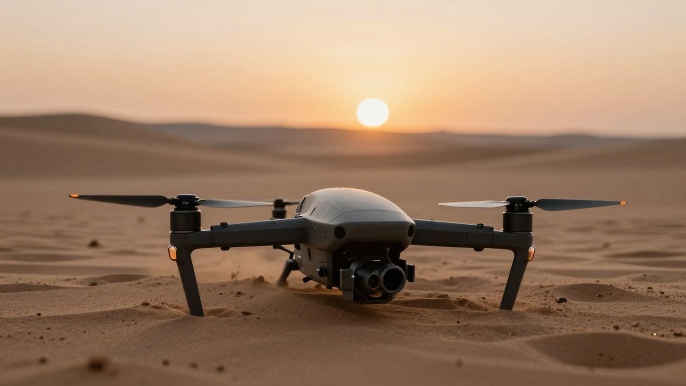
The eBee VISION AgEagle Aerial Systems platform serves as a dedicated asset for tactical ISR, combining ease of transport with advanced flight autonomy. By prioritizing a small footprint, the aircraft allows for mission execution in complex environments where larger vehicles would struggle to deploy or operate effectively.
Key technical specifications and design philosophy
The airframe utilizes materials like expanded polypropylene to maintain an optimal balance between low weight and physical resilience. It features a brushless electric motor system that minimizes acoustic signatures, and the overall design language focuses on intuitive operation through a single control interface that handles both navigation and data management.
Primary use cases in defense and intelligence
Defense forces utilize this system primarily for gathering real-time visual and thermal snapshots of denied or high-risk zones. The platform enables ground units to perform reconnaissance without exposing personnel to direct threats, while the ability to adapt mission parameters during flight allows for tracking moving targets or shifting operational requirements on short notice.
Comparison with standard commercial surveying drones
While industrial mapping drones are often optimized purely for photogrammetry and high-precision spatial data, this platform is engineered for immediate human-in-the-loop decision-making. Users looking at the broader enterprise drone market will note that unlike standard commercial models, this system ships with hardened communication protocols tailored for restricted and high-security communication environments.
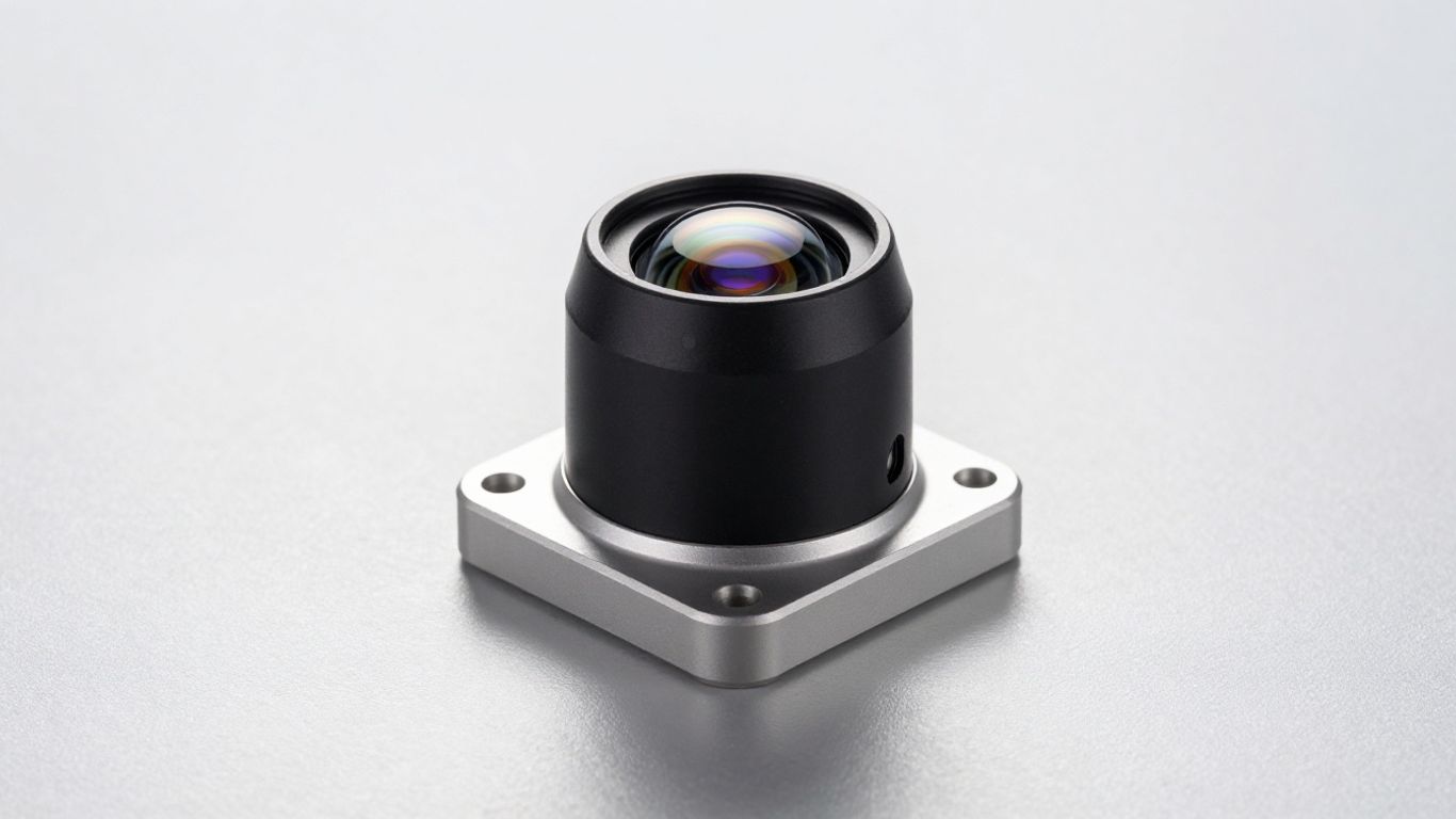
Advanced imaging and sensor capabilities
The integration of sophisticated electro-optical and thermal sensors allows the platform to maintain oversight in variable visibility conditions. These capabilities are managed through a streamlined data pipeline that ensures the operator receives visual inputs with minimal latency, supporting faster reaction times for critical mission outcomes.
Thermal and visible light sensor integration
The system combines a high-zoom RGB sensor with a thermal imaging module to provide dual-spectrum situational awareness. This allows operators to differentiate between heat signatures and physical objects even when ambient light is significantly limited, ensuring that nocturnal operations remain as efficient as daylight missions.
Real-time data transmission and processing
Data is relayed through a secure wireless link designed to withstand interference, enabling the immediate viewing of target coordinates and object tracks. The interface translates these inputs into actionable intelligence, such as providing grid coordinates for specific items of interest identified during the flight path.
Versatility for day and night operations
- RGB sensor for high-detail imagery in daylight
- Thermal sensor for tracking heat signatures in low light
- Customizable flight modes to adapt to changing environmental conditions
- Rapid switching between observation and mapping patterns
This multi-sensor approach makes the system highly effective for sensitive reconnaissance missions where environmental conditions change without warning.
Regulatory compliance and field reliability
System reliability in the field hinges on both hardware integrity and institutional validation, particularly regarding security standards. By aligning itself with rigorous federal mandates, the platform ensures that procurement and deployment remain straightforward for agencies operating under stringent operational requirements.
Navigating Blue UAS certification standards
The platform has secured Blue UAS certification, which functions as a critical clearance for federal agencies looking to acquire proven assets. This designation confirms that the system meets the established security and performance criteria required by defense stakeholders, removing typical barriers to procurement associated with non-cleared platforms.
Survivability in harsh environmental conditions
The aircraft is built to endure temperature fluctuations and mechanical stress common in operational zones. The materials selected for the fuselage prioritize long-term durability, allowing the drone to be repeatedly launched and recovered in abrasive or dusty conditions without degradation of the primary flight control surfaces.
Logistics of deployment in remote operational zones
Logistical footprint is minimized by the portability of the kit, which includes a backpack-mountable configuration. Since the entire mission set can be managed by a single operator, the requirement for transport support and complex launch equipment is significantly reduced, accelerating the timeline from arrival to active aerial monitoring.
Practical deployment and field workflow
Integrating the platform into existing operational workflows requires minimal infrastructure, utilizing portable ground stations that handle command and control links. The system is designed for a direct interface with the pilot, emphasizing speed and functional consistency across diverse deployment scenarios.
Launch and recovery procedures for rapid response
Deployment begins with a hand-launch procedure that requires no specialized pads or catapults, significantly reducing the setup time. Recovery is managed through automated patterns, allowing the system to touch down on varied surfaces once the mission criteria have been met.
Integrating the drone with ground control stations
| Feature | Specification | Role |
|---|---|---|
| Control screen | 7-inch sunlight viewable | Visual link management |
| Battery system | Warm-swap capable | Sustained operational endurance |
| Encryption | AES-256 standard | Data link protection |
This integration allows for a seamless feed of telemetry to the command station while maintaining full control over the flight path, ensuring that users can secure drone data throughout the entire mission cycle.
Pilot training requirements and system maintenance
Basic operation is intuitive, though professional training is recommended to handle advanced tracking and manual maneuvers. Maintenance is streamlined to allow for quick field-level repairs, ensuring that minor wear-and-tear does not result in extended downtime for the flight team.
Strategic applications for modern defense agencies
Modern defense agencies increasingly rely on lightweight systems that provide immediate eyes on the ground without the logistical burden of crewed aircraft. This platform enables a scalable approach to surveillance, allowing for higher frequency tasking in regions that require persistent awareness.
Intelligence, surveillance, and reconnaissance (ISR) applications
The EBee VISION ISR Drone excels in missions requiring sustained monitoring of tactical areas. Operators can define search grids or utilize autonomous tracking modes to identify, log, and follow targets of interest as they move through complex geographic terrain.
Enhancing situational awareness for ground teams
By providing real-time data to mobile teams, the system acts as a force multiplier that helps ground personnel avoid ambushes and navigate around obstacles. The ability to push clear visual confirmation of environmental conditions to a handheld monitor ensures that decision-makers stay informed at all times.
Analyzing operational impact of lightweight aerial systems
Lightweight platforms represent a fundamental shift in how small teams gather data in denied areas. Their low noise profile and rapid setup time allow for operations that prioritize stealth and flexibility, drastically lowering the risk associated with traditional reconnaissance efforts in unconventional warfare zones.
Conclusion
As defense agencies continue to modernize their scouting capabilities, the eBee VISION provides a balanced solution that integrates high-end sensors with the portability required for field use. By focusing on security, durability, and ease of deployment, it remains a consistent tool for those who operate in rapidly changing environments.
Frequently Asked Questions
Is the system capable of operating during night missions?
Yes, the aircraft is equipped with thermal sensors that allow for effective operation in the absence of visible light using heat-signature detection.
Requires the system a satellite connection to fly?
No, the flight system is designed to operate in various conditions, including environments where satellite or GNSS signals might be degraded or denied.
How many operators are needed for deployment?
The design is optimized for a single-pilot operation, which covers everything from initial hand-launch to mission control and recovery.
Does the platform track targets automatically?
Yes, the flight software includes modes that allow the system to lock onto and track moving objects based on visual or thermal inputs.
Is the equipment portable enough for infantry transport?
Yes, the entire platform is designed to be carried in a backpack, making it highly portable for personnel operating in remote or non-road-accessible zones.
What encryption standard protects the wireless data link?
Data links are protected by AES-256 encryption to ensure that sensitive visual and telemetry information remains secure during transit.
Can the system be controlled manually during flight?
Yes, while the system offers automated flight and mapping modes, operators can override these to control the flight maneuvers for specific requirements.